Estimated Value: $248,000 - $286,000
Studio
--
Bath
--
Sq Ft
0.28
Acres
About This Home
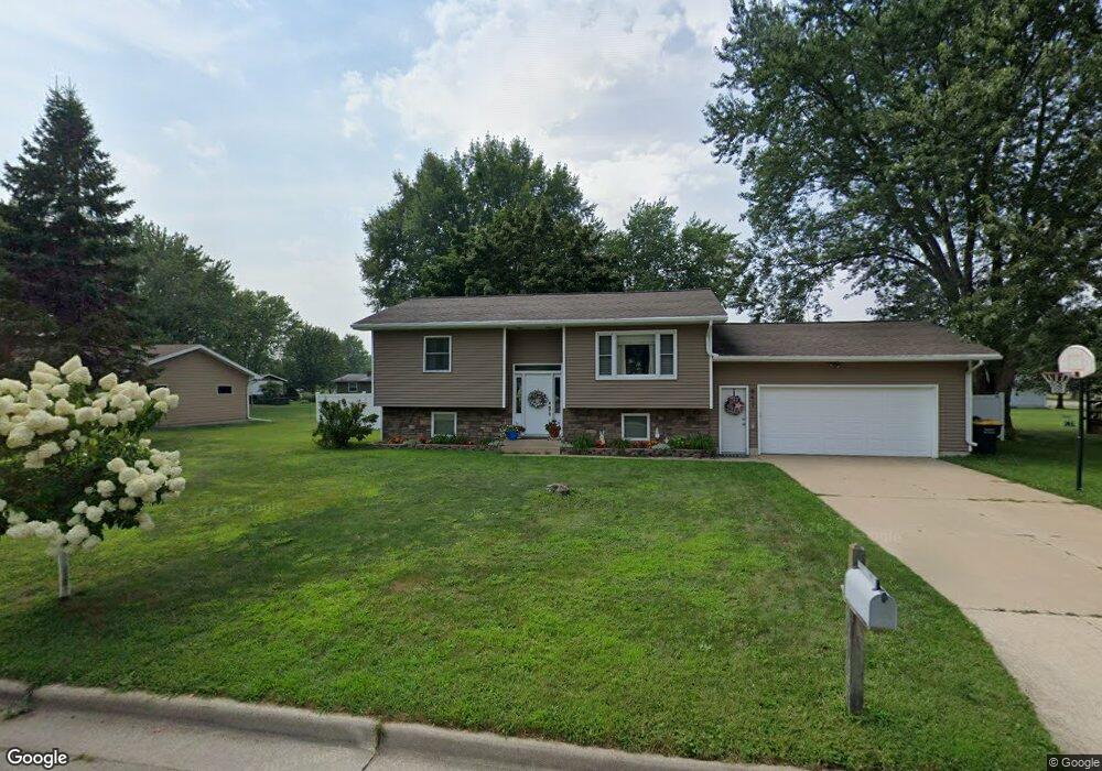
This home is located at 617 Farmer Ave, Tomah, WI 54660 and is currently estimated at $268,393. 617 Farmer Ave is a home located in Monroe County with nearby schools including Tomah High School, St. Paul Lutheran School, and Queen of the Apostles Grade School.
Ownership History
Date
Name
Owned For
Owner Type
Purchase Details
Closed on
Nov 1, 2018
Sold by
Gilson Kelse A and Freemore Kelse A
Bought by
Myers Holly C and Myers Adam G
Current Estimated Value
Home Financials for this Owner
Home Financials are based on the most recent Mortgage that was taken out on this home.
Original Mortgage
$132,000
Outstanding Balance
$114,666
Interest Rate
4.7%
Mortgage Type
New Conventional
Estimated Equity
$153,727
Purchase Details
Closed on
Oct 5, 2007
Sold by
Neas Martin E and Neas Nancy L
Bought by
Freemore Kelse A
Create a Home Valuation Report for This Property
The Home Valuation Report is an in-depth analysis detailing your home's value as well as a comparison with similar homes in the area
Home Values in the Area
Average Home Value in this Area
Purchase History
| Date | Buyer | Sale Price | Title Company |
|---|---|---|---|
| Myers Holly C | $165,000 | Dependable Title Of Wi Llc | |
| Freemore Kelse A | $132,000 | -- |
Source: Public Records
Mortgage History
| Date | Status | Borrower | Loan Amount |
|---|---|---|---|
| Open | Myers Holly C | $132,000 |
Source: Public Records
Tax History
| Year | Tax Paid | Tax Assessment Tax Assessment Total Assessment is a certain percentage of the fair market value that is determined by local assessors to be the total taxable value of land and additions on the property. | Land | Improvement |
|---|---|---|---|---|
| 2025 | $4,118 | $243,200 | $25,000 | $218,200 |
| 2024 | $4,041 | $243,200 | $25,000 | $218,200 |
| 2023 | $3,679 | $179,500 | $24,100 | $155,400 |
| 2022 | $3,434 | $179,500 | $24,100 | $155,400 |
| 2021 | $3,208 | $179,500 | $24,100 | $155,400 |
| 2020 | $3,080 | $140,900 | $25,600 | $115,300 |
| 2019 | $2,981 | $140,900 | $25,600 | $115,300 |
| 2018 | $2,946 | $140,900 | $25,600 | $115,300 |
| 2017 | $2,969 | $140,900 | $25,600 | $115,300 |
| 2016 | $2,749 | $123,700 | $22,300 | $101,400 |
| 2015 | $3,155 | $123,700 | $22,300 | $101,400 |
| 2014 | $2,802 | $123,700 | $22,300 | $101,400 |
| 2011 | $2,713 | $123,700 | $22,300 | $101,400 |
Source: Public Records
Map
Nearby Homes
- 910 Farmer Ave
- 39.35 acre King & Sime Ave
- 322 E Council St
- 210 Superior Ave
- 1109 Superior Ave
- 308 Mclean Ave
- 00 State Highway 16 -
- 1109 Mclean Ave
- 305 W Foster St
- 213 W Monowau St
- 114 W Juneau St
- 0 Franklin Rd Unit 2014917
- County Highway Et Rd
- 1315 Mclean Ave
- Lot 20 Spring Brook
- 211 N Superior Ave
- 511 N Glendale Ave
- 514 W Benton St
- 1407 Stoughton Ave
- 410 N Kilbourn Ave
- 609 Farmer Ave
- 618 Farmer Ave
- 601 Farmer Ave
- 612 Farmer Ave
- 901 E Brownell St
- 615 Donna Ave
- 609 Donna Ave
- 609 King Ave
- 603 Donna Ave
- 713 E Brownell St
- 802 E Brownell St
- 814 E Brownell St
- 820 E Brownell St
- 717 King Ave
- L1-2 King St
- Lot 2 King Ave
- Lot 1 King Ave
- 908 E Brownell St
- 801 Farmer Ave
- 714 E Brownell St
Your Personal Tour Guide
Ask me questions while you tour the home.