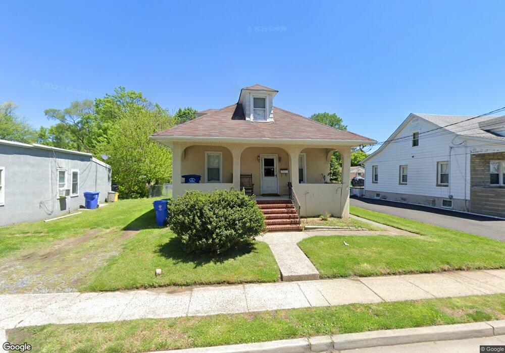
617 N Forklanding Rd Maple Shade, NJ 08052
Estimated Value: $235,300 - $319,000
--
Bed
--
Bath
1,395
Sq Ft
$208/Sq Ft
Est. Value
About This Home
This home is located at 617 N Forklanding Rd, Maple Shade, NJ 08052 and is currently estimated at $290,825, approximately $208 per square foot. 617 N Forklanding Rd is a home located in Burlington County with nearby schools including Ralph J Steinhauer Elementary School, Maude M. Wilkins Elementary School, and Howard R Yocum School.
Ownership History
Date
Name
Owned For
Owner Type
Purchase Details
Closed on
Aug 24, 1999
Sold by
Ocwen Federal Bank Fsb
Bought by
Anderson Wallace and Anderson Irene J
Current Estimated Value
Purchase Details
Closed on
May 26, 1999
Sold by
Wmfc 1997-4 Properties Inc
Bought by
Ocwen Federal Bank Fsb
Purchase Details
Closed on
Apr 19, 1999
Sold by
Nusslein Edward
Bought by
Wfmc 1997-4 Properties Inc
Create a Home Valuation Report for This Property
The Home Valuation Report is an in-depth analysis detailing your home's value as well as a comparison with similar homes in the area
Home Values in the Area
Average Home Value in this Area
Purchase History
| Date | Buyer | Sale Price | Title Company |
|---|---|---|---|
| Anderson Wallace | $56,000 | Commonwealth Land Title Ins | |
| Ocwen Federal Bank Fsb | $55,323 | -- | |
| Wfmc 1997-4 Properties Inc | -- | -- |
Source: Public Records
Tax History Compared to Growth
Tax History
| Year | Tax Paid | Tax Assessment Tax Assessment Total Assessment is a certain percentage of the fair market value that is determined by local assessors to be the total taxable value of land and additions on the property. | Land | Improvement |
|---|---|---|---|---|
| 2025 | $5,356 | $141,100 | $43,600 | $97,500 |
| 2024 | $5,201 | $141,100 | $43,600 | $97,500 |
| 2023 | $5,201 | $141,100 | $43,600 | $97,500 |
| 2022 | $5,121 | $141,100 | $43,600 | $97,500 |
| 2021 | $5,030 | $141,100 | $43,600 | $97,500 |
| 2020 | $5,085 | $141,100 | $43,600 | $97,500 |
| 2019 | $4,899 | $141,100 | $43,600 | $97,500 |
| 2018 | $4,814 | $141,100 | $43,600 | $97,500 |
| 2017 | $4,758 | $141,100 | $43,600 | $97,500 |
| 2016 | $4,687 | $141,100 | $43,600 | $97,500 |
| 2015 | $4,586 | $141,100 | $43,600 | $97,500 |
| 2014 | $4,446 | $141,100 | $43,600 | $97,500 |
Source: Public Records
Map
Nearby Homes
- 12 Collins Ln
- 4 W Germantown Ave
- 432 N Coles Ave
- 1119 Fernwood Ave
- 301 N Coles Ave
- 29 W Broadway
- 48 N Terrace Ave
- 480 W Front St
- 3422 Palace Ct
- 22 Theodore Ave
- 3444 New Jersey Ave
- 8704 Park Ave
- 8534 Orchard Ave
- 104 E Laurelton Ave
- 3423 New Jersey Ct
- 26 N Poplar Ave
- 8515 Bryn Mawr Ave
- 8331 Stockton Ave
- 57 S Terrace Ave
- 19 Farnsworth Ave
- 611 N Forklanding Rd
- 625 N Forklanding Rd
- 625 N Forklanding Rd Unit 623
- 619 N Forklanding Rd
- 607 N Forklanding Rd
- 621 N Forklanding Rd Unit B
- 621 N Forklanding Rd
- 603 N Forklanding Rd
- 610 N Forklanding Rd
- 35 5th Ave
- 606 N Forklanding Rd
- 614 N Forklanding Rd
- 602 N Forklanding Rd
- 635 N Forklanding Rd
- 39 5th Ave
- 12 Orchard Ave
- 2 5th Ave
- 538 N Forklanding Rd
- 16 Orchard Ave
- 639 N Forklanding Rd