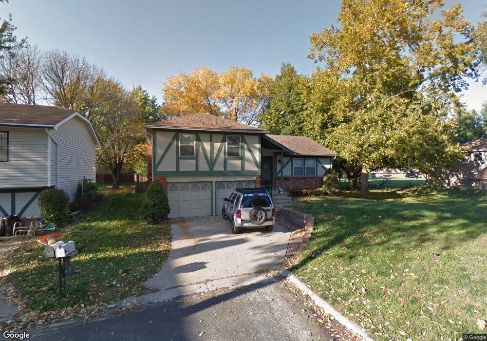
617 Trant St Kansas City, KS 66111
Estimated Value: $251,139 - $260,000
3
Beds
2
Baths
1,206
Sq Ft
$212/Sq Ft
Est. Value
About This Home
This home is located at 617 Trant St, Kansas City, KS 66111 and is currently estimated at $255,785, approximately $212 per square foot. 617 Trant St is a home located in Wyandotte County with nearby schools including Robert E Clark Middle School and Bonner Springs High School.
Ownership History
Date
Name
Owned For
Owner Type
Purchase Details
Closed on
Mar 29, 2006
Sold by
Jacob Lewis E
Bought by
Graham Travis L and Graham Nicolette J
Current Estimated Value
Home Financials for this Owner
Home Financials are based on the most recent Mortgage that was taken out on this home.
Original Mortgage
$132,500
Outstanding Balance
$75,615
Interest Rate
6.24%
Mortgage Type
Fannie Mae Freddie Mac
Estimated Equity
$180,170
Create a Home Valuation Report for This Property
The Home Valuation Report is an in-depth analysis detailing your home's value as well as a comparison with similar homes in the area
Home Values in the Area
Average Home Value in this Area
Purchase History
| Date | Buyer | Sale Price | Title Company |
|---|---|---|---|
| Graham Travis L | -- | Multiple |
Source: Public Records
Mortgage History
| Date | Status | Borrower | Loan Amount |
|---|---|---|---|
| Open | Graham Travis L | $132,500 |
Source: Public Records
Tax History Compared to Growth
Tax History
| Year | Tax Paid | Tax Assessment Tax Assessment Total Assessment is a certain percentage of the fair market value that is determined by local assessors to be the total taxable value of land and additions on the property. | Land | Improvement |
|---|---|---|---|---|
| 2024 | $3,831 | $25,553 | $4,138 | $21,415 |
| 2023 | $3,907 | $24,288 | $3,322 | $20,966 |
| 2022 | $3,481 | $21,505 | $3,085 | $18,420 |
| 2021 | $3,044 | $17,777 | $2,858 | $14,919 |
| 2020 | $2,894 | $16,460 | $2,734 | $13,726 |
| 2019 | $2,822 | $15,701 | $2,734 | $12,967 |
| 2018 | $2,706 | $15,225 | $2,333 | $12,892 |
| 2017 | $2,626 | $14,639 | $2,333 | $12,306 |
| 2016 | $2,667 | $14,766 | $2,333 | $12,433 |
| 2015 | $2,669 | $14,766 | $2,333 | $12,433 |
| 2014 | $2,468 | $14,593 | $2,333 | $12,260 |
Source: Public Records
Map
Nearby Homes
- 738 S 9th St
- 507 Newton St
- 240 White St Unit LOT 240
- 603 Newton St
- 507 High St
- 781 Highland Dr
- 824 Highland Dr
- 828 Highland Dr
- 789 Highland Dr
- 800 Highland Dr
- 20823 W 45th Terrace
- 4531 Woodstock St
- 1803 S 98th St
- 10506 Shelton Ave
- 1630 S 105th Terrace
- 1548 S 105th Ct
- 21222 W 48th St
- 98th Metropolitan Ave
- 9687 Metropolitan Ave
- 4817 Marion St