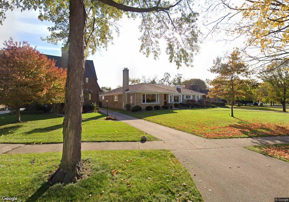
617 Uvedale Rd Riverside, IL 60546
Estimated Value: $816,516 - $973,000
6
Beds
3
Baths
3,441
Sq Ft
$252/Sq Ft
Est. Value
About This Home
This home is located at 617 Uvedale Rd, Riverside, IL 60546 and is currently estimated at $867,629, approximately $252 per square foot. 617 Uvedale Rd is a home located in Cook County with nearby schools including Blythe Park Elementary School, L J Hauser Jr High School, and Riverside Brookfield High School.
Ownership History
Date
Name
Owned For
Owner Type
Purchase Details
Closed on
Jul 10, 2014
Sold by
North Community Bank
Bought by
Linares Martha O and Martha O Linares 2012 Trust
Current Estimated Value
Purchase Details
Closed on
Jan 11, 1996
Sold by
The Northern Trust Company
Bought by
Metropolitan Bank & Trust Company
Home Financials for this Owner
Home Financials are based on the most recent Mortgage that was taken out on this home.
Original Mortgage
$260,000
Interest Rate
7.28%
Create a Home Valuation Report for This Property
The Home Valuation Report is an in-depth analysis detailing your home's value as well as a comparison with similar homes in the area
Home Values in the Area
Average Home Value in this Area
Purchase History
| Date | Buyer | Sale Price | Title Company |
|---|---|---|---|
| Linares Martha O | -- | None Available | |
| Metropolitan Bank & Trust Company | $615,000 | 1St American Title |
Source: Public Records
Mortgage History
| Date | Status | Borrower | Loan Amount |
|---|---|---|---|
| Previous Owner | Metropolitan Bank & Trust Company | $260,000 |
Source: Public Records
Tax History
| Year | Tax Paid | Tax Assessment Tax Assessment Total Assessment is a certain percentage of the fair market value that is determined by local assessors to be the total taxable value of land and additions on the property. | Land | Improvement |
|---|---|---|---|---|
| 2025 | $18,134 | $60,000 | $19,220 | $40,780 |
| 2024 | $18,134 | $60,000 | $19,220 | $40,780 |
| 2023 | $16,311 | $60,000 | $19,220 | $40,780 |
| 2022 | $16,311 | $46,006 | $16,818 | $29,188 |
| 2021 | $15,706 | $46,004 | $16,817 | $29,187 |
| 2020 | $15,273 | $46,004 | $16,817 | $29,187 |
| 2019 | $17,593 | $53,414 | $15,376 | $38,038 |
| 2018 | $17,074 | $53,414 | $15,376 | $38,038 |
| 2017 | $16,540 | $53,414 | $15,376 | $38,038 |
| 2016 | $16,196 | $48,486 | $13,454 | $35,032 |
| 2015 | $16,892 | $51,714 | $13,454 | $38,260 |
| 2014 | $16,621 | $51,714 | $13,454 | $38,260 |
| 2013 | $14,640 | $49,558 | $13,454 | $36,104 |
Source: Public Records
Map
Nearby Homes
- 478 Kent Rd
- 562 Byrd Rd
- 571 Byrd Rd
- 2817 Maple Ave
- 484 Shenstone Rd
- 475 Shenstone Rd Unit 104
- 475 Shenstone Rd Unit 304
- 475 Shenstone Rd Unit 303
- 2816 Wenonah Ave
- 2817 Wenonah Ave
- 369 Addison Rd
- 269 Shenstone Rd
- 3111 Wenonah Ave
- 410 Repton Rd
- 101 Southcote Rd
- 315 Bartram Rd
- 231 Bartram Rd
- 6840 29th Place
- 2728 Grove Ave
- 2508 Kenilworth Ave
- 335 Southcote Rd
- 621 Uvedale Rd
- 333 Southcote Rd
- 625 Selborne Rd
- 629 Selborne Rd
- 633 Selborne Rd
- 446 Longcommon Rd
- 450 Longcommon Rd
- 637 Selborne Rd
- 442 Longcommon Rd
- 317 Southcote Rd
- 462 Longcommon Rd
- 324 Southcote Rd
- 332 Southcote Rd
- 645 Selborne Rd
- 311 Southcote Rd
- 438 Longcommon Rd
- 628 Selborne Rd
- 318 Southcote Rd
Your Personal Tour Guide
Ask me questions while you tour the home.