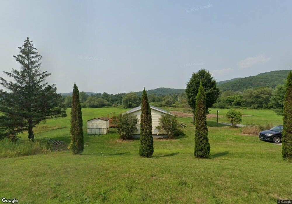
617 Vt Route 4a E Castleton, VT 05735
Estimated Value: $194,000 - $359,000
3
Beds
2
Baths
1,344
Sq Ft
$192/Sq Ft
Est. Value
About This Home
This home is located at 617 Vt Route 4a E, Castleton, VT 05735 and is currently estimated at $258,047, approximately $191 per square foot. 617 Vt Route 4a E is a home located in Rutland County with nearby schools including Castleton Elementary School, Castleton Village School, and Fair Haven Union High School.
Ownership History
Date
Name
Owned For
Owner Type
Purchase Details
Closed on
Apr 17, 2018
Sold by
Satton Brent J and Satton Kristen A
Bought by
Pike Winfred G
Current Estimated Value
Purchase Details
Closed on
Apr 7, 2016
Sold by
Satton Thomas J
Bought by
Satton Brent J and Satton Kristen A
Purchase Details
Closed on
Jun 21, 2005
Sold by
Dumas Aanlyn W
Bought by
Hanson A I
Purchase Details
Closed on
Mar 9, 2005
Sold by
Satton Thomas J
Bought by
Satton Thomas J and Satton Cynthia S
Purchase Details
Closed on
Feb 6, 2002
Sold by
Hidde Pamela A
Bought by
Satton Thomas J
Create a Home Valuation Report for This Property
The Home Valuation Report is an in-depth analysis detailing your home's value as well as a comparison with similar homes in the area
Home Values in the Area
Average Home Value in this Area
Purchase History
| Date | Buyer | Sale Price | Title Company |
|---|---|---|---|
| Pike Winfred G | -- | -- | |
| Satton Brent J | -- | -- | |
| Hanson A I | -- | -- | |
| Hanson A I | -- | -- | |
| Satton Thomas J | -- | -- | |
| Satton Thomas J | -- | -- | |
| Satton Thomas J | $86,920 | -- | |
| Satton Thomas J | $86,920 | -- |
Source: Public Records
Tax History
| Year | Tax Paid | Tax Assessment Tax Assessment Total Assessment is a certain percentage of the fair market value that is determined by local assessors to be the total taxable value of land and additions on the property. | Land | Improvement |
|---|---|---|---|---|
| 2024 | $2,745 | $108,400 | $54,100 | $54,300 |
| 2023 | $2,401 | $108,400 | $54,100 | $54,300 |
| 2022 | $2,286 | $108,400 | $54,100 | $54,300 |
| 2021 | $2,313 | $108,400 | $54,100 | $54,300 |
| 2020 | $2,365 | $108,400 | $54,100 | $54,300 |
| 2019 | $1,681 | $108,400 | $54,100 | $54,300 |
| 2018 | $3,139 | $153,600 | $54,100 | $99,500 |
| 2017 | $3,137 | $153,600 | $54,100 | $99,500 |
| 2016 | $0 | $153,600 | $54,100 | $99,500 |
| 2015 | -- | $1,536 | $0 | $0 |
| 2014 | -- | $1,597 | $0 | $0 |
| 2013 | -- | $1,597 | $0 | $0 |
Source: Public Records
Map
Nearby Homes
- 81 Cramton Rd Unit L-8
- 81 Cramton Rd Unit Lot 17
- 81 Cramton Rd Unit 6
- 81 Cramton Rd Unit Lot 12
- 81 Crampton Rd Unit 33
- 350 Main St Unit 1
- 1970 E Hubbardton Rd
- 21A Preston Ln
- 111 Prospect Point Rd
- 0090 Rosewood Ln
- 0088 Rosewood Ln
- 2137 Route 30 N
- 1313 Route 30 S
- 422 Little Rutland Rd
- 3261 Route 30 N
- 809 Gorhamtown Rd
- 97 School St
- 0086 Rosewood Ln
- 1068 Vermont Route 4a W
- 100 Devery Ln
- Lot 5 Cramton Rd
- 0 Cramton Rd
- 0 Cramton Rd
- 0 Cramton
- 0 Rte 4a Unit 4039152
- 750 Vt Route 4a E
- 2 Crampton Rd
- 358 Crampton Rd
- 862 Route 4a E
- 320 Crampton Rd
- 361 Crampton Rd
- 886 Route 4a E
- 235 Cramton Rd
- 287 Hillside Dr
- 248 Crampton Rd
- 248 Crampton Rd
- 327 Crampton Rd
- 355 Crampton Rd
- 279 Crampton Rd
- Lot #5 Cramton
Your Personal Tour Guide
Ask me questions while you tour the home.