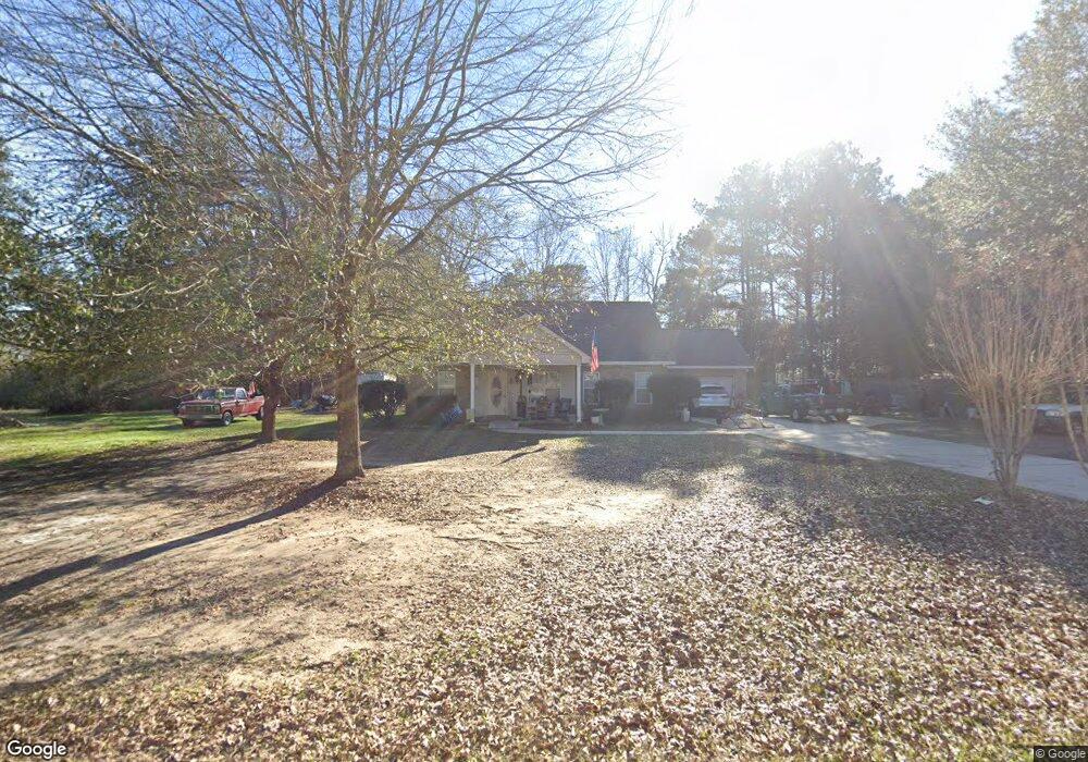
617 Wpa Rd Sumrall, MS 39482
Estimated Value: $212,000 - $260,000
3
Beds
2
Baths
1,440
Sq Ft
$159/Sq Ft
Est. Value
About This Home
This home is located at 617 Wpa Rd, Sumrall, MS 39482 and is currently estimated at $229,297, approximately $159 per square foot. 617 Wpa Rd is a home located in Lamar County with nearby schools including Oak Grove Elementary School, Bellevue Elementary School, and Oak Grove Middle School.
Ownership History
Date
Name
Owned For
Owner Type
Purchase Details
Closed on
Nov 19, 2010
Sold by
Jones William L
Bought by
Long Angela Jones
Current Estimated Value
Purchase Details
Closed on
Nov 18, 2008
Sold by
Mcswain Charles W and Mcswain Francies H
Bought by
Long William E and Long Angela J
Home Financials for this Owner
Home Financials are based on the most recent Mortgage that was taken out on this home.
Original Mortgage
$141,568
Interest Rate
6.51%
Mortgage Type
VA
Create a Home Valuation Report for This Property
The Home Valuation Report is an in-depth analysis detailing your home's value as well as a comparison with similar homes in the area
Home Values in the Area
Average Home Value in this Area
Purchase History
| Date | Buyer | Sale Price | Title Company |
|---|---|---|---|
| Long Angela Jones | -- | -- | |
| Long William E | -- | Richland Title, Inc |
Source: Public Records
Mortgage History
| Date | Status | Borrower | Loan Amount |
|---|---|---|---|
| Open | Long William E | $341,812 | |
| Previous Owner | Long William E | $141,568 |
Source: Public Records
Tax History Compared to Growth
Tax History
| Year | Tax Paid | Tax Assessment Tax Assessment Total Assessment is a certain percentage of the fair market value that is determined by local assessors to be the total taxable value of land and additions on the property. | Land | Improvement |
|---|---|---|---|---|
| 2025 | $1,840 | $14,638 | $0 | $0 |
| 2024 | $1,840 | $14,638 | $0 | $0 |
| 2023 | $1,840 | $14,638 | $0 | $0 |
| 2022 | $567 | $12,241 | $0 | $0 |
| 2021 | $560 | $12,232 | $0 | $0 |
| 2020 | $560 | $12,232 | $0 | $0 |
| 2019 | $564 | $12,046 | $0 | $0 |
| 2018 | $560 | $12,013 | $0 | $0 |
| 2017 | $567 | $12,066 | $0 | $0 |
| 2015 | -- | $12,322 | $0 | $0 |
| 2014 | -- | $12,357 | $0 | $0 |
| 2013 | -- | $12,342 | $0 | $0 |
Source: Public Records
Map
Nearby Homes
- 588 Wpa Rd
- 112 & 114 Ratcliff Rd
- 44 Ratcliff Rd
- 10 Madden Ln
- 0 Ratcliff Rd
- 8.51 Acres Wpa Rd
- 5.67 ac Wpa Rd
- 38 S of
- 10 S of
- 2 S of Fields
- 42 S of Fields
- 92 Cherry Laurel Loop
- 68 Cherry Laurel Loop
- 140 Cherry Laurel Loop
- 104 Cherry Laurel Loop
- 9 W Crossvine Ct
- 3 W Crossvine Ct
- 8 E Crossvine Ct
- 10 E Crossvine Ct
- 12 E Crossvine Ct