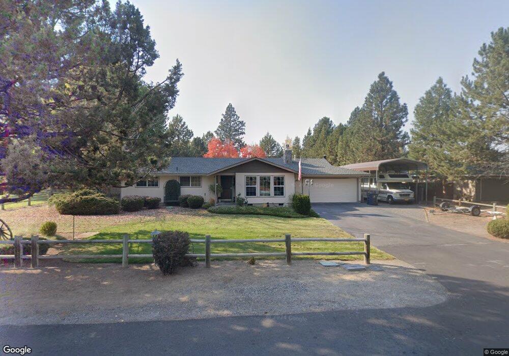
61711 Fargo Ln Bend, OR 97702
Larkspur NeighborhoodEstimated Value: $573,000 - $596,000
3
Beds
2
Baths
1,370
Sq Ft
$428/Sq Ft
Est. Value
About This Home
This home is located at 61711 Fargo Ln, Bend, OR 97702 and is currently estimated at $586,692, approximately $428 per square foot. 61711 Fargo Ln is a home located in Deschutes County with nearby schools including Bear Creek Elementary School, Bend Senior High School, and Eastmont Community School.
Ownership History
Date
Name
Owned For
Owner Type
Purchase Details
Closed on
Oct 25, 2023
Sold by
Moses James Dennis and Moses Patricia Ann
Bought by
Central Oregon Irrigation District
Current Estimated Value
Purchase Details
Closed on
Jan 10, 2010
Sold by
Oliver Ernest G
Bought by
Moses James D and Moses Patricia Ann
Home Financials for this Owner
Home Financials are based on the most recent Mortgage that was taken out on this home.
Original Mortgage
$92,500
Interest Rate
4.43%
Mortgage Type
Seller Take Back
Create a Home Valuation Report for This Property
The Home Valuation Report is an in-depth analysis detailing your home's value as well as a comparison with similar homes in the area
Home Values in the Area
Average Home Value in this Area
Purchase History
| Date | Buyer | Sale Price | Title Company |
|---|---|---|---|
| Central Oregon Irrigation District | -- | None Listed On Document | |
| Moses James D | $100,000 | Amerititle |
Source: Public Records
Mortgage History
| Date | Status | Borrower | Loan Amount |
|---|---|---|---|
| Previous Owner | Moses James D | $92,500 |
Source: Public Records
Tax History Compared to Growth
Tax History
| Year | Tax Paid | Tax Assessment Tax Assessment Total Assessment is a certain percentage of the fair market value that is determined by local assessors to be the total taxable value of land and additions on the property. | Land | Improvement |
|---|---|---|---|---|
| 2025 | $2,962 | $201,600 | -- | -- |
| 2024 | $2,850 | $195,730 | -- | -- |
| 2023 | $2,642 | $190,030 | $0 | $0 |
| 2022 | $2,465 | $179,130 | $0 | $0 |
| 2021 | $2,468 | $173,920 | $0 | $0 |
| 2020 | $2,342 | $173,920 | $0 | $0 |
| 2019 | $2,277 | $168,860 | $0 | $0 |
| 2018 | $2,213 | $163,950 | $0 | $0 |
| 2017 | $2,148 | $159,180 | $0 | $0 |
| 2016 | $2,048 | $154,550 | $0 | $0 |
| 2015 | $1,992 | $150,050 | $0 | $0 |
| 2014 | $1,933 | $145,680 | $0 | $0 |
Source: Public Records
Map
Nearby Homes
- 21035 Clairaway Ave
- 20960 Gardenia Ave
- 61730 Joan Ct
- 1843 SE Moorwood Ct
- 61807 SE Rolo Ct
- 61683 Daly Estates Dr
- 21154 Ritz Place
- 21116 SE Reed Market Rd
- 61635 Daly Estates Dr Unit 17
- 21177 Ritz Place
- 21176 Desert Skies Place
- 61570 SE Rockway Terrace
- 1033 SE Laurelwood Place
- 21130 SE Reed Market Rd
- 61635 Pettigrew Rd Unit 12
- 61620 Daly Estates Dr
- 61536 Ascha Rose Ct
- 61839 Avonlea Cir
- 61556 Twin Lakes Loop
- 61520 SE Admiral Way
- 61703 Fargo Ln
- 61719 Fargo Ln
- 906 SE Briarwood Ct
- 862 SE Briarwood Ct
- 884 SE Briarwood Ct
- 928 SE Briarwood Ct
- 840 SE Briarwood Ct
- 61697 Fargo Ln
- 21022 Bayou Dr
- 818 SE Briarwood Ct
- 950 SE Briarwood Ct
- 21023 Bayou Dr
- 905 SE Briarwood Ct
- 883 SE Briarwood Ct
- 21021 Clairaway Ave
- 796 SE Briarwood Ct
- 61687 Fargo Ln
- 61739 SE Fargo Ln
- 21032 Bayou Dr