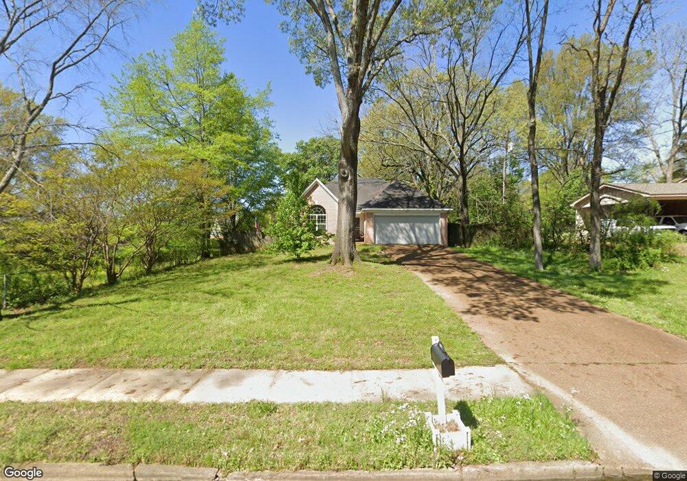
6177 Blocker St Olive Branch, MS 38654
Estimated Value: $245,000 - $264,000
3
Beds
2
Baths
1,758
Sq Ft
$146/Sq Ft
Est. Value
About This Home
This home is located at 6177 Blocker St, Olive Branch, MS 38654 and is currently estimated at $257,376, approximately $146 per square foot. 6177 Blocker St is a home located in DeSoto County with nearby schools including Olive Branch Elementary School, Chickasaw Elementary School, and Olive Branch Middle School.
Ownership History
Date
Name
Owned For
Owner Type
Purchase Details
Closed on
Jul 22, 2011
Sold by
Citimortgage Inc
Bought by
Secretary Of Housing & Urban Development
Current Estimated Value
Purchase Details
Closed on
Jul 6, 2011
Sold by
Whisnant Jeffrey D and Hopper Cynthia I
Bought by
Citimortgage Inc
Purchase Details
Closed on
May 4, 2009
Sold by
Morris Sara H
Bought by
Murray Ray and Poest Shelley
Home Financials for this Owner
Home Financials are based on the most recent Mortgage that was taken out on this home.
Original Mortgage
$126,250
Interest Rate
4.86%
Mortgage Type
Purchase Money Mortgage
Create a Home Valuation Report for This Property
The Home Valuation Report is an in-depth analysis detailing your home's value as well as a comparison with similar homes in the area
Home Values in the Area
Average Home Value in this Area
Purchase History
| Date | Buyer | Sale Price | Title Company |
|---|---|---|---|
| Secretary Of Housing & Urban Development | -- | None Available | |
| Citimortgage Inc | -- | None Available | |
| Murray Ray | -- | Realty Title & Escrow |
Source: Public Records
Mortgage History
| Date | Status | Borrower | Loan Amount |
|---|---|---|---|
| Previous Owner | Murray Ray | $126,250 |
Source: Public Records
Tax History Compared to Growth
Tax History
| Year | Tax Paid | Tax Assessment Tax Assessment Total Assessment is a certain percentage of the fair market value that is determined by local assessors to be the total taxable value of land and additions on the property. | Land | Improvement |
|---|---|---|---|---|
| 2025 | $2,140 | $15,679 | $2,500 | $13,179 |
| 2024 | $1,292 | $11,664 | $2,500 | $9,164 |
| 2023 | $1,292 | $11,664 | $0 | $0 |
| 2022 | $1,293 | $11,669 | $2,500 | $9,169 |
| 2021 | $1,293 | $11,669 | $2,500 | $9,169 |
| 2020 | $1,193 | $10,936 | $2,500 | $8,436 |
| 2019 | $1,193 | $10,936 | $2,500 | $8,436 |
| 2017 | $1,158 | $18,758 | $10,629 | $8,129 |
| 2016 | $1,158 | $10,629 | $2,500 | $8,129 |
| 2015 | $1,458 | $18,758 | $10,629 | $8,129 |
| 2014 | $1,220 | $11,081 | $0 | $0 |
| 2013 | $1,082 | $11,081 | $0 | $0 |
Source: Public Records
Map
Nearby Homes
- 5295 Blocker St
- 9113 Rue Orleans Ln
- 6180 Rd
- 6748 Cockrum Rd
- 5841 Blocker St
- 9270 College St
- 0 Caroma Unit 4006992
- 0 Caroma Unit 10199426
- 9811 Cherokee Dr
- 0 Mid Dr S Unit 4100819
- 9355 Pigeon Roost Rd
- 9893 Cherokee Dr
- 9930 Sequoia Ln
- 9821 Morgan Manor Dr
- 9678 Stuart Cove
- 8911 Oak Branch Ln
- 8897 Parkview Oaks Cir
- 8817 Parkview Oaks Cir
- 8799 Parkview Oaks Cir
- 8834 Purple Martin Dr
- 6203 Blocker St
- 6400 Blocker St
- 5 Blocker St
- 6164 Shadow Oaks Cove N
- 6149 Blocker St
- 9227 Coleman St
- 6164 Shadowland
- 6178 Shadow Oaks Cove N
- 6150 Shadow Oaks Cove N
- 6135 Blocker St
- 6093 Shadowland
- 6308 Mcclendon Cir
- 6096 Shadowland
- 6178 Shadowland
- 6136 Shadow Oaks Cove N
- 6076 S Shadowland
- 6165 Blocker St
- 6136 Shadow Oaks Cove N
- 9176 Shadow Oaks Ln
- 9228 Coleman St