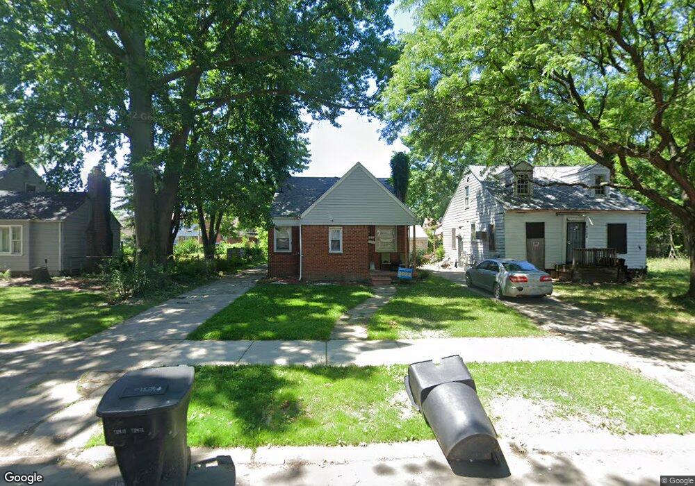
6177 Radnor St Detroit, MI 48224
Cornerstone Village NeighborhoodEstimated Value: $91,000 - $118,000
3
Beds
1
Bath
945
Sq Ft
$112/Sq Ft
Est. Value
About This Home
This home is located at 6177 Radnor St, Detroit, MI 48224 and is currently estimated at $105,510, approximately $111 per square foot. 6177 Radnor St is a home located in Wayne County with nearby schools including Marquette Elementary-Middle School, Edward 'Duke' Ellington Conservatory of Music and Art, and Charles L. Spain Elementary-Middle School.
Ownership History
Date
Name
Owned For
Owner Type
Purchase Details
Closed on
Sep 11, 2019
Sold by
Taylor Kaywanna
Bought by
Garner Johnta
Current Estimated Value
Purchase Details
Closed on
Jun 6, 2018
Sold by
The Detroit Land Bank Authority
Bought by
Taylor Kaywanna
Purchase Details
Closed on
May 17, 2016
Sold by
The Detroit Land Bank Authority
Bought by
Adams Kristina
Purchase Details
Closed on
Jan 6, 2015
Sold by
Treasurer Of The Charter County Of Wayne
Bought by
Detroit Land Bank Authority
Purchase Details
Closed on
Mar 7, 2005
Sold by
Preski Michael F and Preski Nancy C
Bought by
Capital Mortgage Funding
Create a Home Valuation Report for This Property
The Home Valuation Report is an in-depth analysis detailing your home's value as well as a comparison with similar homes in the area
Home Values in the Area
Average Home Value in this Area
Purchase History
| Date | Buyer | Sale Price | Title Company |
|---|---|---|---|
| Garner Johnta | -- | None Available | |
| Taylor Kaywanna | $7,100 | Tis Title Co | |
| Adams Kristina | $3,500 | Title Source | |
| Detroit Land Bank Authority | -- | None Available | |
| Capital Mortgage Funding | -- | Multiple |
Source: Public Records
Tax History Compared to Growth
Tax History
| Year | Tax Paid | Tax Assessment Tax Assessment Total Assessment is a certain percentage of the fair market value that is determined by local assessors to be the total taxable value of land and additions on the property. | Land | Improvement |
|---|---|---|---|---|
| 2025 | $1,072 | $53,900 | $0 | $0 |
| 2024 | $1,072 | $25,300 | $0 | $0 |
| 2023 | $1,269 | $18,800 | $0 | $0 |
| 2022 | $1,353 | $17,100 | $0 | $0 |
| 2021 | $1,160 | $13,400 | $0 | $0 |
| 2020 | $1,160 | $12,100 | $0 | $0 |
| 2019 | $1,143 | $10,200 | $0 | $0 |
| 2018 | $0 | $0 | $0 | $0 |
| 2017 | $976 | $9,400 | $0 | $0 |
| 2016 | $240 | $16,600 | $0 | $0 |
| 2015 | $1,660 | $16,600 | $0 | $0 |
| 2013 | $2,365 | $23,645 | $0 | $0 |
| 2010 | -- | $34,666 | $1,007 | $33,659 |
Source: Public Records
Map
Nearby Homes
- 6166 Farmbrook St
- 6137 Radnor St
- 6144 Radnor St
- 6306 Farmbrook St
- 6301 Lodewyck St
- 5951 Radnor St
- 17918 Chester St
- 5937 Radnor St
- 17817 Chester St
- 5981 University Place
- 5795 Marseilles St
- 6015 Hereford St
- 6160 Neff Ave
- 17601 Chester St
- 21111 Moross Rd
- 21746 Moross Rd
- 6326 Neff Ave
- 5910 Hillcrest St
- 5570 Farmbrook St
- 9438 Camley St
- 6176 Farmbrook St
- 6186 Farmbrook St
- 6185 Radnor St
- 6194 Farmbrook St
- 6161 Radnor St
- 6191 Radnor St
- 6156 Farmbrook St
- 6202 Farmbrook St
- 6202 Farmbrook St
- 6201 Radnor St
- 6148 Farmbrook St
- 6151 Radnor St
- 6210 Farmbrook St
- 6209 Radnor St
- 6145 Radnor St
- 6140 Farmbrook St
- 6216 Farmbrook St
- 6215 Radnor St
- 6175 Farmbrook St
- 6185 Farmbrook St