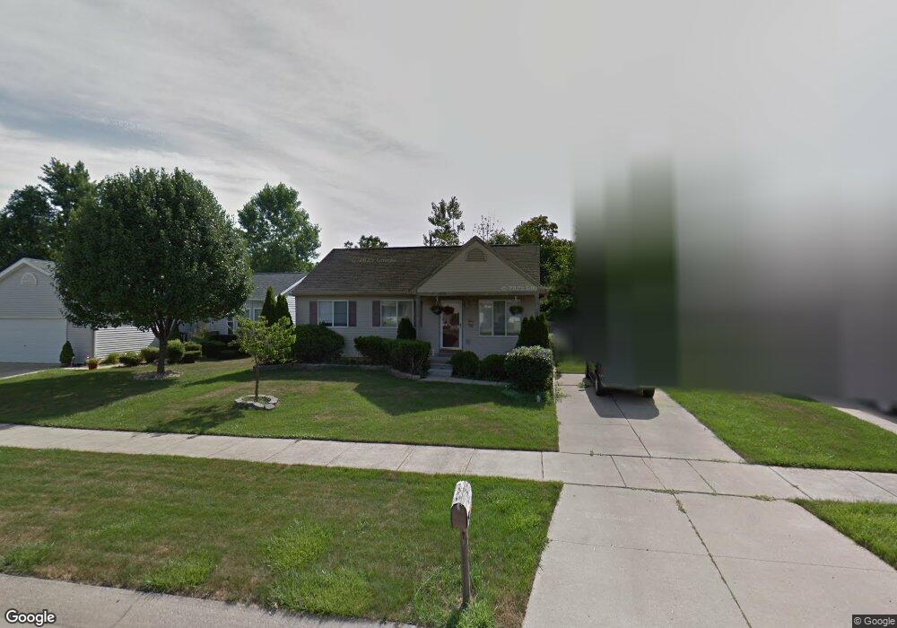
6179 Central St Romulus, MI 48174
Estimated Value: $161,000 - $172,000
3
Beds
1
Bath
936
Sq Ft
$179/Sq Ft
Est. Value
About This Home
This home is located at 6179 Central St, Romulus, MI 48174 and is currently estimated at $167,600, approximately $179 per square foot. 6179 Central St is a home located in Wayne County with nearby schools including Romulus Elementary School, Romulus Middle School, and Romulus Senior High School.
Ownership History
Date
Name
Owned For
Owner Type
Purchase Details
Closed on
Mar 26, 1999
Sold by
Talbot Talbot P and Talbot L
Bought by
Watts W W and Watts A
Current Estimated Value
Purchase Details
Closed on
Oct 31, 1994
Sold by
Middlebelt Dev Inc
Bought by
Talbot Douglas P and Talbot Pamela L
Home Financials for this Owner
Home Financials are based on the most recent Mortgage that was taken out on this home.
Original Mortgage
$67,350
Interest Rate
8.86%
Mortgage Type
New Conventional
Create a Home Valuation Report for This Property
The Home Valuation Report is an in-depth analysis detailing your home's value as well as a comparison with similar homes in the area
Home Values in the Area
Average Home Value in this Area
Purchase History
| Date | Buyer | Sale Price | Title Company |
|---|---|---|---|
| Watts W W | $97,500 | -- | |
| Talbot Douglas P | $70,900 | -- |
Source: Public Records
Mortgage History
| Date | Status | Borrower | Loan Amount |
|---|---|---|---|
| Previous Owner | Talbot Douglas P | $67,350 |
Source: Public Records
Tax History Compared to Growth
Tax History
| Year | Tax Paid | Tax Assessment Tax Assessment Total Assessment is a certain percentage of the fair market value that is determined by local assessors to be the total taxable value of land and additions on the property. | Land | Improvement |
|---|---|---|---|---|
| 2025 | $1,097 | $75,800 | $0 | $0 |
| 2024 | $1,097 | $69,600 | $0 | $0 |
| 2023 | $1,049 | $62,500 | $0 | $0 |
| 2022 | $1,271 | $60,700 | $0 | $0 |
| 2021 | $1,227 | $55,400 | $0 | $0 |
| 2020 | $1,202 | $40,200 | $0 | $0 |
| 2019 | $1,204 | $36,700 | $0 | $0 |
| 2018 | $766 | $30,200 | $0 | $0 |
| 2017 | $610 | $29,900 | $0 | $0 |
| 2016 | $1,030 | $30,700 | $0 | $0 |
| 2015 | $2,103 | $32,500 | $0 | $0 |
| 2013 | $2,250 | $24,400 | $0 | $0 |
| 2012 | $638 | $24,000 | $4,800 | $19,200 |
Source: Public Records
Map
Nearby Homes
- 6155 Cordell St
- 6041 W Maple St Unit 144
- 5912 Georgia Unit 212
- 5926 Esther St
- 6002 Frederick St Unit 81
- 6018 Frederick St Unit 83
- 29120 van Born Rd
- 6837 Middlebelt Rd
- 29870 Lacy Dr Unit 132
- 29635 Julius Blvd
- 5320 S Middlebelt Rd
- 28951 Powers St
- 28919 Powers St
- 29072 Powers St
- 4971 Julius Blvd
- 5022 S Middlebelt Rd
- 29114 Richard St
- POWERS Powers St
- 4770 Matthew St
- 30234 Julius Blvd
- 6191 Central St
- 6159 Central St
- 421 Mill Pond Lane Central St
- 6168 Loraine St
- 6190 Loraine St
- 6158 Loraine St
- 6208 Loraine St
- 6153 Central St
- 6219 Central St
- 6180 Central St
- 6138 Loraine St
- 6218 Loraine St
- 6200 Central St
- 6131 Central St
- 6239 Central St
- 6150 Central St
- 6170 Central St
- 6119 Central St
- 6130 Loraine St
- 6230 Loraine St