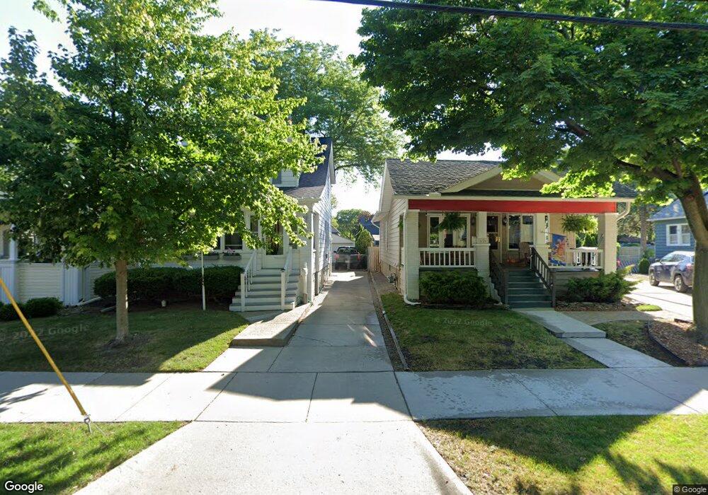
618 Notre Dame St Unit Bldg-Unit Grosse Pointe, MI 48230
Estimated Value: $285,000 - $327,000
--
Bed
1
Bath
1,208
Sq Ft
$256/Sq Ft
Est. Value
About This Home
This home is located at 618 Notre Dame St Unit Bldg-Unit, Grosse Pointe, MI 48230 and is currently estimated at $309,055, approximately $255 per square foot. 618 Notre Dame St Unit Bldg-Unit is a home located in Wayne County with nearby schools including Lewis Maire Elementary School, Pierce Middle School, and Grosse Pointe South High School.
Ownership History
Date
Name
Owned For
Owner Type
Purchase Details
Closed on
Feb 16, 2018
Sold by
Oshita Julie and Oshita Masaru
Bought by
Nancy Knuth Llc
Current Estimated Value
Purchase Details
Closed on
Nov 26, 2002
Sold by
Strabel John E and Strabel Jennifer L
Bought by
Oshita Masaru
Purchase Details
Closed on
Sep 22, 2000
Sold by
Ross Jennifer
Bought by
Ross Jennifer
Purchase Details
Closed on
May 18, 1998
Sold by
Forste Pascale and Forste Scott R
Bought by
Strabel Jennifer Ross John E
Create a Home Valuation Report for This Property
The Home Valuation Report is an in-depth analysis detailing your home's value as well as a comparison with similar homes in the area
Home Values in the Area
Average Home Value in this Area
Purchase History
| Date | Buyer | Sale Price | Title Company |
|---|---|---|---|
| Nancy Knuth Llc | $150,050 | None Available | |
| Oshita Masaru | $227,000 | Capital Title Insurance Agen | |
| Ross Jennifer | -- | -- | |
| Strabel Jennifer Ross John E | $148,000 | -- |
Source: Public Records
Tax History Compared to Growth
Tax History
| Year | Tax Paid | Tax Assessment Tax Assessment Total Assessment is a certain percentage of the fair market value that is determined by local assessors to be the total taxable value of land and additions on the property. | Land | Improvement |
|---|---|---|---|---|
| 2025 | $3,421 | $134,600 | $0 | $0 |
| 2024 | $3,421 | $122,400 | $0 | $0 |
| 2023 | $3,262 | $119,400 | $0 | $0 |
| 2022 | $5,979 | $100,200 | $0 | $0 |
| 2021 | $5,822 | $96,300 | $0 | $0 |
| 2019 | $5,730 | $85,500 | $0 | $0 |
| 2018 | $2,195 | $83,100 | $0 | $0 |
| 2017 | $3,813 | $82,100 | $0 | $0 |
| 2016 | $4,022 | $81,100 | $0 | $0 |
| 2015 | $6,264 | $64,200 | $0 | $0 |
| 2013 | $6,068 | $65,800 | $0 | $0 |
| 2012 | -- | $61,800 | $0 | $0 |
Source: Public Records
Map
Nearby Homes
- 616 Cadieux Rd
- 25 Village Ln
- 43 Cranford Ln
- 45 Cranford Ln
- 497 Neff Rd
- 16935 Maumee Ave
- 674 Neff Rd
- 17012 Maumee Ave
- 710 Neff Rd
- 775 Notre Dame St
- 379 Lakeland St
- 387 Neff Rd
- 1036 Yorkshire Rd
- 386 Notre Dame St
- 459 Washington Rd
- 795 Grosse Pointe Ct
- 1386 Grayton St
- 320 Neff Rd
- 818 Neff Rd
- 1031 Kensington Ave
- 618 Notre Dame St
- 622 Notre Dame St
- 616 Notre Dame St
- 624 Notre Dame St
- 599 Saint Clair St
- 610 Notre Dame St
- 628 Notre Dame St
- 606 Notre Dame St
- 593 Saint Clair St
- 591 St Clair
- 604 Notre Dame St
- 591 Saint Clair St
- 589 Saint Clair St
- 603 Saint Clair St
- 611 Notre Dame St Unit 21
- 598 Notre Dame St
- 598 Notre Dame St Unit DAME
- 609 Notre Dame St
- 583 Saint Clair St
- 583 Saint Clair St