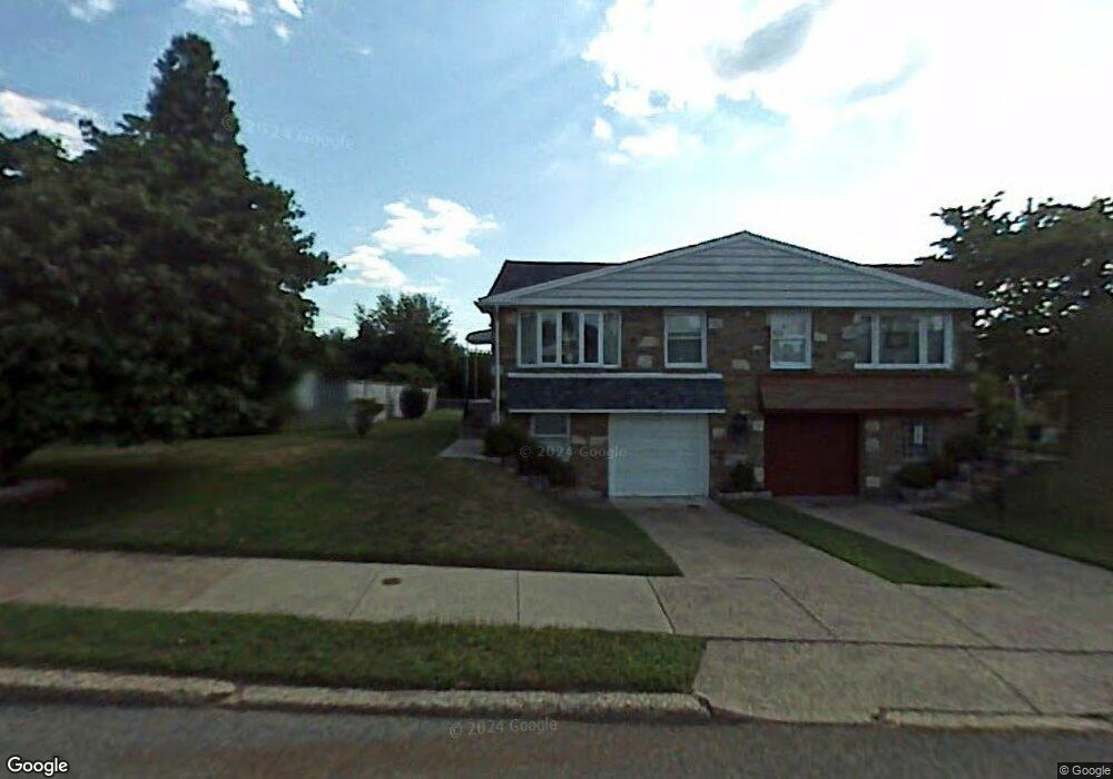
618 Sherrie Rd Philadelphia, PA 19115
Bustleton NeighborhoodEstimated Value: $320,329 - $370,000
2
Beds
2
Baths
1,245
Sq Ft
$283/Sq Ft
Est. Value
About This Home
This home is located at 618 Sherrie Rd, Philadelphia, PA 19115 and is currently estimated at $351,832, approximately $282 per square foot. 618 Sherrie Rd is a home located in Philadelphia County with nearby schools including Greenberg Joseph School, George Washington High School, and Maternity Bvm School.
Ownership History
Date
Name
Owned For
Owner Type
Purchase Details
Closed on
Jun 24, 2011
Sold by
Creighton Debra L and Creighton Theodore B
Bought by
Ware Theresa E and Littrell Judith L
Current Estimated Value
Home Financials for this Owner
Home Financials are based on the most recent Mortgage that was taken out on this home.
Original Mortgage
$136,500
Outstanding Balance
$93,628
Interest Rate
4.6%
Mortgage Type
New Conventional
Estimated Equity
$258,204
Purchase Details
Closed on
May 13, 2006
Sold by
Creighton Theodore W
Bought by
Creighton Theodore B and Creighton Debra L
Purchase Details
Closed on
Oct 31, 1994
Sold by
Wybranski Margaret J and Schmidt Phyllis W
Bought by
Creighton Theodore W
Create a Home Valuation Report for This Property
The Home Valuation Report is an in-depth analysis detailing your home's value as well as a comparison with similar homes in the area
Home Values in the Area
Average Home Value in this Area
Purchase History
| Date | Buyer | Sale Price | Title Company |
|---|---|---|---|
| Ware Theresa E | $198,000 | None Available | |
| Creighton Theodore B | -- | None Available | |
| Creighton Theodore W | $89,000 | -- |
Source: Public Records
Mortgage History
| Date | Status | Borrower | Loan Amount |
|---|---|---|---|
| Open | Ware Theresa E | $136,500 |
Source: Public Records
Tax History Compared to Growth
Tax History
| Year | Tax Paid | Tax Assessment Tax Assessment Total Assessment is a certain percentage of the fair market value that is determined by local assessors to be the total taxable value of land and additions on the property. | Land | Improvement |
|---|---|---|---|---|
| 2026 | $3,242 | $300,300 | $60,060 | $240,240 |
| 2025 | $3,242 | $300,300 | $60,060 | $240,240 |
| 2024 | $3,242 | $300,300 | $60,060 | $240,240 |
| 2023 | $3,242 | $231,600 | $46,320 | $185,280 |
| 2022 | $2,487 | $186,600 | $46,320 | $140,280 |
| 2021 | $3,117 | $0 | $0 | $0 |
| 2020 | $3,117 | $0 | $0 | $0 |
| 2019 | $2,935 | $0 | $0 | $0 |
| 2018 | $2,676 | $0 | $0 | $0 |
| 2017 | $2,676 | $0 | $0 | $0 |
| 2016 | $2,256 | $0 | $0 | $0 |
| 2015 | $2,160 | $0 | $0 | $0 |
| 2014 | -- | $191,200 | $57,960 | $133,240 |
| 2012 | -- | $22,720 | $4,578 | $18,142 |
Source: Public Records
Map
Nearby Homes
- 727 Sherrie Rd
- 8905 Springview Rd
- 8912 Springview Rd
- 637 Charette Rd
- 9124 Springview Rd
- 717 Stelwood Rd
- 9231 Grace Ln
- 1060 Welsh Rd
- 134 Alburger Ave
- 123 Pocasset Rd
- 132 Greycourt Rd
- 1029 Grant Ave
- 116 Delia Ln
- 1020 Grant Ave
- 9314 Trout Rd
- 9346 Rising Sun Ave
- 730 Millwood Rd
- 9812 Ferndale St
- 1123 Grant Ave
- 9810 Bridle Rd
- 616 Sherrie Rd
- 712 Sherrie Rd
- 614 Sherrie Rd
- 721 Charette Rd
- 612 Sherrie Rd
- 714 Sherrie Rd
- 719 Charette Rd
- 723 Charette Rd
- 717 Charette Rd
- 613 Sherrie Rd
- 615 Sherrie Rd
- 611 Sherrie Rd
- 610 Sherrie Rd
- 609 Sherrie Rd
- 719 Sherrie Rd
- 725 Charette Rd
- 716 Sherrie Rd
- 607 Sherrie Rd
- 715 Charette Rd
- 727 Charette Rd