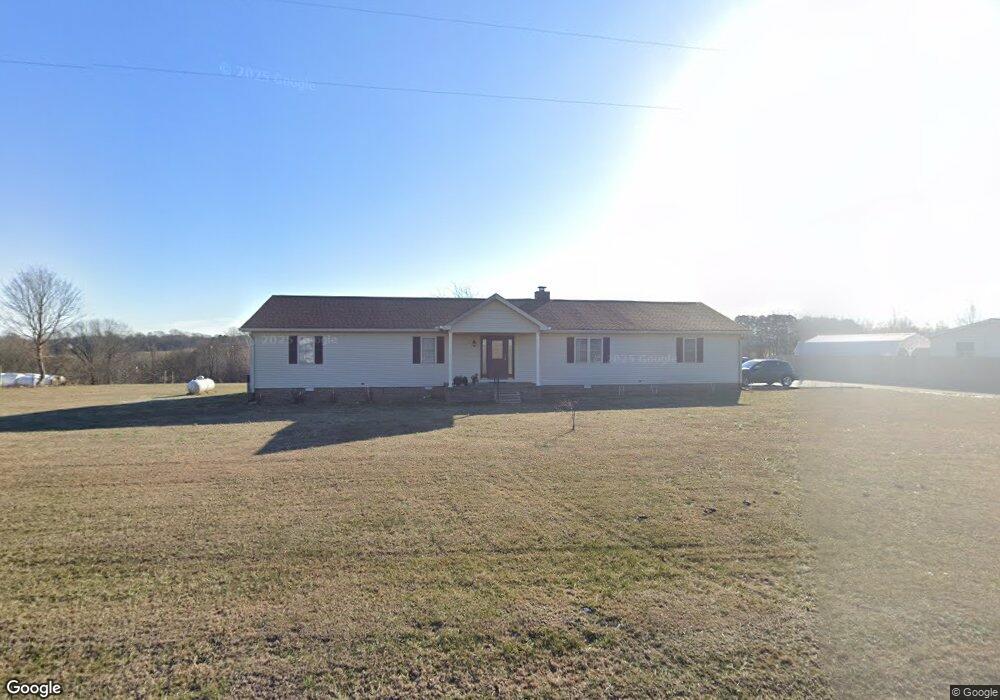
618 Shrum Cemetery Rd Westmoreland, TN 37186
Estimated Value: $318,169 - $503,000
--
Bed
2
Baths
2,316
Sq Ft
$168/Sq Ft
Est. Value
About This Home
This home is located at 618 Shrum Cemetery Rd, Westmoreland, TN 37186 and is currently estimated at $389,792, approximately $168 per square foot. 618 Shrum Cemetery Rd is a home located in Macon County with nearby schools including Lighthouse Academy.
Ownership History
Date
Name
Owned For
Owner Type
Purchase Details
Closed on
Nov 29, 2012
Sold by
Whittemore Jeremy Chad
Bought by
Wedley Robert and Wedley Maureen A
Current Estimated Value
Home Financials for this Owner
Home Financials are based on the most recent Mortgage that was taken out on this home.
Original Mortgage
$129,730
Outstanding Balance
$90,177
Interest Rate
3.44%
Mortgage Type
VA
Estimated Equity
$299,615
Purchase Details
Closed on
Jul 13, 2007
Bought by
Whittemore Jeremy and Whittemore Nicole
Purchase Details
Closed on
Jun 29, 2007
Sold by
Depetrilli Bilbro Nicole M
Bought by
Depetrillio Bilbro Nicole M
Purchase Details
Closed on
Feb 1, 2001
Sold by
Harris Michael and Harris Pamela
Bought by
Depetrillo Nicole M
Purchase Details
Closed on
Dec 6, 1996
Sold by
Ronald Patterson
Bought by
Scottie Williams
Purchase Details
Closed on
Nov 3, 1995
Sold by
Daniels Ronald M Dba
Bought by
Harris Michael C and Harris Pamela
Create a Home Valuation Report for This Property
The Home Valuation Report is an in-depth analysis detailing your home's value as well as a comparison with similar homes in the area
Home Values in the Area
Average Home Value in this Area
Purchase History
| Date | Buyer | Sale Price | Title Company |
|---|---|---|---|
| Wedley Robert | $127,000 | -- | |
| Whittemore Jeremy | $130,000 | -- | |
| Depetrillio Bilbro Nicole M | -- | -- | |
| Depetrillo Nicole M | $116,900 | -- | |
| Scottie Williams | $7,500 | -- | |
| Harris Michael C | $15,000 | -- |
Source: Public Records
Mortgage History
| Date | Status | Borrower | Loan Amount |
|---|---|---|---|
| Open | Wedley Robert | $129,730 |
Source: Public Records
Tax History Compared to Growth
Tax History
| Year | Tax Paid | Tax Assessment Tax Assessment Total Assessment is a certain percentage of the fair market value that is determined by local assessors to be the total taxable value of land and additions on the property. | Land | Improvement |
|---|---|---|---|---|
| 2024 | $846 | $59,875 | $4,250 | $55,625 |
| 2023 | $846 | $59,875 | $0 | $0 |
| 2022 | $816 | $34,000 | $3,125 | $30,875 |
| 2021 | $816 | $34,000 | $3,125 | $30,875 |
| 2020 | $816 | $34,000 | $3,125 | $30,875 |
| 2019 | $816 | $34,000 | $3,125 | $30,875 |
| 2018 | $752 | $34,000 | $3,125 | $30,875 |
| 2017 | $828 | $32,875 | $2,125 | $30,750 |
| 2016 | $789 | $32,875 | $2,125 | $30,750 |
| 2015 | $789 | $32,875 | $2,125 | $30,750 |
| 2014 | $789 | $32,885 | $0 | $0 |
Source: Public Records
Map
Nearby Homes
- 98 Andrea Ln
- 779 Oakdale Rd
- 0 Highway 52 W Unit RTC2944821
- 8141 Old Highway 52
- 177 Lauren Ln
- 397 Lauren Ln
- 2192 Shrum Cemetery Rd
- 2166 Shrum Cemetery Rd
- 2134 Shrum Cemetery Rd
- 1701 Wixtown Rd
- 1733 Wixtown Rd
- 2134 Oakdale Rd
- 2486 Oakdale Rd
- 6704 Highway 52 W
- 6606 Highway 52 W
- 221 Creekside Ln
- 5071 Old Highway 52
- 1314 Green Grove Rd
- 10029 Old Highway 52
- 0 Highway 52 W Unit RTC2515576
- 594 Shrum Cemetery Rd
- 687 Shrum Cemetery Rd
- 741 Shrum Cemetery Rd
- 765 Shrum Cemetery Rd
- 699 Shrum Cemetery Rd
- 550 Shrum Cemetery Rd
- 679 Shrum Cemetery Rd
- 527 Hunters Ln
- 714 Shrum Cemetery Rd
- 512 Shrum Cemetery Rd
- 738 Shrum Cemetery Rd
- 94 Hunters Ln
- 760 Shrum Cemetery Rd
- 489 Shrum Cemetery Rd
- 464 Shrum Cemetery Rd
- 780 Shrum Cemetery Rd
- 576 Shrum Cemetery Rd
- 785 Shrum Cemetery Rd
- 408 Shrum Cemetery Rd
- 800 Shrum Cemetery Rd