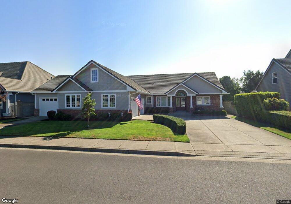
618 St Andrews Loop Creswell, OR 97426
Estimated Value: $695,978 - $830,000
3
Beds
3
Baths
2,184
Sq Ft
$341/Sq Ft
Est. Value
About This Home
This home is located at 618 St Andrews Loop, Creswell, OR 97426 and is currently estimated at $744,495, approximately $340 per square foot. 618 St Andrews Loop is a home located in Lane County with nearby schools including Creslane Elementary School, Creswell Middle School, and Creswell High School.
Ownership History
Date
Name
Owned For
Owner Type
Purchase Details
Closed on
May 22, 2005
Sold by
Dobkins Robert D and Dobkins Barbara J
Bought by
Dobkins Robert D and Dobkins Barbara J
Current Estimated Value
Purchase Details
Closed on
Jul 30, 2004
Sold by
Mcbeth James Brian and Mcbeth Christy M
Bought by
Dobkins Robert D and Dobkins Barbara J
Home Financials for this Owner
Home Financials are based on the most recent Mortgage that was taken out on this home.
Original Mortgage
$158,000
Outstanding Balance
$78,477
Interest Rate
6.24%
Mortgage Type
Purchase Money Mortgage
Estimated Equity
$666,018
Purchase Details
Closed on
Jan 20, 2004
Sold by
Frontier Land Co Llc
Bought by
Mcbeth James Brian and Mcbeth Christy M
Home Financials for this Owner
Home Financials are based on the most recent Mortgage that was taken out on this home.
Original Mortgage
$275,000
Interest Rate
5.86%
Mortgage Type
Purchase Money Mortgage
Create a Home Valuation Report for This Property
The Home Valuation Report is an in-depth analysis detailing your home's value as well as a comparison with similar homes in the area
Home Values in the Area
Average Home Value in this Area
Purchase History
| Date | Buyer | Sale Price | Title Company |
|---|---|---|---|
| Dobkins Robert D | -- | -- | |
| Dobkins Robert D | $320,000 | Cascade Title Co | |
| Mcbeth James Brian | $69,900 | Fidelity Natl Title Co Of Or |
Source: Public Records
Mortgage History
| Date | Status | Borrower | Loan Amount |
|---|---|---|---|
| Open | Dobkins Robert D | $158,000 | |
| Previous Owner | Mcbeth James Brian | $275,000 |
Source: Public Records
Tax History
| Year | Tax Paid | Tax Assessment Tax Assessment Total Assessment is a certain percentage of the fair market value that is determined by local assessors to be the total taxable value of land and additions on the property. | Land | Improvement |
|---|---|---|---|---|
| 2025 | $8,718 | $561,645 | -- | -- |
| 2024 | $6,508 | $545,287 | -- | -- |
| 2023 | $6,508 | $529,405 | -- | -- |
| 2022 | $7,036 | $513,986 | $0 | $0 |
| 2021 | $7,202 | $499,016 | $0 | $0 |
| 2020 | $7,092 | $484,482 | $0 | $0 |
| 2019 | $6,936 | $470,371 | $0 | $0 |
| 2018 | $6,782 | $443,370 | $0 | $0 |
| 2017 | $6,473 | $443,370 | $0 | $0 |
| 2016 | $6,705 | $430,456 | $0 | $0 |
| 2015 | $6,510 | $417,918 | $0 | $0 |
| 2014 | $6,485 | $405,746 | $0 | $0 |
Source: Public Records
Map
Nearby Homes
- 685 St Andrews Loop
- 375 Sunday Dr
- 336 Sunday Dr
- 316 Sunday Dr
- 1237 Spyglass Ct
- 395 Ironwood Loop
- 267 Sunday Dr
- 370 Magnolia Dr
- 240 Magnolia Dr
- 1765 Trevino Rd
- 700 N Mill St Unit 112
- 700 N Mill St Unit 1
- 276 Art Lott Ln
- 83354 N Pacific Hwy
- 689 Blue Jay Loop
- 692 N 1st St
- 156 N 1st St
- 0 River Dr
- 332 Owens Way
- 524 N 5th St
- 628 St Andrews Loop
- 608 St Andrews Loop
- 668 St Andrews Loop
- 678 St Andrews Loop
- 613 St Andrews Loop
- 658 St Andrews Loop
- 607 St Andrews Loop
- 688 St Andrews Loop
- 638 St Andrews Loop
- 638 Saint Andrews Loop
- 598 St Andrews Loop
- 619 St Andrews Loop
- 601 St Andrews Loop
- 648 St Andrews Loop
- 685 Saint Andrews Loop
- 691 St Andrews Loop
- 679 St Andrews Loop
- 595 St Andrews Loop
- 673 St Andrews Loop
- 539 Pebble Beach Dr
Your Personal Tour Guide
Ask me questions while you tour the home.