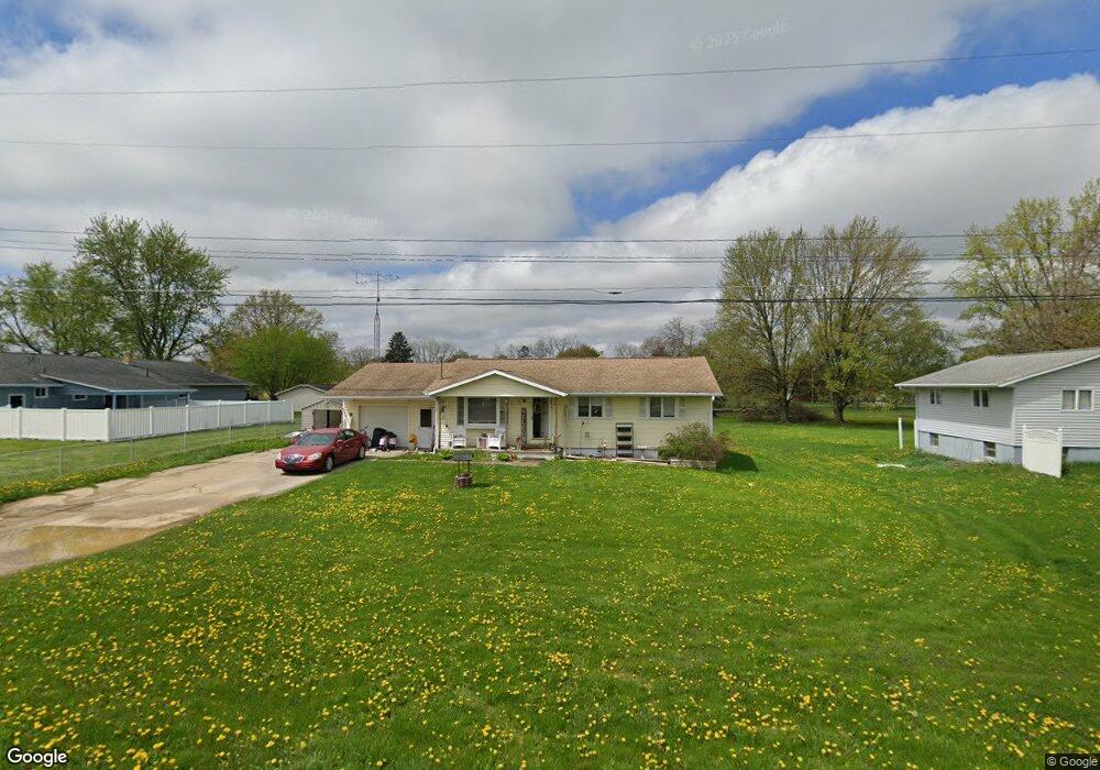
6180 S New Lothrop Rd Durand, MI 48429
Estimated Value: $177,251 - $280,000
--
Bed
--
Bath
--
Sq Ft
0.4
Acres
About This Home
This home is located at 6180 S New Lothrop Rd, Durand, MI 48429 and is currently estimated at $219,563. 6180 S New Lothrop Rd is a home located in Shiawassee County with nearby schools including Bertha Neal Elementary School, Robert Kerr School, and Durand Middle School.
Ownership History
Date
Name
Owned For
Owner Type
Purchase Details
Closed on
Mar 10, 2016
Sold by
Mattern Thomas O and Mattern Sharon
Bought by
Sturgeon Stacy
Current Estimated Value
Home Financials for this Owner
Home Financials are based on the most recent Mortgage that was taken out on this home.
Original Mortgage
$73,475
Outstanding Balance
$58,290
Interest Rate
3.72%
Mortgage Type
New Conventional
Estimated Equity
$161,273
Purchase Details
Closed on
Mar 1, 2010
Sold by
Mattern Shirley
Bought by
Mattern Shirley and Mattern Thomas O
Create a Home Valuation Report for This Property
The Home Valuation Report is an in-depth analysis detailing your home's value as well as a comparison with similar homes in the area
Home Values in the Area
Average Home Value in this Area
Purchase History
| Date | Buyer | Sale Price | Title Company |
|---|---|---|---|
| Sturgeon Stacy | $78,000 | -- | |
| Mattern Shirley | -- | -- |
Source: Public Records
Mortgage History
| Date | Status | Borrower | Loan Amount |
|---|---|---|---|
| Open | Sturgeon Stacy | $73,475 |
Source: Public Records
Tax History Compared to Growth
Tax History
| Year | Tax Paid | Tax Assessment Tax Assessment Total Assessment is a certain percentage of the fair market value that is determined by local assessors to be the total taxable value of land and additions on the property. | Land | Improvement |
|---|---|---|---|---|
| 2025 | $2,332 | $86,900 | $0 | $0 |
| 2024 | $1,945 | $80,900 | $0 | $0 |
| 2023 | $598 | $66,700 | $0 | $0 |
| 2022 | $508 | $56,000 | $0 | $0 |
| 2021 | $1,521 | $52,500 | $0 | $0 |
| 2020 | $1,488 | $48,400 | $0 | $0 |
| 2019 | $1,394 | $40,300 | $0 | $0 |
| 2018 | $1,365 | $40,200 | $0 | $0 |
| 2017 | $1,313 | $38,700 | $0 | $0 |
| 2016 | $195 | $38,700 | $0 | $0 |
| 2015 | $195 | $38,000 | $0 | $0 |
| 2014 | $4 | $36,300 | $0 | $0 |
Source: Public Records
Map
Nearby Homes
- 9710 E Newburg Rd
- 402 N Hampton Dr
- 106 Marquette St
- 108 N Mercer St
- 336 Creek Pointe Cir
- 513 N Mercer St
- 102 W Elm St
- 106 E Summit St
- 300 N Lenawee St
- 204 S Maple St
- 409 N Lincoln St
- 9774 E Lansing Rd
- 1128 N Saginaw St
- Vac Brookfield St
- 8987 Lansing Rd
- 8390 E Pittsburg Rd
- 0 E Lansing Rd Unit 20251013286
- 0 E Lansing Rd Unit 50159391
- 9701 E Bennington Rd
- 8499 (Lot 223) E M 71
- 6220 S Martin Dr
- 6250 S Martin Dr
- 6060 S Martin Dr
- 6160 S New Lothrop Rd
- 6230 S Martin Dr
- 6140 S Martin Dr
- 6090 S Martin Dr
- 6201 S Martin Dr
- 6100 S New Lothrop Rd
- 6181 S Martin Dr
- 6181 S Martin Dr
- 6140 S New Lothrop Rd
- 6120 S New Lothrop Rd
- 6050 S New Lothrop Rd
- 6120 S Martin Dr
- 6050 S New Lothrop Rd
- 6284 S Martin Dr
- 6080 S New Lothrop Rd
- 6040 S New Lothrop Rd
- 6125 S Martin Dr