C
Seller's Agent in 2017
Carolyn Emick
Duke Warner Realty
(541) 419-0717
3 in this area
30 Total Sales
Estimated Value: $290,867 - $504,000
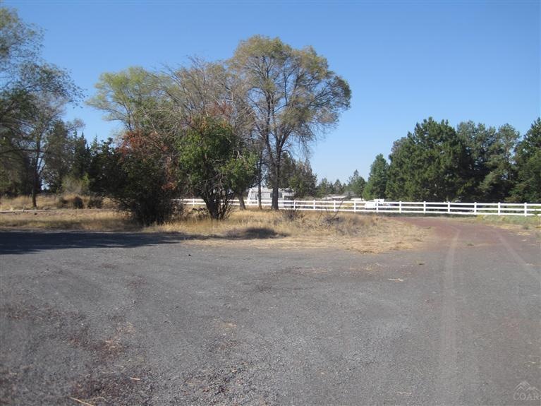
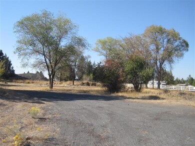
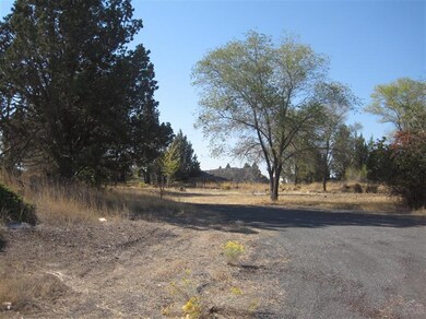
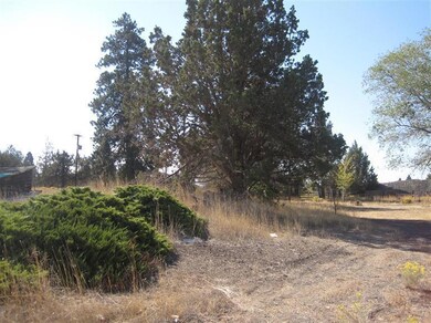
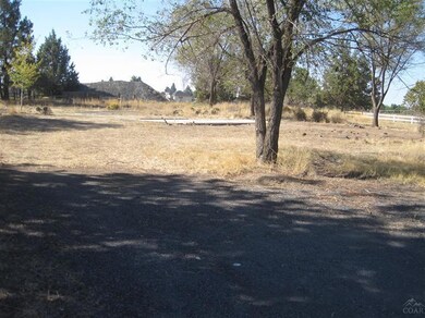
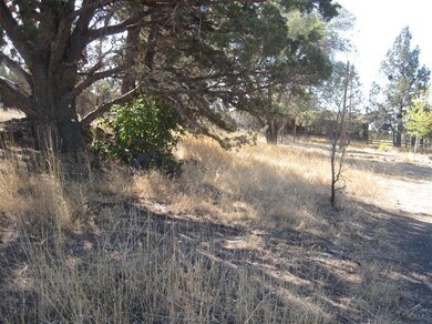
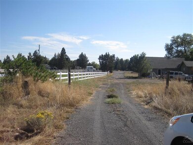
Cascade Mtn. views, mature trees, rock cropping, RS zoned. Would make a good building site. Owner will carry.
Last Agent to Sell the Property
Duke Warner Realty License #890400097 Listed on: 06/07/2017
| Date | Buyer | Sale Price | Title Company |
|---|---|---|---|
| Careshare Investments Llc | $156,000 | First American Title | |
| Bennett Kathleen M | -- | -- | |
| Bennett Leroy Clarence | -- | -- |
| Date | Status | Borrower | Loan Amount |
|---|---|---|---|
| Closed | Careshare Investments Llc | $56,000 |
| Date | Event | Price | List to Sale | Price per Sq Ft |
|---|---|---|---|---|
| 07/31/2017 07/31/17 | Sold | $156,000 | -22.0% | -- |
| 06/16/2017 06/16/17 | Pending | -- | -- | -- |
| 10/07/2015 10/07/15 | For Sale | $199,900 | -- | -- |
| Year | Tax Paid | Tax Assessment Tax Assessment Total Assessment is a certain percentage of the fair market value that is determined by local assessors to be the total taxable value of land and additions on the property. | Land | Improvement |
|---|---|---|---|---|
| 2021 | -- | $0 | $0 | $0 |
| 2020 | $0 | $0 | $0 | $0 |
| 2019 | $743 | $47,940 | $0 | $0 |
| 2018 | $722 | $46,550 | $0 | $0 |
| 2017 | $701 | $45,200 | $0 | $0 |
| 2016 | $669 | $43,890 | $0 | $0 |
| 2015 | $651 | $42,620 | $0 | $0 |
| 2014 | $728 | $47,680 | $0 | $0 |
C
Seller's Agent in 2017
Carolyn Emick
Duke Warner Realty
(541) 419-0717
3 in this area
30 Total Sales
K
Seller Co-Listing Agent in 2017
Kim Warner
Duke Warner Realty
(541) 410-2475
3 in this area
46 Total Sales
Source: Oregon Datashare
MLS Number: 201510011
APN: 119208
Disclaimer: Certain information contained herein is derived from information provided by parties other than Homes.com. All information provided is deemed reliable, but is not guaranteed to be accurate and should be independently verified.
![]() © 2025 Oregon Datashare (KCAR | MLSCO | SOMLS). All rights reserved. The data relating to real estate for sale on this web site comes in part from the Internet Data Exchange Program of the Oregon Datashare. Real estate listings held by IDX Brokerage firms other than Ten-X are marked with the Internet Data Exchange logo or the Internet Data Exchange thumbnail logo and detailed information about them includes the name of the listing Brokers. Information provided is for consumers' personal, non-commercial use and may not be used for any purpose other than to identify prospective properties the viewer may be interested in purchasing. The consumer will not copy, retransmit nor redistribute any of the content from this website. Information provided is deemed reliable, but not guaranteed.
© 2025 Oregon Datashare (KCAR | MLSCO | SOMLS). All rights reserved. The data relating to real estate for sale on this web site comes in part from the Internet Data Exchange Program of the Oregon Datashare. Real estate listings held by IDX Brokerage firms other than Ten-X are marked with the Internet Data Exchange logo or the Internet Data Exchange thumbnail logo and detailed information about them includes the name of the listing Brokers. Information provided is for consumers' personal, non-commercial use and may not be used for any purpose other than to identify prospective properties the viewer may be interested in purchasing. The consumer will not copy, retransmit nor redistribute any of the content from this website. Information provided is deemed reliable, but not guaranteed.
