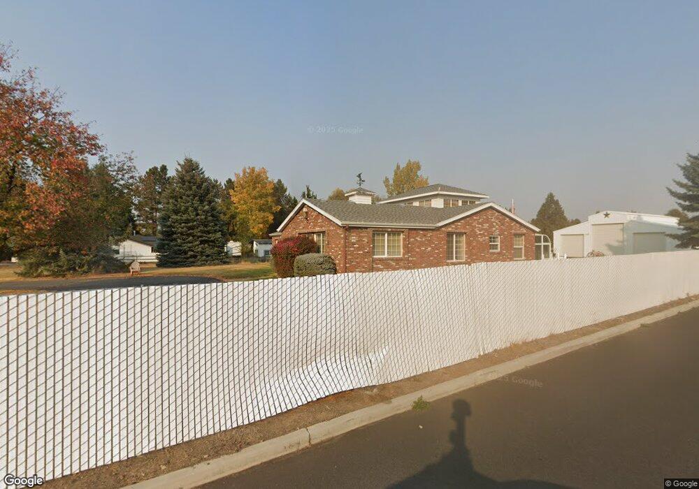
61832 Pettigrew Rd Bend, OR 97702
Larkspur NeighborhoodEstimated Value: $763,000 - $1,006,104
3
Beds
2
Baths
2,780
Sq Ft
$316/Sq Ft
Est. Value
About This Home
This home is located at 61832 Pettigrew Rd, Bend, OR 97702 and is currently estimated at $878,526, approximately $316 per square foot. 61832 Pettigrew Rd is a home located in Deschutes County with nearby schools including Bear Creek Elementary School, Pilot Butte Middle School, and Bend Senior High School.
Ownership History
Date
Name
Owned For
Owner Type
Purchase Details
Closed on
Jun 14, 2021
Sold by
Woo Christina Marie
Bought by
Wallace Jesse
Current Estimated Value
Purchase Details
Closed on
Jan 14, 2021
Sold by
Woo Christina Marie
Bought by
Wallace Jesse
Purchase Details
Closed on
Dec 21, 2020
Sold by
Woo Christina Marie
Bought by
Wallace Jesse Allen
Purchase Details
Closed on
Aug 31, 2017
Sold by
Pieratt Earl Dean
Bought by
Wallaec Jesse A and Wallace Christina Marie
Purchase Details
Closed on
Oct 20, 2004
Sold by
Pieratt Dean and Pieratt Elise
Bought by
Pieratt Earl Dean and The Earl Dean Pieratt Trust
Purchase Details
Closed on
Jan 9, 2004
Sold by
Pieratt Earl Dean and Pieratt Elise
Bought by
Pieratt Dean and Pieratt Elise
Create a Home Valuation Report for This Property
The Home Valuation Report is an in-depth analysis detailing your home's value as well as a comparison with similar homes in the area
Home Values in the Area
Average Home Value in this Area
Purchase History
| Date | Buyer | Sale Price | Title Company |
|---|---|---|---|
| Wallace Jesse | -- | None Available | |
| Wallace Jesse | -- | None Available | |
| Wallace Jesse Allen | $118,000 | None Listed On Document | |
| Wallaec Jesse A | $300,000 | None Available | |
| Pieratt Earl Dean | -- | -- | |
| Pieratt Dean | -- | -- |
Source: Public Records
Tax History
| Year | Tax Paid | Tax Assessment Tax Assessment Total Assessment is a certain percentage of the fair market value that is determined by local assessors to be the total taxable value of land and additions on the property. | Land | Improvement |
|---|---|---|---|---|
| 2025 | $7,127 | $421,790 | -- | -- |
| 2024 | $6,857 | $409,510 | -- | -- |
| 2023 | $6,356 | $397,590 | $0 | $0 |
| 2022 | $5,930 | $374,770 | $0 | $0 |
| 2021 | $5,939 | $363,860 | $0 | $0 |
| 2020 | $5,635 | $363,860 | $0 | $0 |
| 2019 | $5,478 | $353,270 | $0 | $0 |
| 2018 | $5,323 | $342,990 | $0 | $0 |
| 2017 | $5,167 | $333,000 | $0 | $0 |
| 2016 | $4,928 | $323,310 | $0 | $0 |
| 2015 | $4,791 | $313,900 | $0 | $0 |
| 2014 | $4,650 | $304,760 | $0 | $0 |
Source: Public Records
Map
Nearby Homes
- 61813 Azalia Place
- 61839 Avonlea Cir
- 61839 SE 27th St
- 21138 SE Kayla Ct
- 21177 Ritz Place
- 21152 Desert Skies Place
- 61969 SE 27th St
- 61683 Daly Estates Dr
- 21060 Woodhaven Ave
- 997 SE Shadowood Dr
- 61635 Daly Estates Dr Unit 17
- 61632 Pettigrew Rd Unit 18
- 61625 Daly Estates Dr Unit 4
- 61625 Daly Estates Dr Unit 2
- 61620 Daly Estates Dr
- 21130 SE Reed Market Rd
- 161 SE Rice Way
- 21266 Capella Place
- 62062 Dean Swift Rd
- 1630 SE Tempest Dr Unit 6
- 61815 SE Rolo Ct
- 61816 SE Rolo Ct
- 61828 Pettigrew Rd
- 61838 Pettigrew Rd
- 61811 SE Rolo Ct
- 61812 SE Rolo Ct
- 21094 Thomas Dr
- 61809 Azalia Place
- 61808 SE Rolo Ct
- 61850 Pettigrew Rd
- 61804 SE Rolo Ct
- 21093 Thomas Dr
- 61805 Azalia Place
- 100 SE Airpark Dr
- 21130 Thomas Dr
- 61801 Azalia Place
- 21086 Thomas Dr
- 61830 Azalia Place
- 21108 Azalia Ave
- 21112 Azalia Ave
Your Personal Tour Guide
Ask me questions while you tour the home.