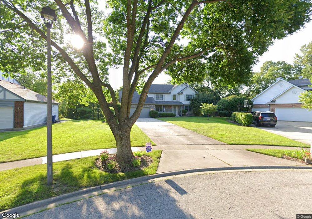
6186 Brittany Ct Gurnee, IL 60031
Estimated Value: $482,403 - $531,000
4
Beds
4
Baths
2,608
Sq Ft
$192/Sq Ft
Est. Value
About This Home
This home is located at 6186 Brittany Ct, Gurnee, IL 60031 and is currently estimated at $501,851, approximately $192 per square foot. 6186 Brittany Ct is a home located in Lake County with nearby schools including Woodland Primary School, Woodland Intermediate School, and Woodland Elementary School.
Ownership History
Date
Name
Owned For
Owner Type
Purchase Details
Closed on
Apr 18, 1994
Sold by
Farris Donald
Bought by
Stolcers Peter K and Boz Stolcers Shannon M
Current Estimated Value
Home Financials for this Owner
Home Financials are based on the most recent Mortgage that was taken out on this home.
Original Mortgage
$209,000
Interest Rate
6.55%
Create a Home Valuation Report for This Property
The Home Valuation Report is an in-depth analysis detailing your home's value as well as a comparison with similar homes in the area
Home Values in the Area
Average Home Value in this Area
Purchase History
| Date | Buyer | Sale Price | Title Company |
|---|---|---|---|
| Stolcers Peter K | $186,000 | Chicago Title Insurance Co |
Source: Public Records
Mortgage History
| Date | Status | Borrower | Loan Amount |
|---|---|---|---|
| Closed | Stolcers Peter K | $209,000 |
Source: Public Records
Tax History Compared to Growth
Tax History
| Year | Tax Paid | Tax Assessment Tax Assessment Total Assessment is a certain percentage of the fair market value that is determined by local assessors to be the total taxable value of land and additions on the property. | Land | Improvement |
|---|---|---|---|---|
| 2024 | $10,854 | $127,584 | $25,274 | $102,310 |
| 2023 | $11,288 | $118,452 | $23,465 | $94,987 |
| 2022 | $11,288 | $121,810 | $23,444 | $98,366 |
| 2021 | $10,204 | $116,922 | $22,503 | $94,419 |
| 2020 | $9,876 | $114,048 | $21,950 | $92,098 |
| 2019 | $9,595 | $110,737 | $21,313 | $89,424 |
| 2018 | $9,537 | $111,417 | $20,967 | $90,450 |
| 2017 | $9,436 | $108,224 | $20,366 | $87,858 |
| 2016 | $9,363 | $103,405 | $19,459 | $83,946 |
| 2015 | $9,121 | $98,070 | $18,455 | $79,615 |
| 2014 | $8,897 | $96,457 | $18,219 | $78,238 |
| 2012 | $8,431 | $97,196 | $18,359 | $78,837 |
Source: Public Records
Map
Nearby Homes
- 295 N Hunt Club Rd
- 16978 W Orchard Valley Dr
- 6161 Oakmont Ln
- 6191 Oakmont Ln
- 6402 Barn Swallow Ct
- 17404 W Walnut Ln Unit 2C
- 6091 Washington St
- 17150 Washington St
- 6409 Davidson Ct
- 6401 Davidson Ct
- 6296 Doral Dr
- 17444 Pin Oak Ln
- 17429 W Chestnut Ln Unit 13A
- 0 Tri State Pkwy
- 17490 Pin Oak Ln
- 34040 N White Oak Ln Unit 46C
- 35051 N Oak Knoll Cir
- 6359 Doral Dr
- 17514 W Bridle Ct
- 17119 W Prairieview Ln
- 6174 Brittany Ct
- 6198 Brittany Ct
- 397 Churchill Ln
- 413 Churchill Ln
- 381 Churchill Ln
- 6210 Brittany Ct
- 6162 Brittany Ct
- 6177 Brittany Ct
- 6213 Brittany Ct
- 6189 Brittany Ct
- 6201 Brittany Ct
- 390 Churchill Ln
- 372 Churchill Ln
- 412 Churchill Ln
- 400 Churchill Ln
- 321 Churchill Ln
- 348 Churchill Ln
- 364 Churchill Ln
- 6268 Winchester Ct
- 320 Churchill Ln