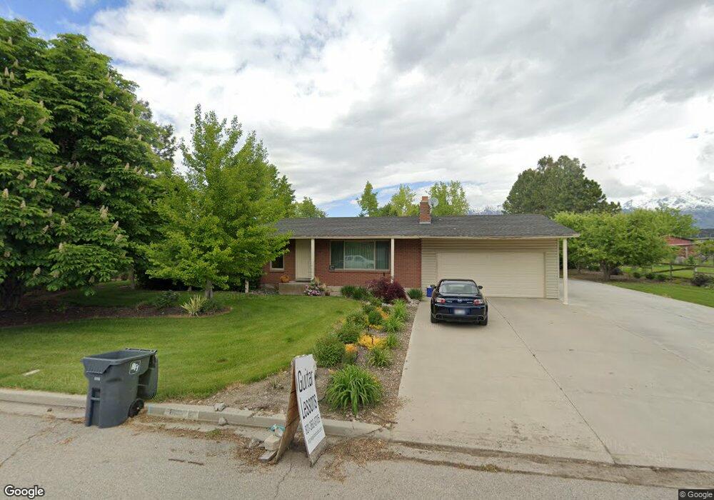
6186 W 10050 N Highland, UT 84003
Estimated Value: $739,000 - $921,000
5
Beds
3
Baths
2,818
Sq Ft
$287/Sq Ft
Est. Value
About This Home
This home is located at 6186 W 10050 N, Highland, UT 84003 and is currently estimated at $810,087, approximately $287 per square foot. 6186 W 10050 N is a home located in Utah County with nearby schools including Freedom Elementary School, Mountain Ridge Junior High School, and American Fork High School.
Ownership History
Date
Name
Owned For
Owner Type
Purchase Details
Closed on
Sep 20, 2012
Sold by
Caldiero Oertli David F and Caldiero Oertli Sara H
Bought by
Argyle Steven Reed and Oretli Kathryn Carol
Current Estimated Value
Purchase Details
Closed on
May 29, 2003
Sold by
Oertli Erwin F and Oertli Carol E S
Bought by
Caldiero Oertli David F and Caldiero Oertli Sara H
Home Financials for this Owner
Home Financials are based on the most recent Mortgage that was taken out on this home.
Original Mortgage
$180,000
Interest Rate
5.75%
Mortgage Type
Purchase Money Mortgage
Create a Home Valuation Report for This Property
The Home Valuation Report is an in-depth analysis detailing your home's value as well as a comparison with similar homes in the area
Home Values in the Area
Average Home Value in this Area
Purchase History
| Date | Buyer | Sale Price | Title Company |
|---|---|---|---|
| Argyle Steven Reed | -- | Title West | |
| Caldiero Oertli David F | -- | Provo Land Title Company |
Source: Public Records
Mortgage History
| Date | Status | Borrower | Loan Amount |
|---|---|---|---|
| Previous Owner | Caldiero Oertli David F | $180,000 |
Source: Public Records
Tax History Compared to Growth
Tax History
| Year | Tax Paid | Tax Assessment Tax Assessment Total Assessment is a certain percentage of the fair market value that is determined by local assessors to be the total taxable value of land and additions on the property. | Land | Improvement |
|---|---|---|---|---|
| 2025 | $3,096 | $405,240 | $406,900 | $329,900 |
| 2024 | $3,096 | $382,415 | $0 | $0 |
| 2023 | $2,878 | $383,515 | $0 | $0 |
| 2022 | $2,805 | $362,450 | $0 | $0 |
| 2021 | $159 | $457,100 | $230,800 | $226,300 |
| 2020 | $2,216 | $418,300 | $200,700 | $217,600 |
| 2019 | $1,975 | $389,900 | $200,700 | $189,200 |
| 2018 | $1,936 | $363,200 | $186,000 | $177,200 |
| 2017 | $1,707 | $170,940 | $0 | $0 |
| 2016 | $1,708 | $159,830 | $0 | $0 |
| 2015 | $1,710 | $151,745 | $0 | $0 |
| 2014 | $1,634 | $143,660 | $0 | $0 |
Source: Public Records
Map
Nearby Homes
- 6185 W 10050 N
- 6156 W 10050 N
- 6205 W 10050 N
- 6147 W 10050 N
- 6226 W 10050 N
- 6136 W 10050 N
- 6225 W 10050 N
- 6131 W 10050 N
- 6174 W Thornton Cir
- 6131 W 10150 N
- 6173 W 10150 N
- 6197 W 10150 N
- 6106 W 10050 N
- 6245 W 10050 N
- 6246 W 10050 N
- 6215 W 10150 N
- 6091 W 10050 N
- 10036 N 6150 W
- 6189 W Thornton Cir
- 6174 Thornton Cir