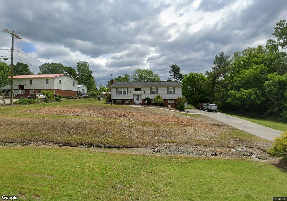
6188 Weant Rd High Point, NC 27263
Estimated Value: $234,766 - $324,000
--
Bed
2
Baths
1,494
Sq Ft
$185/Sq Ft
Est. Value
About This Home
This home is located at 6188 Weant Rd, High Point, NC 27263 and is currently estimated at $276,942, approximately $185 per square foot. 6188 Weant Rd is a home located in Randolph County with nearby schools including John R. Lawrence Elementary School, Wheatmore Middle School, and Trinity High School.
Ownership History
Date
Name
Owned For
Owner Type
Purchase Details
Closed on
Mar 16, 2007
Sold by
Cox Dana R and Cox Rita K
Bought by
Cox Dana R
Current Estimated Value
Create a Home Valuation Report for This Property
The Home Valuation Report is an in-depth analysis detailing your home's value as well as a comparison with similar homes in the area
Home Values in the Area
Average Home Value in this Area
Purchase History
| Date | Buyer | Sale Price | Title Company |
|---|---|---|---|
| Cox Dana R | -- | None Available |
Source: Public Records
Tax History Compared to Growth
Tax History
| Year | Tax Paid | Tax Assessment Tax Assessment Total Assessment is a certain percentage of the fair market value that is determined by local assessors to be the total taxable value of land and additions on the property. | Land | Improvement |
|---|---|---|---|---|
| 2025 | $776 | $211,900 | $57,970 | $153,930 |
| 2024 | $766 | $211,900 | $57,970 | $153,930 |
| 2023 | $766 | $211,900 | $57,970 | $153,930 |
| 2022 | $574 | $130,870 | $24,730 | $106,140 |
| 2021 | $574 | $130,870 | $24,730 | $106,140 |
| 2020 | $570 | $130,870 | $24,730 | $106,140 |
| 2019 | $570 | $130,870 | $24,730 | $106,140 |
| 2018 | $541 | $120,130 | $17,810 | $102,320 |
| 2016 | $1,050 | $120,128 | $17,810 | $102,318 |
| 2015 | $1,053 | $120,128 | $17,810 | $102,318 |
| 2014 | $1,053 | $120,128 | $17,810 | $102,318 |
Source: Public Records
Map
Nearby Homes
- 6071 Weant Rd
- 115 Lindsay Dr
- 5988 Weant Rd
- 110 Deerfield Place
- 100 Lindsay Dr
- 0-C Us Highway 311
- 3827 Wood Ave
- 210 Waters Edge Dr
- 305 Alison Ln
- 108 Sprucewood Ct
- 0 Sprucewood Ct
- 9622 Us Highway 311
- 1206 Byron Ln
- 104 Autumn Hill Ct
- 107 Autumn Hill Ct
- 0-A Us Highway 311
- 108 Willow Terrace
- 105 Willow Terrace
- 4216 Huff Rd
- 0-B Us Highway 311
- 6198 Weant Rd
- 6214 Weant Rd
- 6109 Hazelwood Ln
- 6224 Weant Rd
- 6119 Hazelwood Ln
- 3287 Wood Ave
- 6133 Hazelwood Ln
- 6236 Weant Rd
- 6094 Hazelwood Ln
- 6106 Hazelwood Ln
- 405 Center Pointe Ct
- 409 Center Pointe Ct
- 401 Center Pointe Ct
- 6122 Hazelwood Ln
- 6145 Hazelwood Ln
- 6132 Weant Rd
- 6246 Weant Rd
- 6132 Hazelwood Ln
- 105 Preston Ct
- 6124 Weant Rd