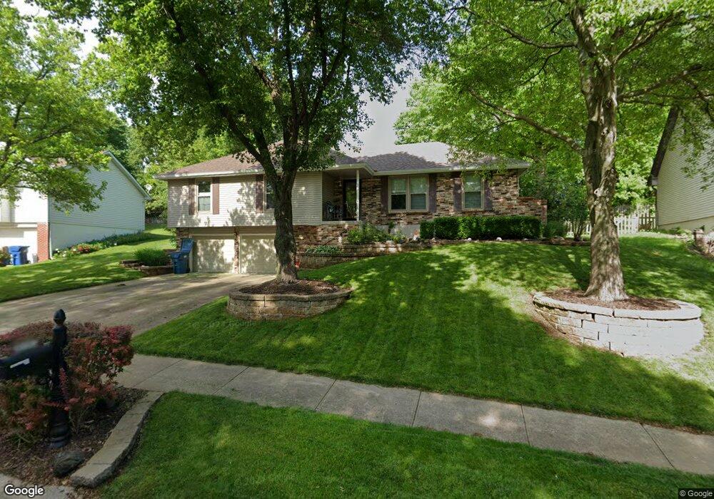
619 Camelot Dr Liberty, MO 64068
Estimated Value: $330,000 - $405,000
3
Beds
2
Baths
1,730
Sq Ft
$206/Sq Ft
Est. Value
About This Home
This home is located at 619 Camelot Dr, Liberty, MO 64068 and is currently estimated at $356,791, approximately $206 per square foot. 619 Camelot Dr is a home located in Clay County with nearby schools including Lewis And Clark Elementary School, Heritage Middle School, and Liberty North High School.
Ownership History
Date
Name
Owned For
Owner Type
Purchase Details
Closed on
Aug 5, 2022
Sold by
Flexer Daniel R
Bought by
Thorne Nathan M and Kohler Tessa B
Current Estimated Value
Home Financials for this Owner
Home Financials are based on the most recent Mortgage that was taken out on this home.
Original Mortgage
$315,400
Outstanding Balance
$302,242
Interest Rate
5.81%
Mortgage Type
New Conventional
Estimated Equity
$54,549
Create a Home Valuation Report for This Property
The Home Valuation Report is an in-depth analysis detailing your home's value as well as a comparison with similar homes in the area
Home Values in the Area
Average Home Value in this Area
Purchase History
| Date | Buyer | Sale Price | Title Company |
|---|---|---|---|
| Thorne Nathan M | $385,000 | Dec Courtney E | |
| Thorne Nathan M | $385,000 | Dec Courtney E |
Source: Public Records
Mortgage History
| Date | Status | Borrower | Loan Amount |
|---|---|---|---|
| Open | Thorne Nathan M | $315,400 | |
| Closed | Thorne Nathan M | $315,400 |
Source: Public Records
Tax History Compared to Growth
Tax History
| Year | Tax Paid | Tax Assessment Tax Assessment Total Assessment is a certain percentage of the fair market value that is determined by local assessors to be the total taxable value of land and additions on the property. | Land | Improvement |
|---|---|---|---|---|
| 2025 | $3,712 | $51,760 | -- | -- |
| 2024 | $3,712 | $48,260 | -- | -- |
| 2023 | $3,775 | $48,260 | $0 | $0 |
| 2022 | $3,143 | $39,670 | $0 | $0 |
| 2021 | $3,118 | $39,672 | $5,700 | $33,972 |
| 2020 | $2,896 | $34,600 | $0 | $0 |
| 2019 | $2,896 | $34,599 | $5,700 | $28,899 |
| 2018 | $2,627 | $30,820 | $0 | $0 |
| 2017 | $2,603 | $30,820 | $5,700 | $25,120 |
| 2016 | $2,603 | $30,820 | $5,700 | $25,120 |
| 2015 | $2,603 | $30,820 | $5,700 | $25,120 |
| 2014 | $2,559 | $30,060 | $6,460 | $23,600 |
Source: Public Records
Map
Nearby Homes
- 527 Lancelot Dr
- 523 Lancelot Dr
- 519 Lancelot Dr
- 815 Kings Ridge
- 317 Camelot Dr
- 900 Wildbriar Dr
- 1484 Hemlock Dr
- 1107 Wildbriar Dr
- 194 Camelot Dr
- 1487 Spruce Dr
- 412 N Fairview Ave
- 506 W Mississippi St
- 606 N Morse Ave
- 1408 Telford Dr
- 1304 Nashua Rd
- 15 Valley Rd
- 1207 Linden Rd
- 1541 N Withers Rd
- 248 Range Line Rd
- 907 N Forest Ln
- 623 Camelot Dr
- 615 Camelot Dr
- 712 Westwoods Dr
- 611 Camelot Dr
- 618 Westwoods Dr
- 20 Camelot Place
- 620 Camelot Dr
- 22 Camelot Place
- 610 Camelot Dr
- 624 Camelot Dr
- 614 Westwoods Dr
- 628 Camelot Dr
- 606 Camelot Dr
- 716 Westwoods Dr
- 603 Camelot Dr
- 24 Camelot Place
- 615 N Clayview Dr
- 619 N Clayview Dr
- 632 Camelot Dr
- 30 Camelot Place