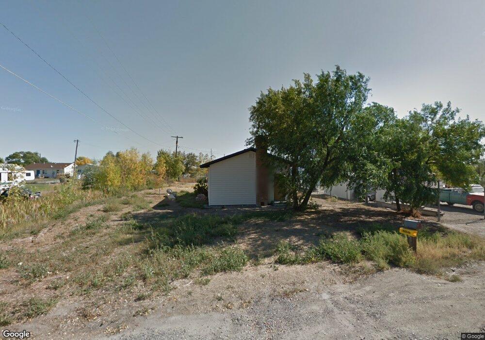
619 Locust Ave Laurel, MT 59044
Estimated Value: $233,001 - $297,000
1
Bed
1
Bath
670
Sq Ft
$385/Sq Ft
Est. Value
About This Home
This home is located at 619 Locust Ave, Laurel, MT 59044 and is currently estimated at $258,250, approximately $385 per square foot. 619 Locust Ave is a home located in Yellowstone County with nearby schools including Fred W. Graff School, West School, and Laurel Middle School.
Ownership History
Date
Name
Owned For
Owner Type
Purchase Details
Closed on
Mar 22, 2022
Sold by
Frank David
Bought by
Rhoads Tyler
Current Estimated Value
Home Financials for this Owner
Home Financials are based on the most recent Mortgage that was taken out on this home.
Original Mortgage
$211,105
Outstanding Balance
$195,990
Interest Rate
3.69%
Mortgage Type
FHA
Estimated Equity
$62,260
Purchase Details
Closed on
Jul 28, 2021
Sold by
Jenkins Verna and Moore Janet
Bought by
Frank David
Home Financials for this Owner
Home Financials are based on the most recent Mortgage that was taken out on this home.
Original Mortgage
$85,000
Interest Rate
2.93%
Mortgage Type
VA
Purchase Details
Closed on
Oct 29, 2018
Sold by
Kroll Ronda
Bought by
Jenkins Verua and Moore Janet
Create a Home Valuation Report for This Property
The Home Valuation Report is an in-depth analysis detailing your home's value as well as a comparison with similar homes in the area
Home Values in the Area
Average Home Value in this Area
Purchase History
| Date | Buyer | Sale Price | Title Company |
|---|---|---|---|
| Rhoads Tyler | -- | Chicago Title | |
| Frank David | -- | Chicago Title | |
| Jenkins Verua | -- | -- |
Source: Public Records
Mortgage History
| Date | Status | Borrower | Loan Amount |
|---|---|---|---|
| Open | Rhoads Tyler | $211,105 | |
| Previous Owner | Frank David | $85,000 |
Source: Public Records
Tax History
| Year | Tax Paid | Tax Assessment Tax Assessment Total Assessment is a certain percentage of the fair market value that is determined by local assessors to be the total taxable value of land and additions on the property. | Land | Improvement |
|---|---|---|---|---|
| 2025 | $1,322 | $242,800 | $56,449 | $186,351 |
| 2024 | $1,322 | $196,300 | $36,672 | $159,628 |
| 2023 | $1,321 | $196,300 | $36,672 | $159,628 |
| 2022 | $1,106 | $160,800 | $0 | $0 |
| 2021 | $658 | $93,800 | $0 | $0 |
| 2020 | $669 | $94,200 | $0 | $0 |
| 2019 | $644 | $94,200 | $0 | $0 |
| 2018 | $632 | $79,600 | $0 | $0 |
| 2017 | $521 | $79,600 | $0 | $0 |
| 2016 | $562 | $81,000 | $0 | $0 |
| 2015 | $553 | $81,000 | $0 | $0 |
| 2014 | $420 | $32,876 | $0 | $0 |
Source: Public Records
Map
Nearby Homes
- 611 Elm Ave
- 1108 E 8th St
- 1106 Sunhaven Dr
- 605 Date Ave
- 1104 E 8th St
- 1031 Fir Ave
- 801 E 4th St
- 717 E 5th, 506 Alder Ave
- 717 E 5th St
- 601 E 5th St
- 516 Pennsylvania Ave
- 1003 Montana Ave
- 110 E 5th St
- 109 E 12th St
- 1665 Wild Lupine Ln
- 116 4th Ave
- 1319 Valley Dr
- 211 Woodland Ave
- 1627 Brookway Cir
- 120 Forrest Ave
- 617 Locust Ave
- 703 Locust Ave
- 628 Locust Ave
- 707 Locust Ave
- 622 Locust Ave
- 605 Locust Ave
- 618 Locust Ave
- 702 Locust Ave
- 711 Locust Ave
- 702 Mullberry Ave
- 706 Locust Ave
- 616 Locust Ave
- 715 Locust Ave
- 710 Locust Ave
- 708 Mullberry Ave
- 708 Mullberry Ave
- 708 Mulberry Ave
- TBD E Main St
- 1619 E Main St
- 1515 E Main St
Your Personal Tour Guide
Ask me questions while you tour the home.