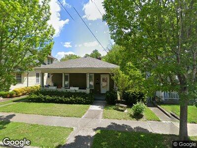
619 Logan St Frankfort, KY 40601
Estimated Value: $152,093 - $185,000
2
Beds
1
Bath
1,148
Sq Ft
$144/Sq Ft
Est. Value
About This Home
This home is located at 619 Logan St, Frankfort, KY 40601 and is currently estimated at $165,273, approximately $143 per square foot. 619 Logan St is a home located in Franklin County with nearby schools including Second Street School, Frankfort High School, and Capital Day School.
Ownership History
Date
Name
Owned For
Owner Type
Purchase Details
Closed on
Mar 24, 2022
Sold by
Ky Home Investors Llc
Bought by
Wingate Deborah
Current Estimated Value
Home Financials for this Owner
Home Financials are based on the most recent Mortgage that was taken out on this home.
Original Mortgage
$116,000
Interest Rate
3.69%
Mortgage Type
Construction
Purchase Details
Closed on
Jun 29, 2018
Sold by
Stokes George
Bought by
Wingate Deborah
Purchase Details
Closed on
Apr 25, 2007
Sold by
Rosenstein Louis Michael and Rosenstein Hollis S
Bought by
Stokes George
Home Financials for this Owner
Home Financials are based on the most recent Mortgage that was taken out on this home.
Original Mortgage
$24,250
Interest Rate
6.11%
Mortgage Type
Stand Alone Second
Create a Home Valuation Report for This Property
The Home Valuation Report is an in-depth analysis detailing your home's value as well as a comparison with similar homes in the area
Home Values in the Area
Average Home Value in this Area
Purchase History
| Date | Buyer | Sale Price | Title Company |
|---|---|---|---|
| Wingate Deborah | $145,000 | None Listed On Document | |
| Wingate Deborah | $80,000 | None Available | |
| Stokes George | $97,000 | -- |
Source: Public Records
Mortgage History
| Date | Status | Borrower | Loan Amount |
|---|---|---|---|
| Closed | Wingate Deborah | $116,000 | |
| Previous Owner | Stokes George | $24,250 | |
| Previous Owner | Stokes George | $72,750 |
Source: Public Records
Tax History Compared to Growth
Tax History
| Year | Tax Paid | Tax Assessment Tax Assessment Total Assessment is a certain percentage of the fair market value that is determined by local assessors to be the total taxable value of land and additions on the property. | Land | Improvement |
|---|---|---|---|---|
| 2024 | $466 | $100,000 | $0 | $0 |
| 2023 | $474 | $100,000 | $0 | $0 |
| 2022 | $1,212 | $100,000 | $0 | $0 |
| 2021 | $476 | $100,000 | $0 | $0 |
| 2020 | $385 | $80,000 | $15,000 | $65,000 |
| 2019 | $385 | $80,000 | $15,000 | $65,000 |
| 2018 | $477 | $80,000 | $15,000 | $65,000 |
| 2017 | $1,060 | $97,000 | $15,000 | $82,000 |
| 2016 | $453 | $97,000 | $15,000 | $82,000 |
| 2015 | $860 | $97,000 | $15,000 | $82,000 |
| 2011 | $860 | $97,000 | $15,000 | $82,000 |
Source: Public Records
Map
Nearby Homes
- 110 E Todd St
- 333 E 4th St Unit A3
- 333 E 4th St Unit A6
- 715 Woodland Ave
- 719 Woodland Ave
- 316 Logan St
- 725 Woodland Ave
- 227 New St
- 218 W Campbell St
- 726-728 Woodland Ave
- 300 Paul Sawyier Dr
- 209 Logan St
- 322 Steele St
- 323 Conway St
- 312 Conway St
- 2047 Berry Hill Dr
- 1127 Leawood Dr
- 1105 Leawood Dr
- 2031 Berry Hill Dr
- 2033 Berry Hill Dr