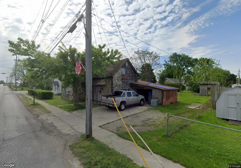
619 Main St Whiteland, IN 46184
Estimated Value: $167,000 - $280,000
2
Beds
1
Bath
1,745
Sq Ft
$132/Sq Ft
Est. Value
About This Home
This home is located at 619 Main St, Whiteland, IN 46184 and is currently estimated at $230,986, approximately $132 per square foot. 619 Main St is a home located in Johnson County with nearby schools including Whiteland Elementary School, Clark-Pleasant Middle School, and Whiteland Community High School.
Ownership History
Date
Name
Owned For
Owner Type
Purchase Details
Closed on
May 13, 2022
Sold by
Cibor Bart J
Bought by
Cibor Theodore W
Current Estimated Value
Purchase Details
Closed on
Dec 29, 2009
Sold by
Secretary Of Hud
Bought by
Cibor Bart J
Purchase Details
Closed on
May 5, 2009
Sold by
Wells Fargo Bank N A
Bought by
Secretary Of Hud
Purchase Details
Closed on
Apr 16, 2009
Sold by
Ayers Alvin L
Bought by
Wells Fargo Bank N A
Purchase Details
Closed on
Nov 14, 2007
Sold by
Federal National Mortgage Association
Bought by
Ayers Avin L
Home Financials for this Owner
Home Financials are based on the most recent Mortgage that was taken out on this home.
Original Mortgage
$50,513
Interest Rate
6.27%
Mortgage Type
FHA
Purchase Details
Closed on
May 17, 2007
Sold by
Hardin Kathy
Bought by
Federal National Mortgage Association
Create a Home Valuation Report for This Property
The Home Valuation Report is an in-depth analysis detailing your home's value as well as a comparison with similar homes in the area
Home Values in the Area
Average Home Value in this Area
Purchase History
| Date | Buyer | Sale Price | Title Company |
|---|---|---|---|
| Cibor Theodore W | -- | Hewitt Law & Mediation Llc | |
| Cibor Bart J | -- | Eagle Land Title Llc | |
| Secretary Of Hud | -- | None Available | |
| Wells Fargo Bank N A | $58,423 | None Available | |
| Ayers Avin L | -- | Ctic | |
| Federal National Mortgage Association | $54,422 | None Available |
Source: Public Records
Mortgage History
| Date | Status | Borrower | Loan Amount |
|---|---|---|---|
| Previous Owner | Ayers Avin L | $50,513 |
Source: Public Records
Tax History
| Year | Tax Paid | Tax Assessment Tax Assessment Total Assessment is a certain percentage of the fair market value that is determined by local assessors to be the total taxable value of land and additions on the property. | Land | Improvement |
|---|---|---|---|---|
| 2025 | $1,404 | $118,800 | $32,300 | $86,500 |
| 2024 | $1,404 | $67,200 | $32,300 | $34,900 |
| 2023 | $1,403 | $67,200 | $32,300 | $34,900 |
| 2022 | $1,398 | $67,200 | $26,100 | $41,100 |
| 2021 | $1,404 | $67,200 | $23,300 | $43,900 |
| 2020 | $1,413 | $67,200 | $14,400 | $52,800 |
| 2019 | $1,413 | $67,200 | $14,400 | $52,800 |
| 2018 | $987 | $48,000 | $11,000 | $37,000 |
| 2017 | $973 | $48,000 | $11,000 | $37,000 |
| 2016 | $964 | $48,000 | $11,000 | $37,000 |
| 2014 | $814 | $40,500 | $12,600 | $27,900 |
| 2013 | $814 | $40,300 | $12,600 | $27,700 |
Source: Public Records
Map
Nearby Homes
- 650 E Pearl St
- 810 Pearl St
- 111 Ames Dr
- 197 Briar Hill Dr
- 131 Ames Dr
- 140 Ames Dr
- 801 Blaine Dr
- 60 Wilkins St
- 830 Saddlebrook Farms Blvd
- 40 Wilkins St
- 50 Wilkins St
- 170 Ames Dr
- 70 Wilkins St
- 181 Ames Dr
- 657 Whiteland Rd
- 545 Whiteland Rd
- 930 Saddlebrook Farms Blvd
- 0 N 200 (Honey Creek Rd ) W Unit MBR21845718
- 30 Benfield Dr
- 221 Ames Dr
Your Personal Tour Guide
Ask me questions while you tour the home.