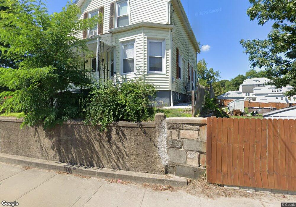
619 Manville Rd Woonsocket, RI 02895
Bernon District NeighborhoodEstimated Value: $375,000 - $395,927
4
Beds
2
Baths
1,647
Sq Ft
$234/Sq Ft
Est. Value
About This Home
This home is located at 619 Manville Rd, Woonsocket, RI 02895 and is currently estimated at $384,982, approximately $233 per square foot. 619 Manville Rd is a home located in Providence County with nearby schools including Woonsocket High School, Rise Prep Mayoral Academy Middle School, and Rise Prep Mayoral Academy.
Ownership History
Date
Name
Owned For
Owner Type
Purchase Details
Closed on
Oct 7, 2005
Sold by
Evers Scott
Bought by
Sosa Ramon
Current Estimated Value
Home Financials for this Owner
Home Financials are based on the most recent Mortgage that was taken out on this home.
Original Mortgage
$172,000
Outstanding Balance
$91,223
Interest Rate
5.81%
Mortgage Type
Purchase Money Mortgage
Estimated Equity
$293,759
Purchase Details
Closed on
Jun 14, 2001
Sold by
Graham Sandra E Est
Bought by
Evers Scott
Create a Home Valuation Report for This Property
The Home Valuation Report is an in-depth analysis detailing your home's value as well as a comparison with similar homes in the area
Home Values in the Area
Average Home Value in this Area
Purchase History
| Date | Buyer | Sale Price | Title Company |
|---|---|---|---|
| Sosa Ramon | $215,000 | -- | |
| Evers Scott | $125,000 | -- | |
| Sosa Ramon | $215,000 | -- | |
| Evers Scott | $125,000 | -- |
Source: Public Records
Mortgage History
| Date | Status | Borrower | Loan Amount |
|---|---|---|---|
| Open | Evers Scott | $172,000 | |
| Closed | Evers Scott | $43,000 | |
| Closed | Evers Scott | $172,000 |
Source: Public Records
Tax History
| Year | Tax Paid | Tax Assessment Tax Assessment Total Assessment is a certain percentage of the fair market value that is determined by local assessors to be the total taxable value of land and additions on the property. | Land | Improvement |
|---|---|---|---|---|
| 2025 | $3,929 | $349,900 | $92,000 | $257,900 |
| 2024 | $3,969 | $273,000 | $93,800 | $179,200 |
| 2023 | $3,817 | $273,000 | $93,800 | $179,200 |
| 2022 | $3,817 | $273,000 | $93,800 | $179,200 |
| 2021 | $3,648 | $153,600 | $51,900 | $101,700 |
| 2020 | $3,686 | $153,600 | $51,900 | $101,700 |
| 2018 | $3,699 | $153,600 | $51,900 | $101,700 |
| 2017 | $4,082 | $135,600 | $51,500 | $84,100 |
| 2016 | $4,318 | $135,600 | $51,500 | $84,100 |
| 2015 | $4,960 | $135,600 | $51,500 | $84,100 |
| 2014 | $3,303 | $131,300 | $55,700 | $75,600 |
Source: Public Records
Map
Nearby Homes
- 414 Rhode Island Ave
- 216 Bertenshaw Rd
- 2 Marian Ln
- 410 Carrington Ave
- 0 Irving Lot 206 Ave Unit 1397321
- 345 Carrington Ave
- 39 Louise St
- 346 Carrington Ave
- 74 Maple St
- 219 Crawford St
- 59 Division St
- 375 Congress St
- 190 Crawford St
- 526 Bernon St
- 24 Paradis Ave
- 0 Irving Lot 192 Ave Unit 1383138
- 374 Thibeault Ave
- 0 Hillview St
- 59 Cooper Ave
- 202 Phillips St
- 31 Saint Simon St
- 31 Saint Simon St Unit 2
- 31 Saint Simon St Unit 1
- 39 Saint Simon St
- 10 Saint Simon St
- 592 Manville Rd
- 6 Mount Saint Charles Ave
- 24 Saint Simon St
- 598 Manville Rd
- 616 Manville Rd
- 36 Saint Simon St
- 47 Saint Simon St
- 0 St Simon St Unit 801165
- 0 St Simon St Unit 1286359
- 0 St Simon St Unit 1272175
- 0 Saint Simon St
- 572 Manville Rd
- 572 Manville Rd Unit 2
- 572 Manville Rd Unit 3
- 34 Mount Saint Charles Ave
Your Personal Tour Guide
Ask me questions while you tour the home.