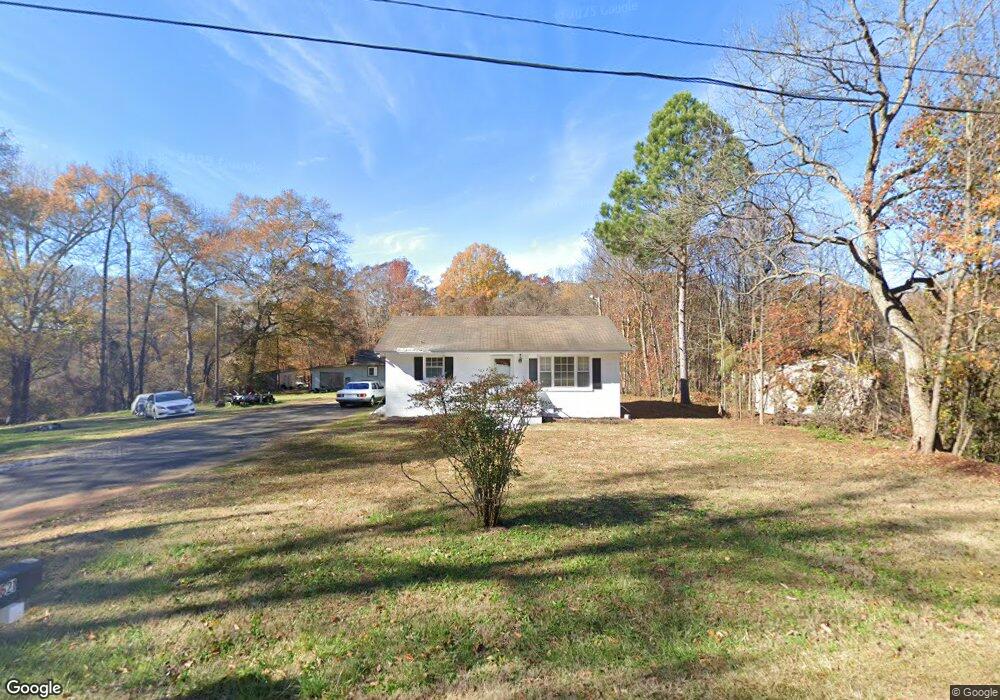
619 Maxie Dr Anderson, SC 29624
Estimated Value: $82,300 - $182,000
2
Beds
--
Bath
825
Sq Ft
$152/Sq Ft
Est. Value
About This Home
This home is located at 619 Maxie Dr, Anderson, SC 29624 and is currently estimated at $125,325, approximately $151 per square foot. 619 Maxie Dr is a home located in Anderson County with nearby schools including Varennes Elementary School, Robert Anderson Middle School, and Westside High School.
Ownership History
Date
Name
Owned For
Owner Type
Purchase Details
Closed on
Jul 15, 2022
Sold by
Gay Marcus M
Bought by
Gay Marcus M and Gay Felicia Terry
Current Estimated Value
Purchase Details
Closed on
Dec 16, 2014
Sold by
Tinsley Dennis E and Watermelon Properties
Bought by
Gay Marcus M
Home Financials for this Owner
Home Financials are based on the most recent Mortgage that was taken out on this home.
Original Mortgage
$14,800
Interest Rate
4.09%
Mortgage Type
New Conventional
Purchase Details
Closed on
Dec 21, 2012
Sold by
Watermelon Properties
Bought by
Gay Marcus M
Purchase Details
Closed on
Dec 15, 2011
Sold by
Anderson County Forfeited Land Commissio
Bought by
Watermelon Properties
Purchase Details
Closed on
Nov 30, 2011
Sold by
Gay Leroy
Bought by
Anderson County Forfeited Land Commissio
Create a Home Valuation Report for This Property
The Home Valuation Report is an in-depth analysis detailing your home's value as well as a comparison with similar homes in the area
Home Values in the Area
Average Home Value in this Area
Purchase History
| Date | Buyer | Sale Price | Title Company |
|---|---|---|---|
| Gay Marcus M | -- | Yon Steven M | |
| Gay Marcus M | -- | Yon Steven M | |
| Gay Marcus M | -- | -- | |
| Watermelon Properties And Rentals Of | -- | -- | |
| Gay Marcus M | -- | -- | |
| Gay Marcus M | $500 | -- | |
| Watermelon Properties | $250 | -- | |
| Anderson County Forfeited Land Commissio | $2,719 | -- |
Source: Public Records
Mortgage History
| Date | Status | Borrower | Loan Amount |
|---|---|---|---|
| Previous Owner | Gay Marcus M | $14,800 |
Source: Public Records
Tax History Compared to Growth
Tax History
| Year | Tax Paid | Tax Assessment Tax Assessment Total Assessment is a certain percentage of the fair market value that is determined by local assessors to be the total taxable value of land and additions on the property. | Land | Improvement |
|---|---|---|---|---|
| 2024 | $384 | $2,540 | $200 | $2,340 |
| 2023 | $384 | $3,810 | $300 | $3,510 |
| 2022 | $354 | $2,540 | $200 | $2,340 |
| 2021 | $351 | $2,430 | $300 | $2,130 |
| 2020 | $428 | $2,430 | $300 | $2,130 |
| 2019 | $346 | $2,430 | $300 | $2,130 |
| 2018 | $351 | $2,430 | $300 | $2,130 |
| 2017 | -- | $2,430 | $300 | $2,130 |
| 2016 | $373 | $2,620 | $400 | $2,220 |
| 2015 | $379 | $2,620 | $400 | $2,220 |
| 2014 | $374 | $2,620 | $400 | $2,220 |
Source: Public Records
Map
Nearby Homes
- 114 Hillcrest Cir Unit A
- 114 Hillcrest Cir
- 112 Flowe Rd
- 222 Hillcrest Cir
- 505 Lewis St
- 431 Lewis St
- 636 Jasmin Dr
- 719 Dora Dr
- 612 Martha Dr
- 1105 W Franklin St
- 00 Ila St
- 1205 W Franklin St
- 701 Delia St
- 701 Delia St Unit B
- 701 Delia St Unit A
- 720 722 Gary St
- 415 Chauga Dr
- 404 Montague St
- 00 W Franklin St
- 0 W Franklin St
- 621 Maxie Dr
- 720 Lewis St
- 714 Lewis St
- 710 Lewis St
- 704 Lewis St
- 715 Lewis St
- 702 Lewis St
- 618 Rear Lewis St
- 709 Lewis St
- 123 Hillcrest Cir
- 121 Hillcrest Cir
- 125 Hillcrest Cir
- 119 Hillcrest Cir
- 127 Hillcrest Cir
- 614 Lewis St
- 616 Rear Lewis St
- 616 Rear Lewis St
- 117 Hillcrest Cir
- 114 Hillcrest Cir Unit A
- Lots 23 & 24 Hillcrest Cir