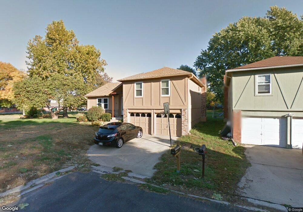
619 S 6th St Edwardsville, KS 66111
Estimated Value: $248,963 - $270,000
3
Beds
2
Baths
1,206
Sq Ft
$215/Sq Ft
Est. Value
About This Home
This home is located at 619 S 6th St, Edwardsville, KS 66111 and is currently estimated at $259,241, approximately $214 per square foot. 619 S 6th St is a home located in Wyandotte County with nearby schools including Robert E Clark Middle School and Bonner Springs High School.
Ownership History
Date
Name
Owned For
Owner Type
Purchase Details
Closed on
May 29, 2001
Sold by
Trickle Roy L and Trickle Barbara A
Bought by
Ellis C David and Ellis Shannon C
Current Estimated Value
Home Financials for this Owner
Home Financials are based on the most recent Mortgage that was taken out on this home.
Original Mortgage
$109,088
Outstanding Balance
$41,341
Interest Rate
7.07%
Mortgage Type
FHA
Estimated Equity
$217,900
Create a Home Valuation Report for This Property
The Home Valuation Report is an in-depth analysis detailing your home's value as well as a comparison with similar homes in the area
Home Values in the Area
Average Home Value in this Area
Purchase History
| Date | Buyer | Sale Price | Title Company |
|---|---|---|---|
| Ellis C David | -- | Guarantee Title |
Source: Public Records
Mortgage History
| Date | Status | Borrower | Loan Amount |
|---|---|---|---|
| Open | Ellis C David | $109,088 |
Source: Public Records
Tax History Compared to Growth
Tax History
| Year | Tax Paid | Tax Assessment Tax Assessment Total Assessment is a certain percentage of the fair market value that is determined by local assessors to be the total taxable value of land and additions on the property. | Land | Improvement |
|---|---|---|---|---|
| 2024 | $3,766 | $25,139 | $4,158 | $20,981 |
| 2023 | $3,782 | $23,529 | $3,326 | $20,203 |
| 2022 | $3,315 | $20,504 | $3,091 | $17,413 |
| 2021 | $2,951 | $17,246 | $2,864 | $14,382 |
| 2020 | $2,806 | $15,967 | $2,739 | $13,228 |
| 2019 | $2,738 | $15,237 | $2,739 | $12,498 |
| 2018 | $2,656 | $14,950 | $2,340 | $12,610 |
| 2017 | $2,578 | $14,375 | $2,340 | $12,035 |
| 2016 | $2,815 | $15,571 | $2,340 | $13,231 |
| 2015 | $2,817 | $15,571 | $2,340 | $13,231 |
| 2014 | $2,649 | $15,088 | $2,340 | $12,748 |
Source: Public Records
Map
Nearby Homes
- 738 S 9th St
- 507 Newton St
- 240 White St Unit LOT 240
- 603 Newton St
- 507 High St
- 781 Highland Dr
- 824 Highland Dr
- 828 Highland Dr
- 789 Highland Dr
- 800 Highland Dr
- 20823 W 45th Terrace
- 4531 Woodstock St
- 10506 Shelton Ave
- 1803 S 98th St
- 1630 S 105th Terrace
- 1548 S 105th Ct
- 98th Metropolitan Ave
- 9687 Metropolitan Ave
- 21222 W 48th St
- 4817 Marion St