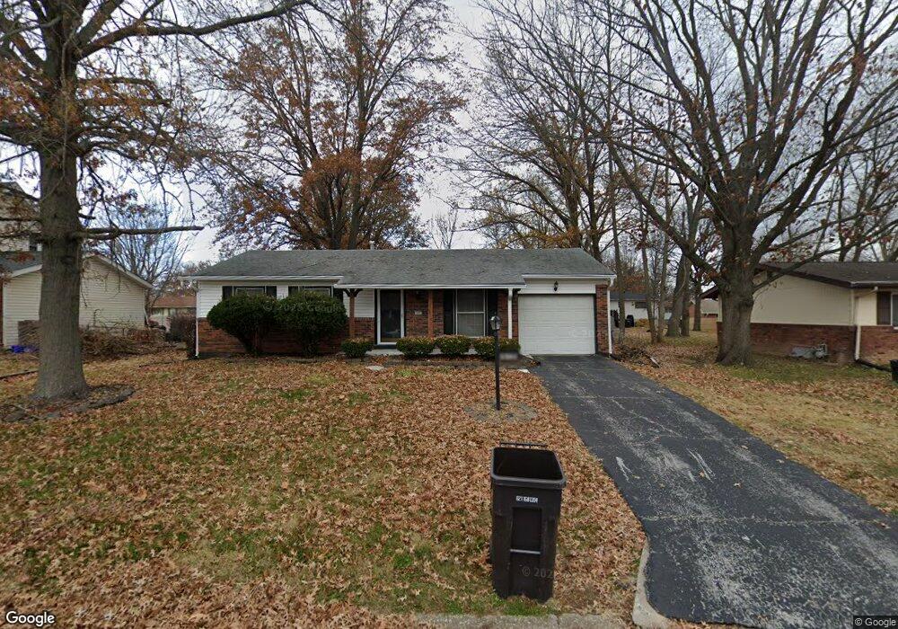
619 Saint Anthony Dr Godfrey, IL 62035
Estimated Value: $164,772 - $170,000
3
Beds
3
Baths
1,008
Sq Ft
$167/Sq Ft
Est. Value
About This Home
This home is located at 619 Saint Anthony Dr, Godfrey, IL 62035 and is currently estimated at $167,943, approximately $166 per square foot. 619 Saint Anthony Dr is a home located in Madison County with nearby schools including Lewis & Clark Elementary School, Alton Middle School, and Alton High School.
Ownership History
Date
Name
Owned For
Owner Type
Purchase Details
Closed on
Nov 23, 2009
Sold by
Hooks Darla
Bought by
Griggs Jeremy
Current Estimated Value
Home Financials for this Owner
Home Financials are based on the most recent Mortgage that was taken out on this home.
Original Mortgage
$108,007
Outstanding Balance
$70,704
Interest Rate
5.05%
Mortgage Type
FHA
Estimated Equity
$97,239
Create a Home Valuation Report for This Property
The Home Valuation Report is an in-depth analysis detailing your home's value as well as a comparison with similar homes in the area
Home Values in the Area
Average Home Value in this Area
Purchase History
| Date | Buyer | Sale Price | Title Company |
|---|---|---|---|
| Griggs Jeremy | $110,000 | Community Title & Escrow Ltd |
Source: Public Records
Mortgage History
| Date | Status | Borrower | Loan Amount |
|---|---|---|---|
| Open | Griggs Jeremy | $108,007 |
Source: Public Records
Tax History Compared to Growth
Tax History
| Year | Tax Paid | Tax Assessment Tax Assessment Total Assessment is a certain percentage of the fair market value that is determined by local assessors to be the total taxable value of land and additions on the property. | Land | Improvement |
|---|---|---|---|---|
| 2024 | $2,553 | $43,860 | $4,980 | $38,880 |
| 2023 | $2,553 | $40,490 | $4,600 | $35,890 |
| 2022 | $2,406 | $37,030 | $4,210 | $32,820 |
| 2021 | $2,146 | $34,830 | $3,960 | $30,870 |
| 2020 | $2,098 | $34,070 | $3,870 | $30,200 |
| 2019 | $2,137 | $33,180 | $3,770 | $29,410 |
| 2018 | $2,098 | $31,760 | $3,610 | $28,150 |
| 2017 | $1,995 | $31,760 | $3,610 | $28,150 |
| 2016 | $1,938 | $31,760 | $3,610 | $28,150 |
| 2015 | $1,665 | $30,760 | $3,500 | $27,260 |
| 2014 | $1,665 | $30,760 | $3,500 | $27,260 |
| 2013 | $1,665 | $30,760 | $3,500 | $27,260 |
Source: Public Records
Map
Nearby Homes
- 421 Saint John Dr
- 5707 Humbert Rd
- 223 Bachman Ln
- 123 Tolle Ln
- 5667 Humbert Rd
- 5661 Humbert Rd
- 0 Humbert Rd Unit MIS25052876
- 5775 Roach Rd
- 504 Elm St
- 00 Pine Ridge Lot#52 Dr
- 212 Pine Ridge Dr
- 607 Mulberry St
- 4805 Wick Mor Dr
- 709 Stamper Ln
- 709 Pardee Rd
- 5510 Lamotte Ln
- 5310 Godfrey Rd Unit 12
- 5310 Godfrey Rd Unit 16
- 5310 Godfrey Rd Unit 2
- 4814 Azalea Place Unit 2
- 621 Saint Anthony Dr
- 617 Saint Anthony Dr
- 618 Saint Paul Dr
- 620 Saint Paul Dr
- 616 Saint Paul Dr
- 615 Saint Anthony Dr
- 623 Saint Anthony Dr
- 614 St Paul Dr
- 622 Saint Paul Dr
- 614 Saint Paul Dr
- 618 Saint Anthony Dr
- 620 Saint Anthony Dr
- 616 Saint Anthony Dr
- 613 Saint Anthony Dr
- 616 St Paul
- 622 Saint Anthony Dr
- 624 Saint Paul Dr
- 612 Saint Paul Dr
- 614 Saint Anthony Dr
- 624 Saint Anthony Dr