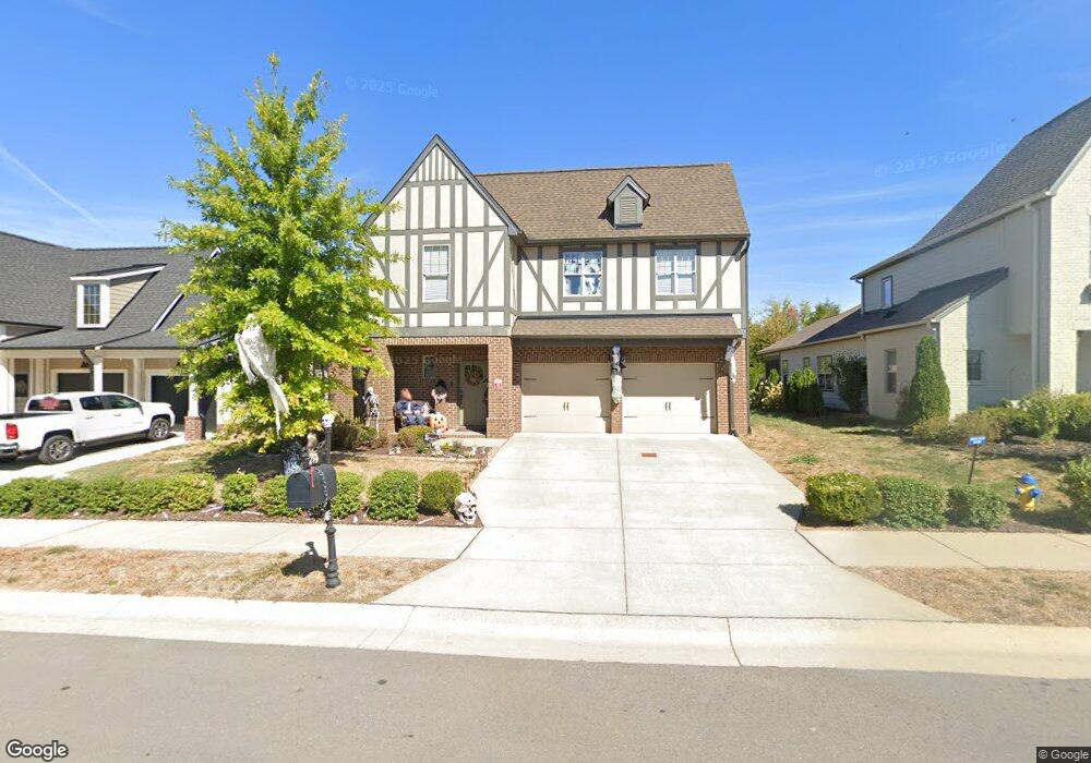
619 Sire Ave Unit 136 Mount Juliet, TN 37122
Estimated Value: $588,004 - $661,000
--
Bed
3
Baths
2,330
Sq Ft
$266/Sq Ft
Est. Value
About This Home
This home is located at 619 Sire Ave Unit 136, Mount Juliet, TN 37122 and is currently estimated at $620,251, approximately $266 per square foot. 619 Sire Ave Unit 136 is a home located in Wilson County with nearby schools including Stoner Creek Elementary School, West Wilson Middle School, and Mt. Juliet High School.
Ownership History
Date
Name
Owned For
Owner Type
Purchase Details
Closed on
Jun 1, 2017
Sold by
Jackson Hillls Partners Llc
Bought by
Williams John D and Williams Jessie J
Current Estimated Value
Home Financials for this Owner
Home Financials are based on the most recent Mortgage that was taken out on this home.
Original Mortgage
$314,830
Outstanding Balance
$261,514
Interest Rate
3.97%
Mortgage Type
New Conventional
Estimated Equity
$358,737
Purchase Details
Closed on
Jan 16, 2017
Sold by
Propst Realty Nashville Llc
Bought by
Jackson Hill Partners Llc
Purchase Details
Closed on
Feb 12, 2015
Sold by
Propst Realty Nashville Llc
Bought by
Propst Realty Nashville Llc
Create a Home Valuation Report for This Property
The Home Valuation Report is an in-depth analysis detailing your home's value as well as a comparison with similar homes in the area
Home Values in the Area
Average Home Value in this Area
Purchase History
| Date | Buyer | Sale Price | Title Company |
|---|---|---|---|
| Williams John D | $331,400 | Windmill Title Llc | |
| Jackson Hill Partners Llc | $916,500 | -- | |
| Propst Realty Nashville Llc | $7,100,000 | -- |
Source: Public Records
Mortgage History
| Date | Status | Borrower | Loan Amount |
|---|---|---|---|
| Open | Williams John D | $314,830 |
Source: Public Records
Tax History Compared to Growth
Tax History
| Year | Tax Paid | Tax Assessment Tax Assessment Total Assessment is a certain percentage of the fair market value that is determined by local assessors to be the total taxable value of land and additions on the property. | Land | Improvement |
|---|---|---|---|---|
| 2024 | $1,880 | $98,500 | $20,000 | $78,500 |
| 2022 | $1,880 | $98,500 | $20,000 | $78,500 |
| 2021 | $1,989 | $98,500 | $20,000 | $78,500 |
| 2020 | $2,160 | $98,500 | $20,000 | $78,500 |
| 2019 | $266 | $80,425 | $16,250 | $64,175 |
| 2018 | $2,146 | $79,925 | $16,250 | $63,675 |
| 2017 | $1,463 | $79,925 | $16,250 | $63,675 |
| 2016 | $508 | $16,250 | $16,250 | $0 |
Source: Public Records
Map
Nearby Homes
- 27 Yearling Way
- 243 Croft Way
- 247 Croft Way
- 270 Croft Way
- 701 Plowson Rd
- 2011 Stonebrook Cir
- 1050 Stonehollow Way
- 4015 Sleepyhollow Way
- 3016 Clyde Cir
- 1012 Zane Dr
- 1010 Zane Dr
- 1019 Zane Dr
- 3140 Hidden Creek Dr
- 300 Tararack Ct
- Weston Plan at Bradshaw Farms - Estates
- Ansley Plan at Bradshaw Farms - Estates
- Buchanan Plan at Bradshaw Farms - Estates
- Kingston Plan at Bradshaw Farms - Estates
- Ashford Plan at Bradshaw Farms - Estates
- 1015 Zane Dr
- 619 Sire Ave
- 621 Sire Ave Unit 137
- 621 Sire Ave Unit 135
- 621 Sire Ave
- 617 Sire Ave Unit 135
- 617 Sire Ave
- 623 Sire Ave Unit 138
- 623 Sire Ave
- 615 Sire Ave Unit 134
- 615 Sire Ave
- 618 Sire Ave Unit 119
- 618 Sire Ave
- 616 Sire Ave Unit 120
- 616 Sire Ave
- 622 Sire Ave Unit 117
- 622 Sire Ave
- 620 Sire Ave
- 620 Sire Ave Unit 118
- 625 Sire Ave Unit 139
- 625 Sire Ave