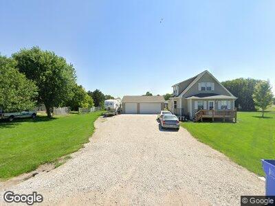
619 W 5th St Axtell, NE 68924
Estimated Value: $242,000 - $357,000
--
Bed
--
Bath
1,577
Sq Ft
$173/Sq Ft
Est. Value
About This Home
This home is located at 619 W 5th St, Axtell, NE 68924 and is currently estimated at $272,120, approximately $172 per square foot. 619 W 5th St is a home with nearby schools including Axtell Elementary School and Axtell High School.
Ownership History
Date
Name
Owned For
Owner Type
Purchase Details
Closed on
Jun 23, 2014
Sold by
Scott H Scott H and Johnson Kathy J
Bought by
Ellis Corey L and Ellis Christina L
Current Estimated Value
Home Financials for this Owner
Home Financials are based on the most recent Mortgage that was taken out on this home.
Original Mortgage
$161,424
Interest Rate
4.19%
Mortgage Type
Stand Alone Refi Refinance Of Original Loan
Create a Home Valuation Report for This Property
The Home Valuation Report is an in-depth analysis detailing your home's value as well as a comparison with similar homes in the area
Home Values in the Area
Average Home Value in this Area
Purchase History
| Date | Buyer | Sale Price | Title Company |
|---|---|---|---|
| Ellis Corey L | $169,920 | Miller Abstract And Title |
Source: Public Records
Mortgage History
| Date | Status | Borrower | Loan Amount |
|---|---|---|---|
| Open | Ellis Corey L | $40,400 | |
| Previous Owner | Ellis Corey L | $161,424 |
Source: Public Records
Tax History Compared to Growth
Tax History
| Year | Tax Paid | Tax Assessment Tax Assessment Total Assessment is a certain percentage of the fair market value that is determined by local assessors to be the total taxable value of land and additions on the property. | Land | Improvement |
|---|---|---|---|---|
| 2024 | $2,935 | $215,290 | $33,210 | $182,080 |
| 2023 | $3,102 | $187,210 | $28,880 | $158,330 |
| 2022 | $3,100 | $181,760 | $28,040 | $153,720 |
| 2021 | $2,748 | $166,265 | $2,755 | $163,510 |
| 2020 | $2,783 | $167,055 | $2,755 | $164,300 |
| 2019 | $2,596 | $167,055 | $2,755 | $164,300 |
| 2018 | $2,488 | $167,055 | $2,755 | $164,300 |
| 2017 | $2,385 | $167,055 | $2,755 | $164,300 |
| 2016 | $2,311 | $167,055 | $2,755 | $164,300 |
| 2015 | $69 | $146,950 | $2,755 | $144,195 |
| 2014 | $69 | $33,795 | $2,755 | $31,040 |
Source: Public Records
Map
Nearby Homes
- 300 W 5th St
- 705 B Ave
- 809 A Ave
- Lots 5-7 Block 3 Craneview Third S Road Awarii Dunes
- L1B2 Craneview 3rd Subdivison
- 303 Lions Dr
- 203 E Sapp St
- 592 S Rd
- 309 Oak St
- 887 & 889 W Campbell St
- 733 S Blaine Ave
- 245 S Brown Ave
- 606 S Brown Ave
- 206 S Nebraska Ave
- 520 E Hawthorne St
- 1423 7th Ave
- 1615 Garfield Dr
- 516 Logan St
- 620 Grant St
- 815 Burlington St