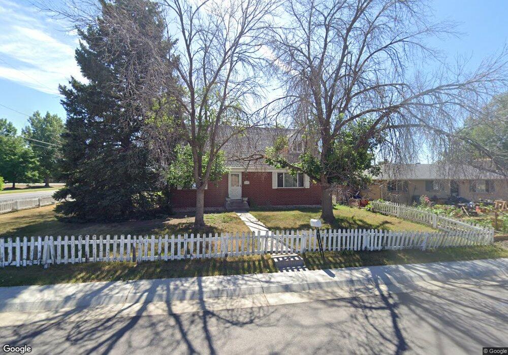
6190 Ames St Arvada, CO 80003
Lamar Heights NeighborhoodEstimated Value: $495,750 - $572,000
3
Beds
3
Baths
960
Sq Ft
$564/Sq Ft
Est. Value
About This Home
This home is located at 6190 Ames St, Arvada, CO 80003 and is currently estimated at $541,188, approximately $563 per square foot. 6190 Ames St is a home located in Jefferson County with nearby schools including Swanson Elementary School, North Arvada Middle School, and Arvada High School.
Ownership History
Date
Name
Owned For
Owner Type
Purchase Details
Closed on
Apr 9, 2012
Sold by
Russan Karen L
Bought by
Kachinski Mary F
Current Estimated Value
Purchase Details
Closed on
Oct 2, 2007
Sold by
Rusan Karen L
Bought by
Kachinski Mary Frances
Home Financials for this Owner
Home Financials are based on the most recent Mortgage that was taken out on this home.
Original Mortgage
$176,000
Interest Rate
6.55%
Mortgage Type
Purchase Money Mortgage
Create a Home Valuation Report for This Property
The Home Valuation Report is an in-depth analysis detailing your home's value as well as a comparison with similar homes in the area
Home Values in the Area
Average Home Value in this Area
Purchase History
| Date | Buyer | Sale Price | Title Company |
|---|---|---|---|
| Kachinski Mary F | -- | None Available | |
| Kachinski Mary Frances | $220,000 | First Amer Heritage Title Co |
Source: Public Records
Mortgage History
| Date | Status | Borrower | Loan Amount |
|---|---|---|---|
| Previous Owner | Kachinski Mary Frances | $176,000 |
Source: Public Records
Tax History
| Year | Tax Paid | Tax Assessment Tax Assessment Total Assessment is a certain percentage of the fair market value that is determined by local assessors to be the total taxable value of land and additions on the property. | Land | Improvement |
|---|---|---|---|---|
| 2024 | $2,225 | $29,634 | $14,247 | $15,387 |
| 2023 | $2,225 | $29,634 | $14,247 | $15,387 |
| 2022 | $1,805 | $25,381 | $12,169 | $13,212 |
| 2021 | $1,835 | $26,111 | $12,519 | $13,592 |
| 2020 | $2,292 | $23,750 | $8,269 | $15,481 |
| 2019 | $2,261 | $23,750 | $8,269 | $15,481 |
| 2018 | $2,097 | $21,417 | $6,008 | $15,409 |
| 2017 | $1,920 | $21,417 | $6,008 | $15,409 |
| 2016 | $1,648 | $17,317 | $6,324 | $10,993 |
| 2015 | $1,457 | $17,317 | $6,324 | $10,993 |
| 2014 | $1,457 | $14,392 | $5,445 | $8,947 |
Source: Public Records
Map
Nearby Homes
- 6185 Sheridan Blvd
- 5152 W 61st Ave
- 4964 W 61st Dr
- 5495 W 60th Ave
- 6131 Wolff St
- 6353 Depew St
- 6040 Wolff St
- 6404 Benton St
- 6381 Wolff St
- 5701 W 60th Ave
- 6594 Benton Cir
- 5687 W 65th Ave
- 6305 Tennyson St
- 6548 Xavier St
- 6104 W 62nd Ave
- 6240 Tennyson St
- 6316 Tennyson St
- 6503 Gray St
- 6462 Harlan St
- 6739 Zenobia Loop Unit 3
- 6170 Ames St
- 5230 W 62nd Ave
- 6150 Ames St
- 6165 Ames St
- 6175 Sheridan Blvd
- 6130 Ames St
- 6145 Ames St
- 6135 Sheridan Blvd
- 6125 Ames St
- 6110 Ames St
- 5390 W 62nd Ave
- 6170 Benton St
- 6115 Sheridan Blvd
- 6150 Benton St
- 6115 Ames St
- 6100 Ames St
- 6130 Benton St
- 6095 Sheridan Blvd
- 6105 Sheridan Blvd
- 5419 W 62nd Ave
Your Personal Tour Guide
Ask me questions while you tour the home.