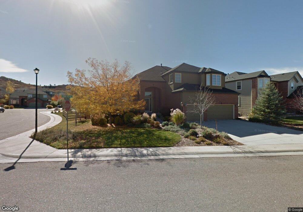
6190 Puma Point Lone Tree, CO 80124
Southridge NeighborhoodEstimated Value: $1,041,197 - $1,323,000
4
Beds
4
Baths
3,424
Sq Ft
$345/Sq Ft
Est. Value
About This Home
This home is located at 6190 Puma Point, Lone Tree, CO 80124 and is currently estimated at $1,182,099, approximately $345 per square foot. 6190 Puma Point is a home located in Douglas County with nearby schools including Wildcat Mountain Elementary School, Rocky Heights Middle School, and Rock Canyon High School.
Ownership History
Date
Name
Owned For
Owner Type
Purchase Details
Closed on
Mar 26, 1999
Sold by
Falcon Homes At Wildcat Ridge Llc
Bought by
Raskis Peter S and Raskis Joylene E
Current Estimated Value
Home Financials for this Owner
Home Financials are based on the most recent Mortgage that was taken out on this home.
Original Mortgage
$130,000
Interest Rate
6.69%
Purchase Details
Closed on
Nov 18, 1997
Sold by
Intravest 320
Bought by
Falcon Homes Wildcat Ridge
Purchase Details
Closed on
Nov 7, 1997
Sold by
Falcon Homes Inc
Bought by
Falcon Homes Wildcat Ridge
Purchase Details
Closed on
Sep 8, 1997
Sold by
Intravest 320
Bought by
Falcon Homes Wildcat Ridge Co
Create a Home Valuation Report for This Property
The Home Valuation Report is an in-depth analysis detailing your home's value as well as a comparison with similar homes in the area
Home Values in the Area
Average Home Value in this Area
Purchase History
| Date | Buyer | Sale Price | Title Company |
|---|---|---|---|
| Raskis Peter S | $385,015 | Land Title | |
| Falcon Homes Wildcat Ridge | -- | -- | |
| Falcon Homes Wildcat Ridge | -- | -- | |
| Falcon Homes Wildcat Ridge Co | $618,900 | -- | |
| Falcon Homes Wildcat Ridge Co | -- | -- |
Source: Public Records
Mortgage History
| Date | Status | Borrower | Loan Amount |
|---|---|---|---|
| Previous Owner | Raskis Peter S | $130,000 |
Source: Public Records
Tax History
| Year | Tax Paid | Tax Assessment Tax Assessment Total Assessment is a certain percentage of the fair market value that is determined by local assessors to be the total taxable value of land and additions on the property. | Land | Improvement |
|---|---|---|---|---|
| 2025 | $6,583 | $68,460 | $12,880 | $55,580 |
| 2024 | $6,583 | $73,610 | $14,360 | $59,250 |
| 2023 | $6,644 | $73,610 | $14,360 | $59,250 |
| 2022 | $5,020 | $56,460 | $10,380 | $46,080 |
| 2021 | $5,213 | $56,460 | $10,380 | $46,080 |
| 2020 | $5,042 | $56,230 | $9,890 | $46,340 |
| 2019 | $5,058 | $56,230 | $9,890 | $46,340 |
| 2018 | $4,376 | $52,320 | $9,830 | $42,490 |
| 2017 | $4,439 | $52,320 | $9,830 | $42,490 |
| 2016 | $4,125 | $49,090 | $10,190 | $38,900 |
| 2015 | $2,101 | $49,090 | $10,190 | $38,900 |
| 2014 | $3,692 | $42,050 | $9,950 | $32,100 |
Source: Public Records
Map
Nearby Homes
- 6098 Puma Ridge
- 10899 Bobcat Terrace
- 10541 Jaguar Glen
- 10660 Jewelberry Cir
- 10499 Cheetah Winds
- 7085 Leopard Gate
- 10916 Towerbridge Rd
- 5639 Jaguar Way
- 7053 Leopard Dr
- 5341 Windflower Ln
- 10653 Lieter Place
- 10996 Glengate Cir
- 10445 Cheetah Winds
- 10439 Cheetah Winds
- 10468 Wagon Box Cir
- 10330 Lions Path
- 10844 Huntwick St
- 10849 Huntwick St
- 10292 Nickolas Ave
- 4748 Bluegate Dr
- 6170 Puma Point
- 11009 Puma Cliff
- 11002 Puma Cliff
- 0 Puma Point
- 6150 Puma Point
- 6195 Puma Point
- 6175 Puma Point
- 10960 Puma Cliff
- 11013 Puma Cliff
- 10994 Puma Run
- 11010 Puma Cliff
- 10992 Puma Run
- 10961 Puma Cliff
- 10996 Puma Run
- 6140 Puma Point
- 11025 Puma Cliff
- 11018 Puma Cliff
- 6145 Puma Point
- 10988 Puma Run
- 11000 Puma Run
Your Personal Tour Guide
Ask me questions while you tour the home.