Estimated Value: $75,602 - $167,000
3
Beds
1
Bath
1,144
Sq Ft
$110/Sq Ft
Est. Value
About This Home
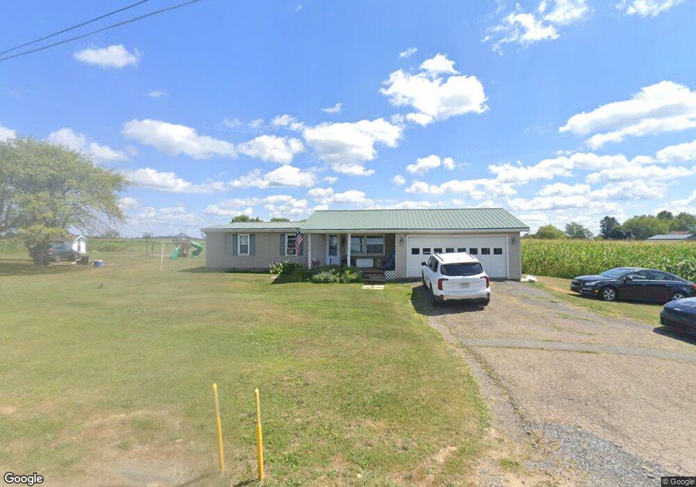
This home is located at 6192 Route 338, Knox, PA 16232 and is currently estimated at $126,151, approximately $110 per square foot. 6192 Route 338 is a home located in Clarion County with nearby schools including Keystone Elementary School, Keystone Junior/Senior High School, and Meadow View Amish School.
Ownership History
Date
Name
Owned For
Owner Type
Purchase Details
Closed on
Feb 25, 2009
Sold by
Berst Richard T and Berst Rhonda J
Bought by
Carroll Christopher S
Current Estimated Value
Home Financials for this Owner
Home Financials are based on the most recent Mortgage that was taken out on this home.
Original Mortgage
$9,000
Outstanding Balance
$5,659
Interest Rate
4.92%
Estimated Equity
$120,492
Create a Home Valuation Report for This Property
The Home Valuation Report is an in-depth analysis detailing your home's value as well as a comparison with similar homes in the area
Home Values in the Area
Average Home Value in this Area
Purchase History
| Date | Buyer | Sale Price | Title Company |
|---|---|---|---|
| Carroll Christopher S | $60,000 | -- |
Source: Public Records
Mortgage History
| Date | Status | Borrower | Loan Amount |
|---|---|---|---|
| Open | Carroll Christopher S | $9,000 | |
| Open | Carroll Christopher S | $48,000 |
Source: Public Records
Tax History Compared to Growth
Tax History
| Year | Tax Paid | Tax Assessment Tax Assessment Total Assessment is a certain percentage of the fair market value that is determined by local assessors to be the total taxable value of land and additions on the property. | Land | Improvement |
|---|---|---|---|---|
| 2025 | $1,611 | $19,160 | $1,660 | $17,500 |
| 2024 | $1,521 | $19,160 | $1,660 | $17,500 |
| 2023 | $1,458 | $19,160 | $1,660 | $17,500 |
| 2022 | $1,439 | $19,160 | $1,660 | $17,500 |
| 2021 | $1,448 | $19,160 | $1,660 | $17,500 |
| 2020 | $1,448 | $19,160 | $1,660 | $17,500 |
| 2019 | $1,424 | $19,160 | $1,660 | $17,500 |
| 2018 | $1,424 | $19,160 | $1,660 | $17,500 |
| 2017 | $1,424 | $19,160 | $1,660 | $17,500 |
| 2016 | $1,424 | $19,160 | $1,660 | $17,500 |
| 2014 | -- | $19,160 | $1,660 | $17,500 |
Source: Public Records
Map
Nearby Homes
- 216 High Point Rd
- 28 Graff Rd
- 1278 Wentlings Corners Rd
- 0 Willow Ave
- 630 S Main St
- 601 S Main St
- 427 Main St
- 518 E Penn Ave
- 374 E Penn Ave
- 336 Best Ave
- 327 Mendenhall Ave
- 127 Nagel Ln
- 1248 Chestnut Ridge Rd
- 725 River Bends Dr
- 513 Ron McHenry Rd
- 000 Laurel Rd
- 2404 Pennsylvania 208
- 429 Main St
- 3765/3905
- 3176 Pennsylvania 58
- 30 Twin Church Rd
- 59 Tippecanoe Rd
- 73 Tippecanoe Rd
- 80 Twin Church Rd
- 63 McNany Rd
- 61 Tippecanoe Rd
- 93 Tippecanoe Rd
- 139 Tippecanoe Rd
- 77 McNany Rd
- 155 Tippecanoe Rd
- 173 Tippecanoe Rd
- 47 McNany Rd
- 0 McNany Rd
- 148 Tippecanoe Rd
- 40 High Point Rd
- 113 Wentlings Corners Rd
- 207 Wentlings Corners Rd
- 186 Tippecanoe Rd
- 23 McNany Rd
- 159 Wentlings Corners Rd