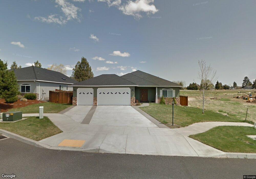
61930 Rawhide Dr Bend, OR 97702
Larkspur NeighborhoodEstimated Value: $701,361 - $754,000
About This Home
This home is located at 61930 Rawhide Dr, Bend, OR 97702 and is currently estimated at $735,340, approximately $345 per square foot. 61930 Rawhide Dr is a home located in Deschutes County with nearby schools including Bear Creek Elementary School, Pilot Butte Middle School, and Bend Senior High School.
Ownership History
We collect this data history from publicly available records. To have your information removed, we recommend requesting removal directly through your county’s website.
Purchase Details
Home Financials for this Owner
Home Financials are based on the most recent Mortgage that was taken out on this home.Home Values in the Area
Average Home Value in this Area
Purchase History
We collect this data history from publicly available records. To have your information removed, we recommend requesting removal directly through your county’s website.
| Date | Buyer | Sale Price | Title Company |
|---|---|---|---|
| $263,393 | First Amer Title Ins Co Or |
Mortgage History
We collect this data history from publicly available records. To have your information removed, we recommend requesting removal directly through your county’s website.
| Date | Status | Borrower | Loan Amount |
|---|---|---|---|
| Previous Owner | $175,000 |
Tax History
We collect this data history from publicly available records. To have your information removed, we recommend requesting removal directly through your county’s website.
| Year | Tax Paid | Tax Assessment Tax Assessment Total Assessment is a certain percentage of the fair market value that is determined by local assessors to be the total taxable value of land and additions on the property. | Land | Improvement |
|---|---|---|---|---|
| 2025 | $5,174 | $306,200 | ||
| 2024 | $4,978 | $297,290 | ||
| 2023 | $4,614 | $288,640 | $0 | $0 |
| 2022 | $4,305 | $272,080 | $0 | $0 |
| 2021 | $4,312 | $264,160 | $0 | $0 |
| 2020 | $4,091 | $264,160 | $0 | $0 |
| 2019 | $3,977 | $256,470 | $0 | $0 |
| 2018 | $3,864 | $249,000 | $0 | $0 |
| 2017 | $3,751 | $241,750 | $0 | $0 |
| 2016 | $3,577 | $234,710 | $0 | $0 |
| 2015 | $3,478 | $227,880 | $0 | $0 |
| 2014 | $3,376 | $221,250 | $0 | $0 |
Map
- 2241 SE Pilatus Ln
- 217 SE Soft Tail Dr
- 61984 Pettigrew Rd
- 21125 Bear Creek Rd
- 69 SE Piper Dr
- 62017 NE Nate's Place
- 21164 Copperfield Ave
- 194 SE Cessna Dr
- 62062 Dean Swift Rd
- 21184 Silverado Valley Ln
- 21023 Thomas Dr
- 21182 Thomas Dr
- 21154 Darnel Ave
- 23 SE Benaiah Cir
- 21184 Darnel Ave
- 21190 Darnel Ave
- 2200 NE Hwy 20 Unit 15
- 21035 Clairaway Ave
- 796 SE Briarwood Ct
- 21172 Clairaway Ave
- 61942 Rawhide Dr
- 61948 Rawhide Dr
- 61936 Rawhide Dr
- 61936 SE Rawhide
- 21074 Pettigrew Ct
- 61954 Rawhide Dr
- 2253 SE Pilatus Ln
- 2250 SE Wind Rider Ln
- 21081 Pettigrew Ct
- 21082 Pettigrew Ct
- 2247 SE Pilatus Ln
- 2244 SE Wind Rider Ln
- 2252 SE Pilatus Ln
- 21083 Pettigrew Ct
- 2246 SE Pilatus Ln
- 2255 SE Velocette Ln
- 2238 SE Wind Rider Ln
- 93 Rawhide Dr
- 97 Rawhide Dr
- 2249 SE Velocette Ln
Ask me questions while you tour the home.