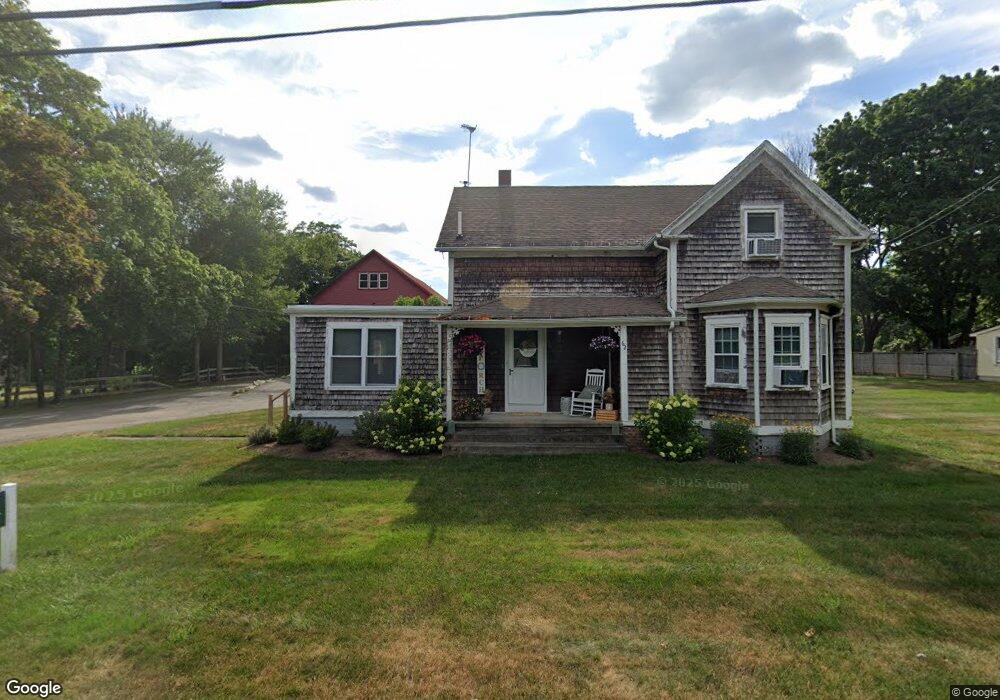
62 Blanding Rd Rehoboth, MA 02769
Estimated Value: $561,000 - $622,000
3
Beds
2
Baths
800
Sq Ft
$747/Sq Ft
Est. Value
About This Home
This home is located at 62 Blanding Rd, Rehoboth, MA 02769 and is currently estimated at $597,850, approximately $747 per square foot. 62 Blanding Rd is a home located in Bristol County with nearby schools including Dighton-Rehoboth Regional High School, St Margaret School, and Cedar Brook School.
Ownership History
Date
Name
Owned For
Owner Type
Purchase Details
Closed on
May 10, 2019
Sold by
Baasch Elaine M and Baasch Gene R
Bought by
Baasch Gene R and Baasch Elaine M
Current Estimated Value
Purchase Details
Closed on
Jun 7, 2001
Sold by
Baasch Gene R and Baasch Elaine M
Bought by
Thibault Richard M and Thibault Maria A
Create a Home Valuation Report for This Property
The Home Valuation Report is an in-depth analysis detailing your home's value as well as a comparison with similar homes in the area
Home Values in the Area
Average Home Value in this Area
Purchase History
| Date | Buyer | Sale Price | Title Company |
|---|---|---|---|
| Baasch Gene R | -- | -- | |
| Thibault Richard M | $94,900 | -- |
Source: Public Records
Mortgage History
| Date | Status | Borrower | Loan Amount |
|---|---|---|---|
| Previous Owner | Thibault Richard M | $160,000 | |
| Previous Owner | Thibault Richard M | $315,548 | |
| Previous Owner | Thibault Richard M | $95,000 |
Source: Public Records
Tax History Compared to Growth
Tax History
| Year | Tax Paid | Tax Assessment Tax Assessment Total Assessment is a certain percentage of the fair market value that is determined by local assessors to be the total taxable value of land and additions on the property. | Land | Improvement |
|---|---|---|---|---|
| 2025 | $57 | $509,800 | $193,000 | $316,800 |
| 2024 | $5,739 | $505,200 | $192,800 | $312,400 |
| 2023 | $5,974 | $490,700 | $188,600 | $302,100 |
| 2022 | $5,974 | $471,500 | $235,500 | $236,000 |
| 2021 | $5,416 | $409,100 | $175,900 | $233,200 |
| 2020 | $5,194 | $395,900 | $175,900 | $220,000 |
| 2018 | $4,734 | $395,500 | $178,400 | $217,100 |
| 2017 | $4,967 | $395,500 | $178,400 | $217,100 |
| 2016 | $4,805 | $395,500 | $178,400 | $217,100 |
| 2015 | $4,505 | $366,000 | $171,200 | $194,800 |
| 2014 | $4,370 | $351,300 | $164,000 | $187,300 |
Source: Public Records
Map
Nearby Homes
- 9 Hidden Hills Dr
- 25 Lincoln St
- 824 Taunton Ave
- 67 Wheeler St
- 23 Colonial Way
- 37 Colonial Way
- 420 Chestnut St
- 16 Salisbury St
- 181 Hope St
- 0 Patterson St Unit 73348933
- 0 Winter St
- 42 Tee Jay Dr
- 25 Pimental Dr
- 181 Sherman Ave
- 57 Redwood Ln
- 6 Running Stream Rd
- 15 Hickory Ridge Rd
- 111 Summer St
- 20 School St
- 224 Arcade Ave
- 62 Blanding Rd Unit 2
- 58 Blanding Rd
- 56 Blanding Rd
- 54 Blanding Rd
- 52 Blanding Rd
- 63 Blanding Rd
- 68 Blanding Rd
- 59 Blanding Rd
- 55 Blanding Rd
- 72 Blanding Rd
- 67 Blanding Rd
- 569 Winthrop St Unit 2
- 569 Winthrop St Unit 3
- 569 Winthrop St Unit 1
- 578 Winthrop St
- 582 Winthrop St
- 576 Winthrop St
- 584 Winthrop St
- 44 Blanding Rd
- 71 Blanding Rd