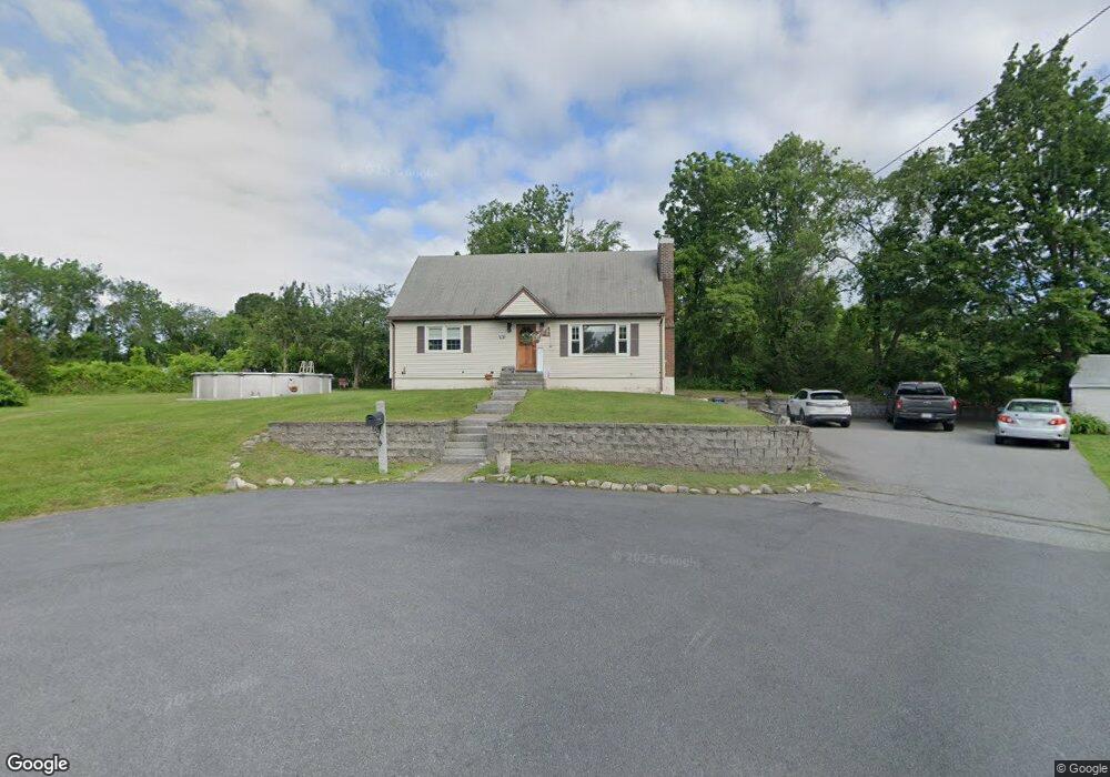
62 Bonnie Ave Dracut, MA 01826
Estimated Value: $580,000 - $620,369
3
Beds
2
Baths
1,680
Sq Ft
$362/Sq Ft
Est. Value
About This Home
This home is located at 62 Bonnie Ave, Dracut, MA 01826 and is currently estimated at $608,592, approximately $362 per square foot. 62 Bonnie Ave is a home located in Middlesex County with nearby schools including Greenmont Avenue School, Richardson Middle School, and Dracut Senior High School.
Ownership History
Date
Name
Owned For
Owner Type
Purchase Details
Closed on
Apr 27, 2000
Sold by
Lessard Barbara A
Bought by
Lessard Robert J and Lessard Sharon M
Current Estimated Value
Home Financials for this Owner
Home Financials are based on the most recent Mortgage that was taken out on this home.
Original Mortgage
$161,500
Interest Rate
8.23%
Mortgage Type
Purchase Money Mortgage
Create a Home Valuation Report for This Property
The Home Valuation Report is an in-depth analysis detailing your home's value as well as a comparison with similar homes in the area
Home Values in the Area
Average Home Value in this Area
Purchase History
| Date | Buyer | Sale Price | Title Company |
|---|---|---|---|
| Lessard Robert J | $170,000 | -- |
Source: Public Records
Mortgage History
| Date | Status | Borrower | Loan Amount |
|---|---|---|---|
| Open | Lessard Robert J | $200,000 | |
| Closed | Lessard Robert J | $161,000 | |
| Closed | Lessard Robert J | $161,500 |
Source: Public Records
Tax History Compared to Growth
Tax History
| Year | Tax Paid | Tax Assessment Tax Assessment Total Assessment is a certain percentage of the fair market value that is determined by local assessors to be the total taxable value of land and additions on the property. | Land | Improvement |
|---|---|---|---|---|
| 2025 | $5,362 | $529,800 | $234,000 | $295,800 |
| 2024 | $5,170 | $494,700 | $223,100 | $271,600 |
| 2023 | $4,988 | $430,700 | $194,000 | $236,700 |
| 2022 | $5,057 | $411,500 | $176,600 | $234,900 |
| 2021 | $4,901 | $376,700 | $160,500 | $216,200 |
| 2020 | $4,751 | $355,900 | $155,700 | $200,200 |
| 2019 | $4,792 | $348,500 | $148,300 | $200,200 |
| 2018 | $6,443 | $311,100 | $148,300 | $162,800 |
| 2017 | $9,834 | $311,100 | $148,300 | $162,800 |
| 2016 | $4,038 | $272,100 | $142,600 | $129,500 |
| 2015 | $3,962 | $265,400 | $142,600 | $122,800 |
| 2014 | $3,769 | $260,100 | $142,600 | $117,500 |
Source: Public Records
Map
Nearby Homes
- 315 Broadway Rd Unit 7
- 241 Broadway Rd Unit 50
- 67 Foxhill Ln Unit 67
- 121 Old Marsh Hill Rd
- 167 Betty Ann Ln
- 1572 Bridge St
- 109 Meadow Creek Dr
- 26 Frank St
- 321 Old Marsh Hill Rd
- 67 Lincoln Ln
- 19 Esther Way Unit Lot 10
- 18 Stone St
- 20 Esther Way Unit 11
- 35 Thissell Ave
- 81 Spring Park Ave
- 675 Robbins Ave Unit 1
- 700 Robbins Ave Unit 6
- 650 Robbins Ave Unit 33
- 7 Wildwood St Unit A24
- 4 Hazelwood Ave Unit 12
- 58 Bonnie Ave
- 65 Bonnie Ave
- 52 Bonnie Ave
- 38 Bonnie Ave
- 15 Stanley Ave
- 238 Fox Ave
- 5 Stanley Ave
- 34 Bonnie Ave
- 14 Stanley Ave
- 28 Bonnie Ave
- 241 Fox Ave
- 226 Broadway Rd
- 256 Fox Ave
- 25 Bonnie Ave
- 231 Broadway Rd
- 14 Bonnie Ave
- 204 Broadway Rd
- 41 Blackberry Fields Rd
- 247 Broadway Rd Unit 44
- 247 Broadway Rd Unit 43