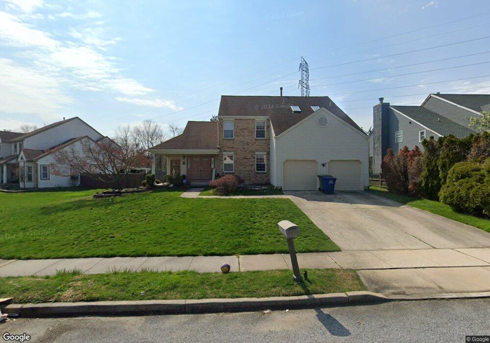
62 Hawk Ln Marlton, NJ 08053
Estimated Value: $598,000 - $611,000
3
Beds
3
Baths
2,555
Sq Ft
$237/Sq Ft
Est. Value
About This Home
This home is located at 62 Hawk Ln, Marlton, NJ 08053 and is currently estimated at $605,062, approximately $236 per square foot. 62 Hawk Ln is a home located in Burlington County with nearby schools including Robert B. Jaggard School, Marlton Middle School, and Cherokee High School.
Ownership History
Date
Name
Owned For
Owner Type
Purchase Details
Closed on
Aug 3, 2009
Sold by
Brittain Cris E and Brittain Wendy E
Bought by
Mehta Ashish M and Parikh Ruchita
Current Estimated Value
Home Financials for this Owner
Home Financials are based on the most recent Mortgage that was taken out on this home.
Original Mortgage
$288,000
Outstanding Balance
$188,447
Interest Rate
5.28%
Mortgage Type
New Conventional
Estimated Equity
$416,615
Purchase Details
Closed on
Mar 27, 1998
Sold by
Kelliher Maurice A and Kelliher Barbara A
Bought by
Brittain Cris E and Brittain Wendy E
Home Financials for this Owner
Home Financials are based on the most recent Mortgage that was taken out on this home.
Original Mortgage
$128,800
Interest Rate
6.98%
Create a Home Valuation Report for This Property
The Home Valuation Report is an in-depth analysis detailing your home's value as well as a comparison with similar homes in the area
Home Values in the Area
Average Home Value in this Area
Purchase History
| Date | Buyer | Sale Price | Title Company |
|---|---|---|---|
| Mehta Ashish M | $320,000 | Elite Choice Title | |
| Brittain Cris E | $161,000 | Surety Title Corporation |
Source: Public Records
Mortgage History
| Date | Status | Borrower | Loan Amount |
|---|---|---|---|
| Open | Mehta Ashish M | $288,000 | |
| Previous Owner | Brittain Cris E | $128,800 |
Source: Public Records
Tax History
| Year | Tax Paid | Tax Assessment Tax Assessment Total Assessment is a certain percentage of the fair market value that is determined by local assessors to be the total taxable value of land and additions on the property. | Land | Improvement |
|---|---|---|---|---|
| 2025 | $10,757 | $315,000 | $100,000 | $215,000 |
| 2024 | $10,121 | $315,000 | $100,000 | $215,000 |
| 2023 | $10,121 | $315,000 | $100,000 | $215,000 |
| 2022 | $9,667 | $315,000 | $100,000 | $215,000 |
| 2021 | $9,441 | $315,000 | $100,000 | $215,000 |
| 2020 | $9,318 | $315,000 | $100,000 | $215,000 |
| 2019 | $9,242 | $315,000 | $100,000 | $215,000 |
| 2018 | $9,113 | $315,000 | $100,000 | $215,000 |
| 2017 | $9,006 | $315,000 | $100,000 | $215,000 |
| 2016 | $8,587 | $307,900 | $100,000 | $207,900 |
| 2015 | $8,436 | $307,900 | $100,000 | $207,900 |
| 2014 | $8,196 | $307,900 | $100,000 | $207,900 |
Source: Public Records
Map
Nearby Homes
- 63 Banner Ct Unit 63
- 44 Ashley Ct
- 802 Lindsey Ct Unit 802
- 504 Longstone Dr
- 234 Fir Tree Ct
- 2 Quaker St
- 924 Cropwell Rd
- 206 Mimosa Dr
- 15 W Main St
- 1525 Squire Ln
- 23 King Ave
- 6 Wheelwright Ln
- 61 S Maple Ave
- 8 Elbow Ln
- 1107 Chesterwood Ct Unit 1107
- 30 Cooper Ave
- 906 Chesterwood Ct
- 1022 Rymill Run
- 224 Teal Ln
- 81 N Locust Ave Unit A
Your Personal Tour Guide
Ask me questions while you tour the home.