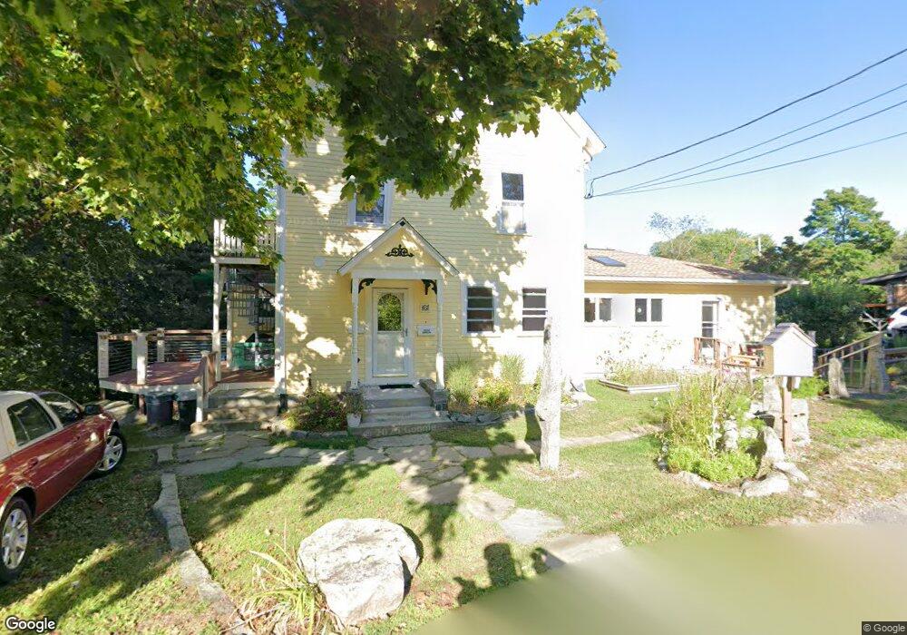
62 High St Gloucester, MA 01930
Estimated Value: $830,000 - $1,080,981
4
Beds
2
Baths
2,555
Sq Ft
$368/Sq Ft
Est. Value
About This Home
This home is located at 62 High St, Gloucester, MA 01930 and is currently estimated at $940,995, approximately $368 per square foot. 62 High St is a home located in Essex County with nearby schools including Plum Cove School, Ralph B O'maley Middle School, and Gloucester High School.
Ownership History
Date
Name
Owned For
Owner Type
Purchase Details
Closed on
Aug 29, 2018
Sold by
Garrison Frank W
Bought by
Garrison Frank W and Green-Garrison Janet
Current Estimated Value
Purchase Details
Closed on
Nov 14, 1975
Bought by
Garrison Frank W
Create a Home Valuation Report for This Property
The Home Valuation Report is an in-depth analysis detailing your home's value as well as a comparison with similar homes in the area
Purchase History
| Date | Buyer | Sale Price | Title Company |
|---|---|---|---|
| Garrison Frank W | -- | -- | |
| Garrison Frank W | $31,500 | -- |
Source: Public Records
Mortgage History
| Date | Status | Borrower | Loan Amount |
|---|---|---|---|
| Previous Owner | Garrison Frank W | $70,000 | |
| Previous Owner | Garrison Frank W | $7,000 |
Source: Public Records
Tax History
| Year | Tax Paid | Tax Assessment Tax Assessment Total Assessment is a certain percentage of the fair market value that is determined by local assessors to be the total taxable value of land and additions on the property. | Land | Improvement |
|---|---|---|---|---|
| 2025 | $8,499 | $874,400 | $281,000 | $593,400 |
| 2024 | $8,323 | $855,400 | $267,600 | $587,800 |
| 2023 | $8,549 | $807,300 | $238,900 | $568,400 |
| 2022 | $7,974 | $679,800 | $203,100 | $476,700 |
| 2021 | $7,709 | $619,700 | $184,600 | $435,100 |
| 2020 | $7,333 | $594,700 | $184,600 | $410,100 |
| 2019 | $6,877 | $541,900 | $184,600 | $357,300 |
| 2018 | $6,468 | $500,200 | $184,600 | $315,600 |
| 2017 | $6,189 | $469,200 | $175,800 | $293,400 |
| 2016 | $6,007 | $441,400 | $176,300 | $265,100 |
| 2015 | $5,912 | $433,100 | $176,300 | $256,800 |
Source: Public Records
Map
Nearby Homes
- 10 Emerald St
- 43 High St Unit B
- 7 Colburn St
- 13 Phillips Ave
- 32 Haven Ave
- 33 Quarry Ridge Ln Unit 33
- 5 Smith St Unit R
- 672 Washington St
- 1 Charte Ct
- 1 Main St Unit R
- 1 Main St Unit C
- 177 Main St
- 16 Hodgkins Rd Unit 2
- 27 Hodgkins Rd
- 4 Norwood Ave
- 226 Atlantic St
- 2 Breezy Point Rd
- 34R Summer St
- 2 Finch Ln
- 167 Atlantic St
Your Personal Tour Guide
Ask me questions while you tour the home.