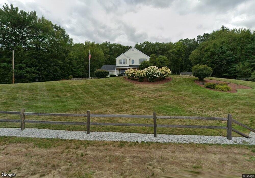
62 Laurel Crest Dr Brookline, NH 03033
Estimated Value: $730,916 - $786,000
4
Beds
3
Baths
3,137
Sq Ft
$243/Sq Ft
Est. Value
About This Home
This home is located at 62 Laurel Crest Dr, Brookline, NH 03033 and is currently estimated at $760,729, approximately $242 per square foot. 62 Laurel Crest Dr is a home with nearby schools including Richard Maghakian Memorial School, Captain Samuel Douglass Academy, and Hollis-Brookline Middle School.
Ownership History
Date
Name
Owned For
Owner Type
Purchase Details
Closed on
Mar 18, 2015
Sold by
Stpierre Patricia L and Stpierre Donald H
Bought by
Patricia St Pierre Ret
Current Estimated Value
Purchase Details
Closed on
Feb 25, 2015
Sold by
1 Line Realty Dev Llc
Bought by
Stpierre Patricia and Stpireer Donald H
Purchase Details
Closed on
Aug 31, 1999
Sold by
One Line Rlty Dev Llc
Bought by
St Pierre Patricia L and St Pierre Donald H
Home Financials for this Owner
Home Financials are based on the most recent Mortgage that was taken out on this home.
Original Mortgage
$185,500
Interest Rate
7.53%
Create a Home Valuation Report for This Property
The Home Valuation Report is an in-depth analysis detailing your home's value as well as a comparison with similar homes in the area
Home Values in the Area
Average Home Value in this Area
Purchase History
| Date | Buyer | Sale Price | Title Company |
|---|---|---|---|
| Patricia St Pierre Ret | -- | -- | |
| Stpierre Patricia | -- | -- | |
| St Pierre Patricia L | $232,000 | -- |
Source: Public Records
Mortgage History
| Date | Status | Borrower | Loan Amount |
|---|---|---|---|
| Previous Owner | St Pierre Patricia L | $102,217 | |
| Previous Owner | St Pierre Patricia L | $185,500 |
Source: Public Records
Tax History
| Year | Tax Paid | Tax Assessment Tax Assessment Total Assessment is a certain percentage of the fair market value that is determined by local assessors to be the total taxable value of land and additions on the property. | Land | Improvement |
|---|---|---|---|---|
| 2025 | $17,457 | $708,500 | $218,600 | $489,900 |
| 2024 | $16,019 | $708,500 | $218,600 | $489,900 |
| 2023 | $14,723 | $708,500 | $218,600 | $489,900 |
| 2022 | $13,291 | $447,200 | $131,700 | $315,500 |
| 2021 | $12,781 | $447,200 | $131,700 | $315,500 |
| 2020 | $12,299 | $442,400 | $131,700 | $310,700 |
| 2019 | $13,214 | $442,400 | $131,700 | $310,700 |
| 2018 | $13,077 | $442,400 | $131,700 | $310,700 |
| 2017 | $11,697 | $355,100 | $111,500 | $243,600 |
| 2016 | $11,484 | $352,700 | $111,500 | $241,200 |
| 2015 | $10,585 | $340,900 | $111,500 | $229,400 |
| 2014 | $11,199 | $340,900 | $111,500 | $229,400 |
| 2013 | $10,232 | $323,500 | $111,500 | $212,000 |
Source: Public Records
Map
Nearby Homes
- 9 Winterberry Rd
- 7 Winterberry Rd
- 3 Winterberry Rd
- 15 N End Rd
- 364 Townsend Hill Rd
- 198 N End Rd
- 0 Brookline St
- 1235 Townsend Rd
- 2 Corey Hill Rd
- 6 High Oaks Path
- 2 Warren's Way
- 5 Turnpike Rd Unit 213 TWO
- 6 Flint Meadow Dr
- 8B Louis Dr
- 9 Kaneohe Ct
- 102 Wheeler St
- 359 Main St
- 16 Worcester Rd
- 1 Depot Street Extension Unit 5
- 1 Depot Street Extension Unit 2
- 58 Laurelcrest Dr
- 64 Laurel Crest Dr
- 57 Laurelcrest Dr
- 59 Laurel Crest Dr
- 61 Laurelcrest Dr
- 56 Laurel Crest Dr
- 55 Laurel Crest Dr
- 20 Wallace Brook Rd
- 53 Laurel Crest Dr
- 54 Laurel Crest Dr
- 22 Wallace Brook Rd
- 14 Wallace Brook Rd
- 51 Laurel Crest Dr
- 12 Wallace Brook Rd
- 52 Laurelcrest Dr
- 28 Laurel Crest Dr
- 14 Hillside Dr Unit J-33-56
- 14 Hillside Dr
- 0 Wallace Brook Rd Unit 4319481
Your Personal Tour Guide
Ask me questions while you tour the home.