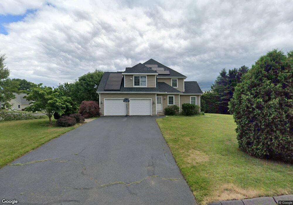
62 Nathaniel Dr Wethersfield, CT 06109
Estimated Value: $675,000 - $779,000
4
Beds
3
Baths
2,633
Sq Ft
$272/Sq Ft
Est. Value
About This Home
This home is located at 62 Nathaniel Dr, Wethersfield, CT 06109 and is currently estimated at $716,633, approximately $272 per square foot. 62 Nathaniel Dr is a home located in Hartford County with nearby schools including Samuel B. Webb Elementary School, Silas Deane Middle School, and Wethersfield High School.
Ownership History
Date
Name
Owned For
Owner Type
Purchase Details
Closed on
Jul 19, 2019
Sold by
Bisio George P and Bisio Francine R
Bought by
Palombizio Peter E and Palombizio Saloni
Current Estimated Value
Purchase Details
Closed on
Oct 19, 1999
Sold by
Rjd Dev Co Llc
Bought by
Bisio George P and Bisio Francine R
Home Financials for this Owner
Home Financials are based on the most recent Mortgage that was taken out on this home.
Original Mortgage
$277,200
Interest Rate
7.8%
Create a Home Valuation Report for This Property
The Home Valuation Report is an in-depth analysis detailing your home's value as well as a comparison with similar homes in the area
Home Values in the Area
Average Home Value in this Area
Purchase History
| Date | Buyer | Sale Price | Title Company |
|---|---|---|---|
| Palombizio Peter E | $538,000 | -- | |
| Bisio George P | $115,000 | -- |
Source: Public Records
Mortgage History
| Date | Status | Borrower | Loan Amount |
|---|---|---|---|
| Previous Owner | Bisio George P | $261,647 | |
| Previous Owner | Bisio George P | $273,405 | |
| Previous Owner | Bisio George P | $277,200 |
Source: Public Records
Tax History
| Year | Tax Paid | Tax Assessment Tax Assessment Total Assessment is a certain percentage of the fair market value that is determined by local assessors to be the total taxable value of land and additions on the property. | Land | Improvement |
|---|---|---|---|---|
| 2025 | $18,579 | $450,720 | $113,920 | $336,800 |
| 2024 | $13,445 | $311,090 | $89,080 | $222,010 |
| 2023 | $12,997 | $311,090 | $89,080 | $222,010 |
| 2022 | $12,780 | $311,090 | $89,080 | $222,010 |
| 2021 | $12,652 | $311,090 | $89,080 | $222,010 |
| 2020 | $12,658 | $311,090 | $89,080 | $222,010 |
| 2019 | $12,674 | $311,090 | $89,080 | $222,010 |
| 2018 | $12,295 | $301,500 | $85,700 | $215,800 |
| 2017 | $11,991 | $301,500 | $85,700 | $215,800 |
| 2016 | $11,620 | $301,500 | $85,700 | $215,800 |
| 2015 | $11,514 | $301,500 | $85,700 | $215,800 |
| 2014 | $11,077 | $301,500 | $85,700 | $215,800 |
Source: Public Records
Map
Nearby Homes
- 7 Barrington Dr Unit C
- 764 Ridge Rd
- 20 Forest Dr
- 519 Prospect St
- 0 Collier Rd
- 101 Collier Rd
- 129 Goff Rd
- 273 Forest Dr
- 274 Cedarwood Ln
- 158 Dix Rd
- 173 Timber Trail
- 137 Dale Rd
- 15 Potter Crossing
- 89 Merriman Rd
- 144 Brown St
- 25 Tinsmith Crossing
- 250 Edward St
- 62 Schoolhouse Crossing
- 76 Luca Lane Homesite 8
- 55 Rutledge Rd
- 54 Nathaniel Dr
- 109 Gooseberry Hill
- 120 Gooseberry Hill
- 103 Gooseberry Hill
- 49 Nathaniel Dr
- 57 Nathaniel Dr
- 94 Gooseberry Hill
- 46 Nathaniel Dr
- 117 Gooseberry Hill
- 124 Gooseberry Hill
- 23 Johnna Ln
- 91 Gooseberry Hill
- 41 Nathaniel Dr
- 38 Nathaniel Dr
- 121 Gooseberry Hill
- 80 Gooseberry Hill
- 232 Windmill Hill
- 226 Windmill Hill
- 16 Grass Bonnet Ln
- 238 Windmill Hill
Your Personal Tour Guide
Ask me questions while you tour the home.