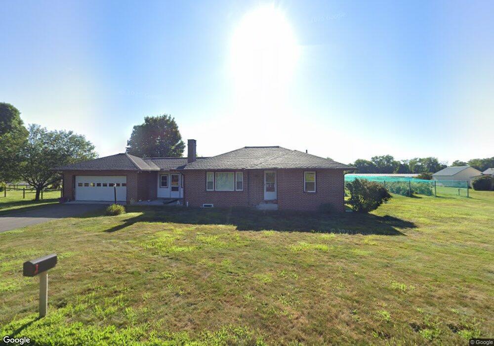
62 River Rd South Deerfield, MA 01373
Estimated Value: $352,161 - $380,000
3
Beds
1
Bath
1,170
Sq Ft
$312/Sq Ft
Est. Value
About This Home
This home is located at 62 River Rd, South Deerfield, MA 01373 and is currently estimated at $365,540, approximately $312 per square foot. 62 River Rd is a home located in Franklin County with nearby schools including Whately Elementary School and Frontier Regional School.
Ownership History
Date
Name
Owned For
Owner Type
Purchase Details
Closed on
Jan 27, 2009
Sold by
Kolodziej Kevin Est
Bought by
Nourse Realty Llc
Current Estimated Value
Home Financials for this Owner
Home Financials are based on the most recent Mortgage that was taken out on this home.
Original Mortgage
$199,750
Outstanding Balance
$129,010
Interest Rate
5.51%
Mortgage Type
Purchase Money Mortgage
Estimated Equity
$236,530
Create a Home Valuation Report for This Property
The Home Valuation Report is an in-depth analysis detailing your home's value as well as a comparison with similar homes in the area
Home Values in the Area
Average Home Value in this Area
Purchase History
| Date | Buyer | Sale Price | Title Company |
|---|---|---|---|
| Nourse Realty Llc | $200,000 | -- |
Source: Public Records
Mortgage History
| Date | Status | Borrower | Loan Amount |
|---|---|---|---|
| Open | Nourse Realty Llc | $199,750 |
Source: Public Records
Tax History Compared to Growth
Tax History
| Year | Tax Paid | Tax Assessment Tax Assessment Total Assessment is a certain percentage of the fair market value that is determined by local assessors to be the total taxable value of land and additions on the property. | Land | Improvement |
|---|---|---|---|---|
| 2025 | $3,891 | $291,700 | $104,700 | $187,000 |
| 2024 | $3,631 | $265,200 | $90,100 | $175,100 |
| 2023 | $3,507 | $247,000 | $85,800 | $161,200 |
| 2022 | $3,386 | $247,000 | $85,800 | $161,200 |
| 2021 | $3,357 | $225,000 | $85,800 | $139,200 |
| 2020 | $3,346 | $213,500 | $83,500 | $130,000 |
| 2019 | $3,306 | $213,000 | $83,500 | $129,500 |
| 2018 | $3,267 | $213,000 | $83,500 | $129,500 |
| 2017 | $3,323 | $213,000 | $83,500 | $129,500 |
| 2016 | $3,097 | $207,000 | $83,500 | $123,500 |
| 2015 | $3,283 | $203,000 | $79,500 | $123,500 |
| 2014 | $3,201 | $203,000 | $79,500 | $123,500 |
Source: Public Records
Map
Nearby Homes
- 3 Depot Rd
- 15 S Plain Rd
- 146 Old Amherst Rd
- 110 Old Amherst Rd
- 320 West St
- 32 Swamp Rd
- 0 North St Unit 73407299
- 151 Pantry Rd
- 147 Pantry Rd
- Lot C Mountain Rd
- Lot A Mountain Rd
- Lot B Mountain Rd
- 15 Crestview Dr
- 0 Straits Rd
- 238 N Main St
- 7 Roosevelt St
- 40 Eastern Ave
- 33 Eastern Ave
- 24 Graves St
- LOT D Mountain Rd
- 60 River Rd
- 64 River Rd
- 59 River Rd
- 69 River Rd
- 71 River Rd
- 73 River Rd
- 75 River Rd
- 78 River Rd
- 41 River Rd
- 97 River Rd
- 100 River Rd
- 25 River Rd
- 17 River Rd Unit 21
- 21 River Rd
- 16A & B River Rd
- 105 River Rd
- 0 River Rd Unit 72278361
- 0 River Rd Unit 73029800
- 0 River Rd Unit 72914140
- 0 River Rd Unit 72450657