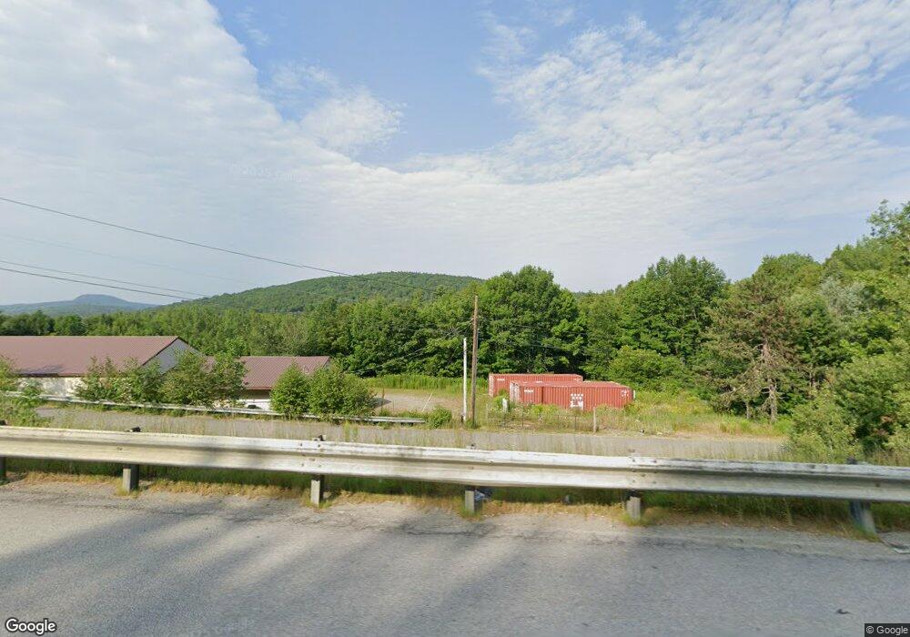
62 Rowe Brook Rd Dedham, ME 04429
Estimated Value: $304,000
3
Beds
1
Bath
816
Sq Ft
$373/Sq Ft
Est. Value
About This Home
This home is located at 62 Rowe Brook Rd, Dedham, ME 04429 and is currently estimated at $304,000, approximately $372 per square foot. 62 Rowe Brook Rd is a home located in Hancock County with nearby schools including Dedham School.
Ownership History
Date
Name
Owned For
Owner Type
Purchase Details
Closed on
Apr 15, 2014
Sold by
Seymour Jason and Bank New York Mellon Tr
Bought by
Bank New York Mellon Tr
Current Estimated Value
Purchase Details
Closed on
Feb 27, 2007
Sold by
Saunders Carolyn J
Bought by
Seymour Jason and Seymour Webdy A
Home Financials for this Owner
Home Financials are based on the most recent Mortgage that was taken out on this home.
Original Mortgage
$100,000
Interest Rate
8.9%
Mortgage Type
Purchase Money Mortgage
Create a Home Valuation Report for This Property
The Home Valuation Report is an in-depth analysis detailing your home's value as well as a comparison with similar homes in the area
Home Values in the Area
Average Home Value in this Area
Purchase History
Date | Buyer | Sale Price | Title Company |
---|---|---|---|
Bank New York Mellon Tr | -- | -- | |
Seymour Jason | $1,001 | -- |
Source: Public Records
Mortgage History
Date | Status | Borrower | Loan Amount |
---|---|---|---|
Previous Owner | Seymour Jason | $100,000 |
Source: Public Records
Tax History Compared to Growth
Tax History
Year | Tax Paid | Tax Assessment Tax Assessment Total Assessment is a certain percentage of the fair market value that is determined by local assessors to be the total taxable value of land and additions on the property. | Land | Improvement |
---|---|---|---|---|
2024 | $1,297 | $90,700 | $30,200 | $60,500 |
2023 | $1,185 | $69,700 | $23,200 | $46,500 |
2022 | $1,101 | $69,700 | $23,200 | $46,500 |
2021 | $1,115 | $69,700 | $23,200 | $46,500 |
2020 | $1,087 | $69,700 | $23,200 | $46,500 |
2019 | $1,014 | $69,700 | $23,200 | $46,500 |
2018 | $993 | $69,700 | $23,200 | $46,500 |
2017 | $993 | $69,700 | $23,200 | $46,500 |
2016 | $976 | $69,700 | $23,200 | $46,500 |
2014 | $691 | $44,850 | $8,200 | $36,650 |
2013 | $668 | $44,850 | $8,200 | $36,650 |
Source: Public Records
Map
Nearby Homes
- 9 Highland Rd
- 57 Sunset Rd
- 00 Main Rd
- Lot 5 Peakes Hill Rd
- Lot 4 Peakes Hill Rd
- Lot 77-7 Cabot Trail
- 423 Upper Dedham Rd
- 37 Lower Dedham Rd
- 84 Blueberry Ridge Rd
- 35 Dragonfly Dr
- 123 Main Rd
- 245 Lakeview Ave
- 557 South Rd
- 213 South Rd
- Lots 2&3 Maple Ridge Rd
- 760 Lower Dedham Rd
- 88 Adams Ln
- Lot 006-3 Dole Hill Rd
- 157 Lower Dedham Rd
- 0 Tbd Mountain View Dr
- 62 Rowe Brook Rd
- 40 Rowe Brook Rd
- 0 Rowe Brook Rd
- 41 Rowe Brook Rd
- 420 Rowe Brook Rd
- 19 Rowe Brook Rd
- 50 Rowe Brook Rd
- 51 Rowe Brook Rd
- 116 Pine Trail Unit 1
- 116 Pine Trail
- 3 Rowe Brook Rd
- 128 Pine Trail
- 0 Rowe Brook
- 0 Fire Road 7
- 19 Twiss Ln
- 432 Rowe Brook Rd
- 435 Rowe Brook Rd
- 140 Pine Trail
- 117 Pine Trail
- 115 Pine Trail