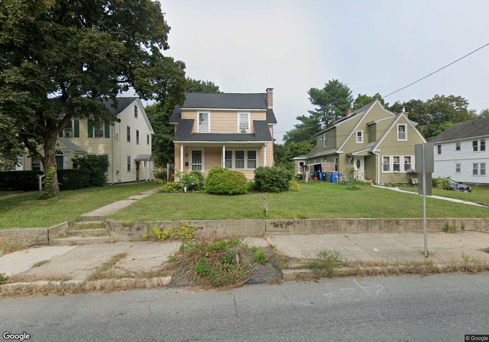
62 S Main St Uxbridge, MA 01569
Estimated Value: $365,000 - $437,000
3
Beds
2
Baths
1,135
Sq Ft
$361/Sq Ft
Est. Value
About This Home
This home is located at 62 S Main St, Uxbridge, MA 01569 and is currently estimated at $409,606, approximately $360 per square foot. 62 S Main St is a home located in Worcester County with nearby schools including Uxbridge High School, Our Lady of the Valley Regional School, and Whitinsville Christian School.
Ownership History
Date
Name
Owned For
Owner Type
Purchase Details
Closed on
May 24, 2000
Sold by
Boyle Leonard E and Underdahl-Boyle Pamels
Bought by
Jackson Kenneth R and Jackson Susan M
Current Estimated Value
Purchase Details
Closed on
Jan 5, 1988
Sold by
Cnossen Paul A
Bought by
Zajac Martin F
Create a Home Valuation Report for This Property
The Home Valuation Report is an in-depth analysis detailing your home's value as well as a comparison with similar homes in the area
Home Values in the Area
Average Home Value in this Area
Purchase History
| Date | Buyer | Sale Price | Title Company |
|---|---|---|---|
| Jackson Kenneth R | $129,000 | -- | |
| Jackson Kenneth R | $129,000 | -- | |
| Zajac Martin F | $185,000 | -- |
Source: Public Records
Mortgage History
| Date | Status | Borrower | Loan Amount |
|---|---|---|---|
| Open | Zajac Martin F | $147,000 | |
| Closed | Zajac Martin F | $130,000 |
Source: Public Records
Tax History Compared to Growth
Tax History
| Year | Tax Paid | Tax Assessment Tax Assessment Total Assessment is a certain percentage of the fair market value that is determined by local assessors to be the total taxable value of land and additions on the property. | Land | Improvement |
|---|---|---|---|---|
| 2025 | $42 | $320,500 | $128,100 | $192,400 |
| 2024 | $3,920 | $303,400 | $117,400 | $186,000 |
| 2023 | $3,803 | $272,600 | $106,800 | $165,800 |
| 2022 | $3,502 | $231,000 | $96,800 | $134,200 |
| 2021 | $3,586 | $226,700 | $92,500 | $134,200 |
| 2020 | $3,611 | $215,700 | $96,100 | $119,600 |
| 2019 | $3,486 | $200,900 | $89,000 | $111,900 |
| 2018 | $3,407 | $198,400 | $89,000 | $109,400 |
| 2017 | $3,071 | $181,100 | $76,400 | $104,700 |
| 2016 | $3,113 | $177,200 | $67,800 | $109,400 |
| 2015 | $3,047 | $175,100 | $67,800 | $107,300 |
Source: Public Records
Map
Nearby Homes
- 24 Road Ahr
- 24 Olde Canal Way Unit 24
- 72 Homeward Ave
- 20 Nature View Dr Unit 20
- 48 Homeward Ave
- The Contemporary Villager Plan at Patriot's Landing
- Karenrose Sunnery Plan at Patriot's Landing
- 37 Elizabeth St
- 256 Mendon St
- 328 Millville Rd
- 128 Mantell Rd
- 46 Pouts Ln Unit 46
- 288 High St
- 346 Millville Rd
- 113 Rogerson Crossing Unit 113
- 129 Quaker Hwy Unit 6
- 107 Henry St
- 100 Spring Hill Dr Unit 100
- 286 Blackstone St
- Layla Plan at Pine Ridge
- 60 S Main St
- 64 S Main St
- 56 S Main St
- 56 S Main St Unit A
- 1 High St
- 70 S Main St
- 2 Carpenter Terrace
- 50 S Main St
- 50 S Main St Unit 3
- 50 S Main St Unit 1
- 50 S Main St Unit 2
- 74 S Main St
- 67 S Main St
- 67 S Main St Unit 1
- 7 High St
- 53 S Main St
- LOT 8 High St
- 8 High St
- 46 S Main St Unit 2
- 46 S Main St