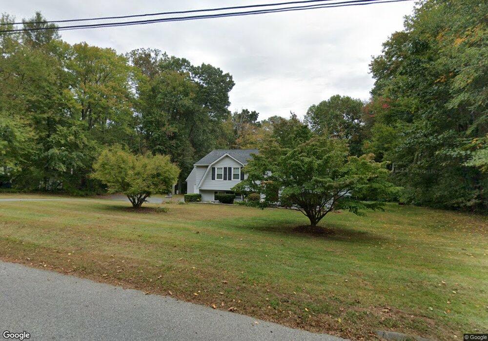
62 Schulman Veslak Rd East Haddam, CT 06423
Estimated Value: $383,000 - $430,758
3
Beds
2
Baths
1,336
Sq Ft
$302/Sq Ft
Est. Value
About This Home
This home is located at 62 Schulman Veslak Rd, East Haddam, CT 06423 and is currently estimated at $402,940, approximately $301 per square foot. 62 Schulman Veslak Rd is a home located in Middlesex County with nearby schools including East Haddam Elementary School, Nathan Hale-Ray Middle School, and Nathan Hale-Ray High School.
Ownership History
Date
Name
Owned For
Owner Type
Purchase Details
Closed on
Jul 8, 1999
Sold by
Foreman James A and Foreman Holly A
Bought by
Marion Eric J and Marion Renee
Current Estimated Value
Purchase Details
Closed on
Apr 18, 1997
Sold by
Shumbo Stanley W and Shumbo Deborah L
Bought by
Foreman James A and Foreman Holly A
Create a Home Valuation Report for This Property
The Home Valuation Report is an in-depth analysis detailing your home's value as well as a comparison with similar homes in the area
Home Values in the Area
Average Home Value in this Area
Purchase History
| Date | Buyer | Sale Price | Title Company |
|---|---|---|---|
| Marion Eric J | $154,000 | -- | |
| Foreman James A | $133,500 | -- |
Source: Public Records
Mortgage History
| Date | Status | Borrower | Loan Amount |
|---|---|---|---|
| Open | Foreman James A | $177,000 | |
| Closed | Foreman James A | $150,100 | |
| Closed | Foreman James A | $10,000 |
Source: Public Records
Tax History Compared to Growth
Tax History
| Year | Tax Paid | Tax Assessment Tax Assessment Total Assessment is a certain percentage of the fair market value that is determined by local assessors to be the total taxable value of land and additions on the property. | Land | Improvement |
|---|---|---|---|---|
| 2025 | $6,400 | $228,080 | $93,820 | $134,260 |
| 2024 | $6,103 | $228,080 | $93,820 | $134,260 |
| 2023 | $5,873 | $228,080 | $93,820 | $134,260 |
| 2022 | $4,943 | $155,480 | $64,550 | $90,930 |
| 2021 | $4,733 | $155,480 | $64,550 | $90,930 |
| 2020 | $4,733 | $155,480 | $64,550 | $90,930 |
| 2019 | $4,733 | $155,480 | $64,550 | $90,930 |
| 2018 | $4,612 | $155,480 | $64,550 | $90,930 |
| 2017 | $4,769 | $161,210 | $69,580 | $91,630 |
| 2016 | $4,732 | $161,210 | $69,580 | $91,630 |
| 2015 | $4,624 | $161,210 | $69,580 | $91,630 |
| 2014 | $4,498 | $161,210 | $69,580 | $91,630 |
Source: Public Records
Map
Nearby Homes
- 63 Schulman Veslak Rd
- 112 Schulman Veslak Rd
- 206 Sheepskin Hollow Rd
- 0 Lakeside Dr
- 114 Lakeside Dr
- 331 Tater Hill Rd
- 317 Tater Hill Rd
- 53 Shanaghans Rd
- 8 Tom Rd
- 55 Bogel Rd
- 2 Acorn Dr
- 45 Alger Rd
- 253 Clark Hill Rd
- 21 Olmstead Rd
- 23 Olmstead Rd
- 42 Dogwood Rd
- 0 Hopyard Rd Unit 24103236
- 53 Falls Bashan Rd
- 16 Mount Parnassus Rd
- 154 Falls Rd
- 58 Schulman Veslak Rd
- 64 Schulman Veslak Rd
- 61 Schulman Veslak Rd
- 66 Schulman Veslak Rd
- 65 Schulman Veslak Rd
- 59 Schulman Veslak Rd
- 69 Schulman Veslak Rd
- 76 Schulman Veslak Rd
- 57 Schulman Veslak Rd
- 80 Schulman Veslak Rd
- 68 Schulman Veslak Rd
- 54 Schulman Veslak Rd
- 78 Schulman Veslak Rd
- 55 Schulman Veslak Rd
- 71 Schulman Veslak Rd
- 81 Schulman Veslak Rd
- 16 Heritage Brook Dr
- 14 Heritage Brook Dr
- 82 Schulman Veslak Rd
- 88 Schulman Veslak Rd