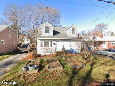
62 Taft Ave Portland, ME 04102
Nasons Corner NeighborhoodEstimated Value: $390,000 - $483,000
3
Beds
1
Bath
1,320
Sq Ft
$334/Sq Ft
Est. Value
About This Home
This home is located at 62 Taft Ave, Portland, ME 04102 and is currently estimated at $440,295, approximately $333 per square foot. 62 Taft Ave is a home located in Cumberland County with nearby schools including Amanda C Rowe School, Lincoln Middle School, and Breakwater School.
Ownership History
Date
Name
Owned For
Owner Type
Purchase Details
Closed on
May 17, 2022
Sold by
Phillips Travis
Bought by
Boys Nina O and Cleaveland Nicholas M
Current Estimated Value
Home Financials for this Owner
Home Financials are based on the most recent Mortgage that was taken out on this home.
Original Mortgage
$198,000
Outstanding Balance
$189,504
Interest Rate
5.3%
Mortgage Type
Purchase Money Mortgage
Estimated Equity
$250,791
Purchase Details
Closed on
May 23, 2005
Sold by
Davis Raymond E Est and Gilman Juliet
Bought by
Phillips Travis
Home Financials for this Owner
Home Financials are based on the most recent Mortgage that was taken out on this home.
Original Mortgage
$34,800
Interest Rate
5.95%
Mortgage Type
Purchase Money Mortgage
Create a Home Valuation Report for This Property
The Home Valuation Report is an in-depth analysis detailing your home's value as well as a comparison with similar homes in the area
Home Values in the Area
Average Home Value in this Area
Purchase History
| Date | Buyer | Sale Price | Title Company |
|---|---|---|---|
| Boys Nina O | $220,000 | None Available | |
| Phillips Travis | -- | -- |
Source: Public Records
Mortgage History
| Date | Status | Borrower | Loan Amount |
|---|---|---|---|
| Open | Boys Nina O | $131,887 | |
| Open | Boys Nina O | $198,000 | |
| Previous Owner | Phillips Travis | $34,800 |
Source: Public Records
Tax History Compared to Growth
Tax History
| Year | Tax Paid | Tax Assessment Tax Assessment Total Assessment is a certain percentage of the fair market value that is determined by local assessors to be the total taxable value of land and additions on the property. | Land | Improvement |
|---|---|---|---|---|
| 2024 | $4,821 | $321,200 | $76,500 | $244,700 |
| 2023 | $4,326 | $300,200 | $76,500 | $223,700 |
| 2022 | $4,086 | $300,200 | $76,500 | $223,700 |
| 2021 | $3,900 | $300,200 | $76,500 | $223,700 |
| 2020 | $3,559 | $152,700 | $53,900 | $98,800 |
| 2019 | $3,559 | $152,700 | $53,900 | $98,800 |
| 2018 | $3,306 | $152,700 | $53,900 | $98,800 |
| 2017 | $3,306 | $152,700 | $53,900 | $98,800 |
| 2016 | $3,223 | $152,700 | $53,900 | $98,800 |
| 2015 | $3,150 | $152,700 | $53,900 | $98,800 |
| 2014 | $3,054 | $152,700 | $53,900 | $98,800 |
Source: Public Records
Map
Nearby Homes
- 26 Celebration Ct
- 0 Hillcrest Ave
- 49 Birchwood Dr
- 76 Birchwood Dr
- 162 Rowe Ave
- 22 Presnell St
- 30 Glenridge
- 3 Newcomb St
- 63A Capisic St
- 5 Glenridge
- 271 Capisic St
- 47 Edgeworth Ave
- 12 Black Sparrow Dr
- 57 Colonial Rd
- 1673 Westbrook St
- 38 Trailhead Way
- 85 Columbia Rd
- 78 Owl's Nest Rd
- 486 Woodford St
- 84 Hillside Rd