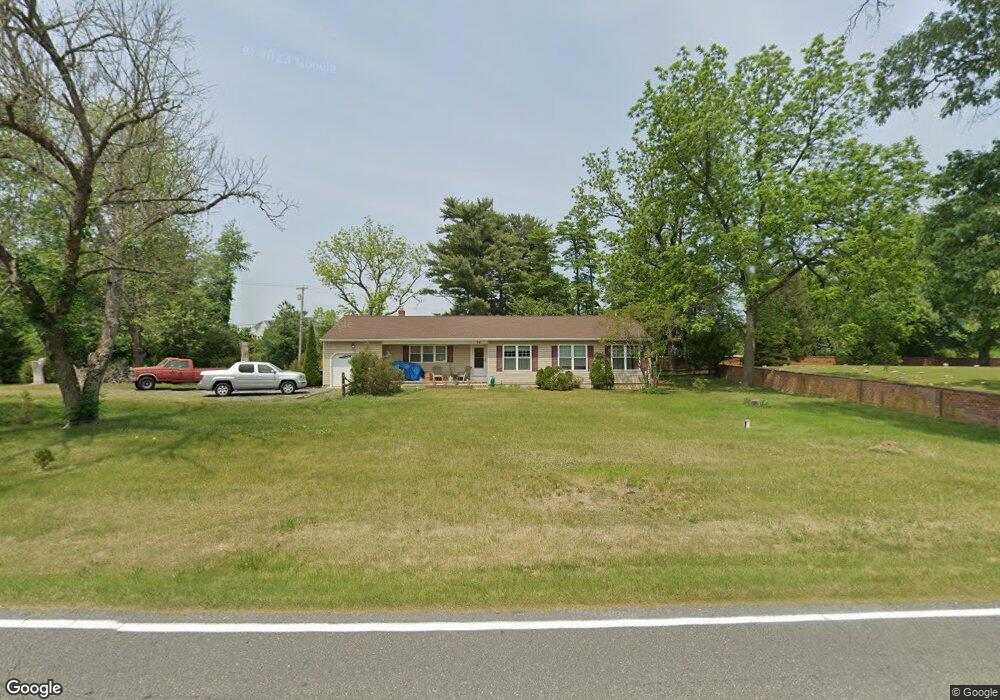
62 W Wolfert Station Rd Mickleton, NJ 08056
Estimated Value: $391,000 - $492,000
Studio
--
Bath
1,848
Sq Ft
$236/Sq Ft
Est. Value
About This Home
This home is located at 62 W Wolfert Station Rd, Mickleton, NJ 08056 and is currently estimated at $436,756, approximately $236 per square foot. 62 W Wolfert Station Rd is a home located in Gloucester County with nearby schools including Jeffrey Clark School, Samuel Mickle School, and Kingsway Regional Middle School.
Ownership History
Date
Name
Owned For
Owner Type
Purchase Details
Closed on
Dec 17, 1999
Sold by
George David H
Bought by
Mcshane Neil J and Mcshane Elisabeth S
Current Estimated Value
Home Financials for this Owner
Home Financials are based on the most recent Mortgage that was taken out on this home.
Original Mortgage
$107,000
Outstanding Balance
$33,370
Interest Rate
7.81%
Estimated Equity
$403,386
Purchase Details
Closed on
Oct 20, 1995
Sold by
Dormann John F and Dormann Karen E
Bought by
George David H
Create a Home Valuation Report for This Property
The Home Valuation Report is an in-depth analysis detailing your home's value as well as a comparison with similar homes in the area
Home Values in the Area
Average Home Value in this Area
Purchase History
| Date | Buyer | Sale Price | Title Company |
|---|---|---|---|
| Mcshane Neil J | $142,000 | Pilgrim Title Agency | |
| George David H | $136,000 | Pilgrim Title Agency |
Source: Public Records
Mortgage History
| Date | Status | Borrower | Loan Amount |
|---|---|---|---|
| Open | Mcshane Neil J | $107,000 |
Source: Public Records
Tax History
| Year | Tax Paid | Tax Assessment Tax Assessment Total Assessment is a certain percentage of the fair market value that is determined by local assessors to be the total taxable value of land and additions on the property. | Land | Improvement |
|---|---|---|---|---|
| 2025 | $8,224 | $258,700 | $83,900 | $174,800 |
| 2024 | $7,963 | $258,700 | $83,900 | $174,800 |
| 2023 | $7,963 | $258,700 | $83,900 | $174,800 |
| 2022 | $7,738 | $258,700 | $83,900 | $174,800 |
| 2021 | $7,789 | $258,700 | $83,900 | $174,800 |
| 2020 | $7,826 | $258,700 | $83,900 | $174,800 |
| 2019 | $7,745 | $258,700 | $83,900 | $174,800 |
| 2018 | $7,577 | $229,800 | $65,900 | $163,900 |
| 2017 | $7,478 | $229,800 | $65,900 | $163,900 |
| 2016 | $7,390 | $229,800 | $65,900 | $163,900 |
| 2015 | $7,082 | $229,800 | $65,900 | $163,900 |
| 2014 | $6,646 | $229,800 | $65,900 | $163,900 |
Source: Public Records
Map
Nearby Homes
- 71 W Tomlin Station Rd
- 0 Tomlin Station Rd Unit NJGL2061600
- 67 E Rattling Run Rd
- 50 Mill Rd
- 241 Gaunt Dr
- 18 Millwood Dr
- 424 Country Way
- 415 Country Way
- 10 & 26 Garwin Rd
- 253 Jennings Way
- 200 David Mills Ln
- 792 Paulsboro Rd
- 788 Paulsboro Rd
- 118 Timberlane Rd
- 120 Jubilee Dr
- 209 Charles Corliss Blvd
- 155 Rulon Rd
- 355 Friendship Rd
- 43 45 Repaupo Station Rd
- 6 Burton Ln
- 139 Quaker Rd
- 201 Bartlett Dr
- 61 W Wolfert Station Rd
- 68 W Wolfert Station Rd
- 203 Bartlett Dr
- 200 Smallwood Dr
- 52 W Wolfert Station Rd
- 205 Bartlett Dr
- 7 Campbell Ct
- 49 W Wolfert Station Rd
- 5 Campbell Ct
- 202 Smallwood Dr
- 207 Bartlett Dr
- 3 Campbell Ct
- 201 Smallwood Dr
- 201 Smallwood Dr Unit 92
- 204 Smallwood Dr
- 209 Bartlett Dr
- 203 Smallwood Dr Unit 91
- 203 Smallwood Dr
Your Personal Tour Guide
Ask me questions while you tour the home.