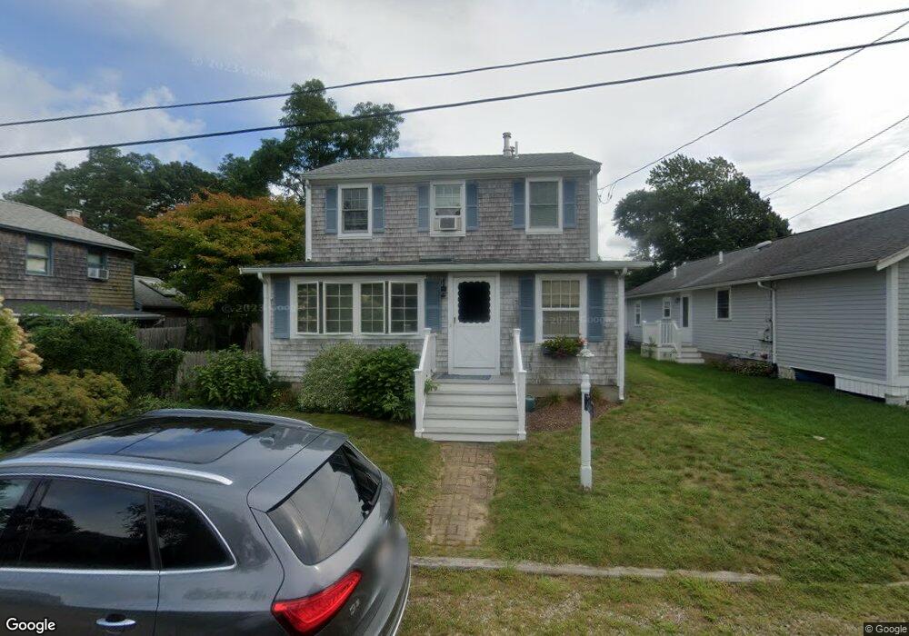
62 Wamsutta Ave Pocasset, MA 02559
Pocasset NeighborhoodEstimated Value: $816,000 - $1,124,000
3
Beds
2
Baths
1,939
Sq Ft
$467/Sq Ft
Est. Value
About This Home
This home is located at 62 Wamsutta Ave, Pocasset, MA 02559 and is currently estimated at $905,227, approximately $466 per square foot. 62 Wamsutta Ave is a home located in Barnstable County with nearby schools including Bourne High School and Cadence Academy Preschool - Bourne.
Create a Home Valuation Report for This Property
The Home Valuation Report is an in-depth analysis detailing your home's value as well as a comparison with similar homes in the area
Home Values in the Area
Average Home Value in this Area
Tax History Compared to Growth
Tax History
| Year | Tax Paid | Tax Assessment Tax Assessment Total Assessment is a certain percentage of the fair market value that is determined by local assessors to be the total taxable value of land and additions on the property. | Land | Improvement |
|---|---|---|---|---|
| 2025 | $5,342 | $684,000 | $371,500 | $312,500 |
| 2024 | $5,223 | $651,300 | $353,800 | $297,500 |
| 2023 | $5,078 | $576,400 | $313,100 | $263,300 |
| 2022 | $4,586 | $454,500 | $245,600 | $208,900 |
| 2021 | $4,456 | $413,700 | $223,500 | $190,200 |
| 2020 | $4,425 | $412,000 | $221,400 | $190,600 |
| 2019 | $4,217 | $401,200 | $221,400 | $179,800 |
| 2018 | $4,085 | $387,600 | $216,300 | $171,300 |
| 2017 | $3,954 | $383,900 | $214,300 | $169,600 |
| 2016 | $3,537 | $348,100 | $203,500 | $144,600 |
| 2015 | $3,344 | $332,100 | $187,500 | $144,600 |
Source: Public Records
Map
Nearby Homes
- 171 Bellavista Dr
- 22 Nairn Rd
- 34 Kenwood Rd
- 254 Barlows Landing Rd
- 45 Kenwood Rd
- 48 Red Brook Harbor Rd
- 70 Wings Neck Rd
- 3 Red Brook Pond Dr
- 940 County Rd
- 1094 County Rd
- 24 Richmond Rd
- 940 County Rd
- 709 County Rd
- 14 Navajo Rd
- 174 Barlows Landing Rd
- 7 4th Ave
- 15 1st St
- 89 Harbor Dr
- 39 Bennets Neck Dr
- 7 Portside Dr