
Seller's Agent in 2025
Jesse Grade
Skogman Realty Co.
(319) 241-0579
254 Total Sales
Estimated Value: $117,000 - $131,000
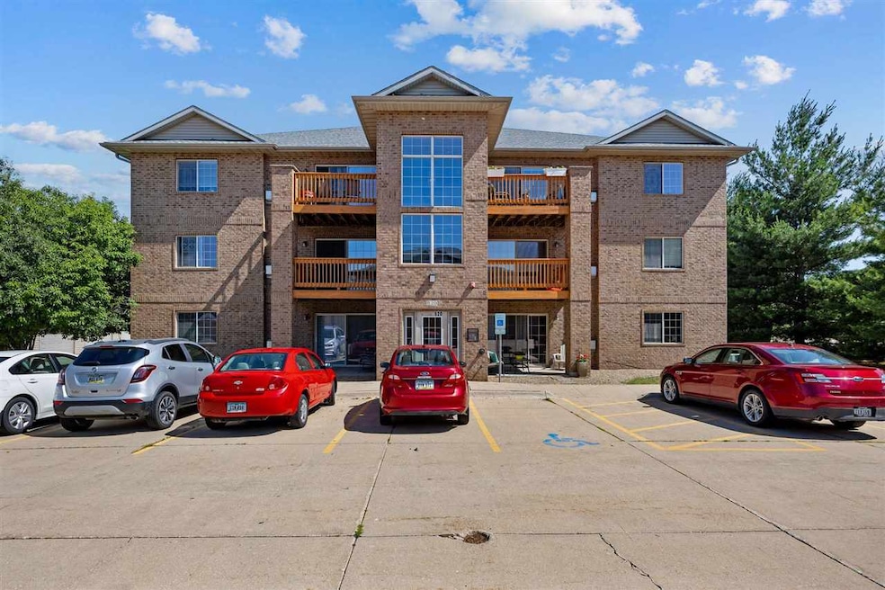
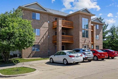
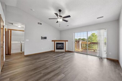
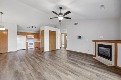
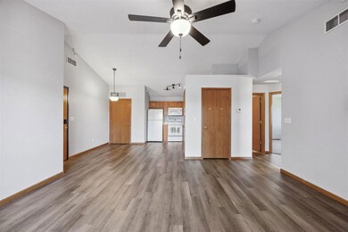
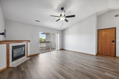
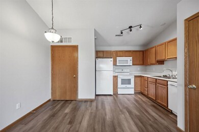
PRICE IMPROVEMENT!! This condo in the desired Linn Mar school district has been lovingly maintained for 20 years! Such a convenient location, close to everything and a short walking distance to coffee shops and restaurants! Some recent updates include LVP flooring, carpet and fresh paint throughout! Interior features include vaulted ceilings, family room with tile gas fireplace, eat-in kitchen with pantry, two large bedrooms and full bath. The A/C and roof were replaced in 2020. Relax in the evenings on your semi private deck overlooking green space and walking trail! A one stall garage is included, and there is a secure entrance into the building with code or key.
Last Buyer's Agent
Nonmember NONMEMBER
NONMEMBER
| Date | Buyer | Sale Price | Title Company |
|---|---|---|---|
| Lynch Jacob Michael | $116,500 | None Listed On Document | |
| Shaver Chrystal L | $88,000 | -- |
| Date | Status | Borrower | Loan Amount |
|---|---|---|---|
| Open | Lynch Jacob Michael | $113,005 | |
| Previous Owner | Shaver Chrystal L | $69,750 |
| Date | Event | Price | List to Sale | Price per Sq Ft |
|---|---|---|---|---|
| 08/27/2025 08/27/25 | Sold | $116,500 | -1.2% | $126 / Sq Ft |
| 07/11/2025 07/11/25 | Price Changed | $117,900 | -1.7% | $128 / Sq Ft |
| 06/20/2025 06/20/25 | For Sale | $119,900 | -- | $130 / Sq Ft |
| Year | Tax Paid | Tax Assessment Tax Assessment Total Assessment is a certain percentage of the fair market value that is determined by local assessors to be the total taxable value of land and additions on the property. | Land | Improvement |
|---|---|---|---|---|
| 2025 | $2,068 | $117,000 | $17,000 | $100,000 |
| 2024 | $2,000 | $116,000 | $17,000 | $99,000 |
| 2023 | $2,000 | $116,000 | $17,000 | $99,000 |
| 2022 | $1,776 | $96,400 | $14,000 | $82,400 |
| 2021 | $1,862 | $89,200 | $12,000 | $77,200 |
| 2020 | $1,862 | $87,900 | $12,000 | $75,900 |
| 2019 | $1,680 | $80,800 | $12,000 | $68,800 |
| 2018 | $1,524 | $80,800 | $12,000 | $68,800 |
| 2017 | $1,801 | $80,500 | $7,500 | $73,000 |
| 2016 | $1,801 | $80,500 | $7,500 | $73,000 |
| 2015 | $1,813 | $80,989 | $7,500 | $73,489 |
| 2014 | $1,618 | $80,989 | $7,500 | $73,489 |
| 2013 | $1,560 | $80,989 | $7,500 | $73,489 |
Seller's Agent in 2025
Jesse Grade
Skogman Realty Co.
(319) 241-0579
254 Total Sales
N
Buyer's Agent in 2025
Nonmember NONMEMBER
NONMEMBER
Source: Iowa City Area Association of REALTORS®
MLS Number: 202504127
APN: 11341-04008-01022
Disclaimer: Certain information contained herein is derived from information provided by parties other than Homes.com. All information provided is deemed reliable, but is not guaranteed to be accurate and should be independently verified.
![]() IDX information is provided exclusively for consumers’ personal, non-commercial use, that it may not be used for any purpose other than to identify prospective properties consumers may be interested in purchasing.
IDX information is provided exclusively for consumers’ personal, non-commercial use, that it may not be used for any purpose other than to identify prospective properties consumers may be interested in purchasing.
Listing information is deemed reliable, but not guaranteed accurate by the MLS.