Estimated Value: $294,899 - $482,000
--
Bed
--
Bath
1,199
Sq Ft
$339/Sq Ft
Est. Value
About This Home
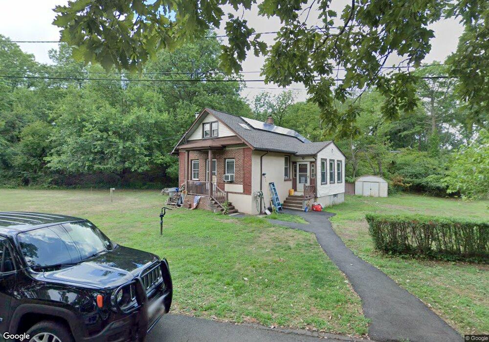
This home is located at 620 Main St, Fords, NJ 08863 and is currently estimated at $406,975, approximately $339 per square foot. 620 Main St is a home located in Middlesex County with nearby schools including Ford Avenue Elementary School, Fords Middle School, and Woodbridge High School.
Ownership History
Date
Name
Owned For
Owner Type
Purchase Details
Closed on
Apr 17, 2008
Sold by
Moon Edward C and Moon Norman E
Bought by
Engelbrecht Gary and Engelbrecht Claire
Current Estimated Value
Home Financials for this Owner
Home Financials are based on the most recent Mortgage that was taken out on this home.
Original Mortgage
$101,600
Interest Rate
5.46%
Mortgage Type
Purchase Money Mortgage
Create a Home Valuation Report for This Property
The Home Valuation Report is an in-depth analysis detailing your home's value as well as a comparison with similar homes in the area
Home Values in the Area
Average Home Value in this Area
Purchase History
| Date | Buyer | Sale Price | Title Company |
|---|---|---|---|
| Engelbrecht Gary | $127,000 | Crystal Title |
Source: Public Records
Mortgage History
| Date | Status | Borrower | Loan Amount |
|---|---|---|---|
| Previous Owner | Engelbrecht Gary | $101,600 |
Source: Public Records
Tax History Compared to Growth
Tax History
| Year | Tax Paid | Tax Assessment Tax Assessment Total Assessment is a certain percentage of the fair market value that is determined by local assessors to be the total taxable value of land and additions on the property. | Land | Improvement |
|---|---|---|---|---|
| 2025 | $6,172 | $45,600 | $28,800 | $16,800 |
| 2024 | $6,019 | $45,600 | $28,800 | $16,800 |
| 2023 | $6,019 | $45,600 | $28,800 | $16,800 |
| 2022 | $5,653 | $45,600 | $28,800 | $16,800 |
| 2021 | $5,594 | $45,600 | $28,800 | $16,800 |
| 2020 | $5,410 | $45,600 | $28,800 | $16,800 |
| 2019 | $5,273 | $45,600 | $28,800 | $16,800 |
| 2018 | $5,134 | $45,600 | $28,800 | $16,800 |
| 2017 | $5,031 | $45,600 | $28,800 | $16,800 |
| 2016 | $4,983 | $45,600 | $28,800 | $16,800 |
| 2015 | $4,885 | $45,600 | $28,800 | $16,800 |
| 2014 | $4,768 | $45,600 | $28,800 | $16,800 |
Source: Public Records
Map
Nearby Homes
- 650 Main St
- 28 Caswell Ave
- 285 Schmidt Place
- 19 Caswell Ave
- 30 Caswell Ave
- 23 Caswell Ave
- 289 Schmidt Place
- 40 Caswell Ave
- 276 Schmidt Place
- 3 N John St
- 44 Caswell Ave
- 43 Caswell Ave
- 7 N John St
- 293 Schmidt Place
- 288 Schmidt Place
- 45 Caswell Ave
- 134 Pender Place
- 290 Schmidt Place
- 4 N John St
- 11 N John St