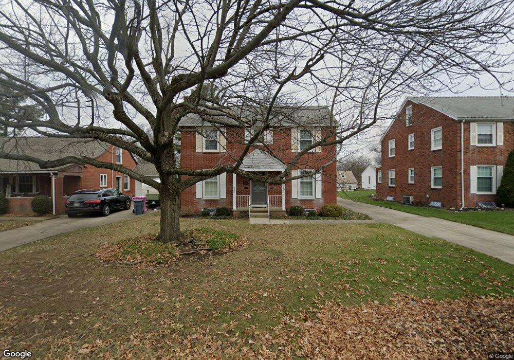
620 Manchester Rd Mansfield, OH 44903
Estimated Value: $156,000 - $189,000
About This Home
This home is located at 620 Manchester Rd, Mansfield, OH 44903 and is currently estimated at $175,720, approximately $80 per square foot. 620 Manchester Rd is a home located in Richland County with nearby schools including Goal Digital Academy, Discovery School, and St. Peter's Elementary/Montessori School.
Ownership History
We collect this data history from publicly available records. To have your information removed, we recommend requesting removal directly through your county’s website.
Purchase Details
Home Financials for this Owner
Home Financials are based on the most recent Mortgage that was taken out on this home.Home Values in the Area
Average Home Value in this Area
Purchase History
We collect this data history from publicly available records. To have your information removed, we recommend requesting removal directly through your county’s website.
| Date | Buyer | Sale Price | Title Company |
|---|---|---|---|
| $115,000 | Chicago Title |
Mortgage History
We collect this data history from publicly available records. To have your information removed, we recommend requesting removal directly through your county’s website.
| Date | Status | Borrower | Loan Amount |
|---|---|---|---|
| Open | $97,750 |
Tax History
We collect this data history from publicly available records. To have your information removed, we recommend requesting removal directly through your county’s website.
| Year | Tax Paid | Tax Assessment Tax Assessment Total Assessment is a certain percentage of the fair market value that is determined by local assessors to be the total taxable value of land and additions on the property. | Land | Improvement |
|---|---|---|---|---|
| 2025 | $1,769 | $38,650 | $4,450 | $34,200 |
| 2024 | $1,769 | $38,650 | $4,450 | $34,200 |
| 2023 | $1,810 | $38,650 | $4,450 | $34,200 |
| 2022 | $1,897 | $33,950 | $3,820 | $30,130 |
| 2021 | $1,418 | $33,950 | $3,820 | $30,130 |
| 2020 | $1,450 | $33,950 | $3,820 | $30,130 |
| 2019 | $1,607 | $33,950 | $3,820 | $30,130 |
| 2018 | $1,585 | $33,950 | $3,820 | $30,130 |
| 2017 | $1,542 | $33,950 | $3,820 | $30,130 |
| 2016 | $1,617 | $34,380 | $4,890 | $29,490 |
| 2015 | $1,617 | $34,380 | $4,890 | $29,490 |
| 2014 | $1,525 | $34,380 | $4,890 | $29,490 |
| 2012 | $1,404 | $34,390 | $5,150 | $29,240 |
Map
- 527 Forest St
- 551 Cline Ave
- 501 Forest St
- 544 Arlington Ave
- 246 Taylor Rd
- 495 Davey Ave
- 908 E Linden Cir
- 575 Maple St
- 547 Maple St
- 850 Arlington Ave
- 116 Stewart Ave S
- 140 Sherman Ave
- 107 Glenwood Blvd
- 356 Townview Cir N
- 122 Poplar St
- 655 Woodhill Rd
- 42 Parkwood Blvd
- 411 Davis Rd
- 664 Woodhill Rd
- 925 Maumee Ave
- 626 Manchester Rd
- 614 Manchester Rd
- 632 Manchester Rd
- 608 Manchester Rd
- 625 Barnard Ave
- 619 Barnard Ave
- 631 Barnard Ave
- 638 Manchester Rd
- 611 Barnard Ave
- 611 Manchester Rd
- 637 Barnard Ave
- 600 Manchester Rd
- 621 Manchester Rd
- 607 Barnard Ave
- 644 Manchester Rd
- 643 Barnard Ave
- 594 Manchester Rd
- 641 Manchester Rd
- 0 Barnard Ave
- 624 Barnard Ave
Ask me questions while you tour the home.